
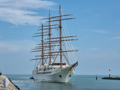
SEA CLOUD SPIRIT
Passenger
Current Trip
| Time Travelled | 11 h, 47 mins |
|---|---|
| Remaining Time | 2 h, 15 mins |
| Distance Travelled | 113.05 nm |
| Remaining Distance | 29.37 nm |
| AVG Speed | 9.6 Knots |
| MAX Speed | 11.9 Knots |
| AVG Wind | 14.8 knots |
| MAX Wind | 26 knots |
| MIN Temp | 14.4°C / 57.92°F |
| MAX Temp | 22.9°C / 73.22°F |
| Draught | 5.7 m |
| Position Received | 1 h, 23 m ago |
Current Position
| Longitude | -6.09256° |
|---|---|
| Latitude | 36.08198° |
| Status | Under way using engine |
| Speed | 11.9 Knots |
| Course | 293.5° |
| Area | North Atlantic Ocean |
| Station | T-AIS |
| Position Received | 1 h, 23 m ago |
Info
Information
The current position of SEA CLOUD SPIRIT is in North Atlantic Ocean with coordinates 36.08198° / -6.09256° as reported on 2024-05-18 03:58 by AIS to our vessel tracker app. The vessel's current speed is 11.9 Knots and is heading at the port of CADIZ. The estimated time of arrival as calculated by vessel tracking app is 2024-05-18 07:37 LT
The vessel SEA CLOUD SPIRIT (IMO: 9483712, MMSI: 215855000) is a Passenger It's sailing under the flag of [MT] Malta.
In this page you can find informations about the vessels current position, last detected port calls, and current voyage information. If the vessels is not in coverage by AIS you will find the latest position.
The current position of SEA CLOUD SPIRIT is detected by our AIS receivers and we are not responsible for the reliability of the data. The last position was recorded while the vessel was in Coverage by the Ais receivers of our vessel tracking app.
The current draught of SEA CLOUD SPIRIT as reported by AIS is 5.7 meters
Weather
| Temperature | 16.6°C / 61.88°F |
|---|---|
| Wind Speed | 9 knots |
| Direction | 348° NNW |
| Pressure | 1012.5 hPa |
| Humidity | 68.7 % |
| Cloud Coverage | 5 % |
Featured Company
Last Port Calls
| Port | Arrival | Departure | Time In Port |
|---|---|---|---|
| 2024-05-17 03:49 | 2024-05-17 17:35 | 13 h | |
| 2024-05-14 10:23 | 2024-05-15 13:48 | 1 d | |
| 2024-05-13 04:17 | 2024-05-13 15:25 | 11 h | |
| 2024-05-12 04:20 | 2024-05-12 16:12 | 11 h | |
| 2024-05-11 05:03 | 2024-05-11 12:29 | 7 h | |
| 2024-05-10 04:07 | 2024-05-10 16:20 | 12 h | |
| 2024-05-06 03:56 | 2024-05-06 17:21 | 13 h | |
| 2024-05-04 05:16 | 2024-05-04 17:16 | 12 h | |
| 2024-05-03 04:01 | 2024-05-03 16:28 | 12 h | |
| 2024-04-29 03:42 | 2024-04-29 17:18 | 13 h |
Most Visited Ports (Last year)
| Port | Arrivals | |
|---|---|---|
| 7 | ||
| 4 | ||
| 4 | ||
| 4 | ||
| 4 | ||
| 3 |
Last Trips
| Origin | Departure | Destination | Arrival | Distance | |
|---|---|---|---|---|---|
| 2024-05-15 15:48 | 2024-05-17 05:49 | 351.60 nm | |||
| 2024-05-13 17:25 | 2024-05-14 12:23 | 165.56 nm | |||
| 2024-05-12 18:12 | 2024-05-13 06:17 | 57.12 nm | |||
| 2024-05-11 14:29 | 2024-05-12 06:20 | 143.55 nm | |||
| 2024-05-10 18:20 | 2024-05-11 07:03 | 121.85 nm | |||
| 2024-05-06 19:21 | 2024-05-10 06:07 | 315.32 nm | |||
| 2024-05-04 19:16 | 2024-05-06 05:56 | 160.18 nm | |||
| 2024-05-03 18:28 | 2024-05-04 07:16 | 123.63 nm | |||
| 2024-04-29 19:18 | 2024-05-03 06:01 | 337.96 nm | |||
| 2024-04-28 13:32 | 2024-04-29 05:42 | 107.21 nm |
Events
| Time | Event | Details | Position / Dest | Info |
|---|---|---|---|---|
| 2024-05-18 04:03 | Status Changed | Default Under way using engine |
36.08984 / -6.11458
ES CAD
|
Speed: 11.9 kn Course: 293.5° |
| 2024-05-18 03:58 | Change Sea Area | Spanish part of the North Atlantic Ocean Spanish part of the Strait of Gibraltar |
36.08198 / -6.09256
North Atlantic Ocean
ES CAD
|
Speed: 11.9 kn Course: 293.5° |
| 2024-05-18 03:58 | Status Changed | Under way using engine Default |
36.08198 / -6.09256
ES CAD
|
Speed: 11.7 kn Course: 293° |
| 2024-05-18 03:58 | OUT of Coverage |
36.08198 / -6.09256
North Atlantic Ocean
ES CAD
|
Speed: 11.9 kn Course: 293.5° |
|
| 2024-05-18 03:38 | IN Coverage |
36.08198 / -6.09256
North Atlantic Ocean
ES CAD
|
Speed: 11.9 kn Course: 293.5° |
|
| 2024-05-18 01:02 | Status Changed | Default Under way using engine |
35.97991 / -5.54169
ES CAD
|
Speed: 8.2 kn Course: 251.4° |
| 2024-05-18 00:54 | OUT of Coverage |
35.98671 / -5.51849
Strait of Gibraltar
ES CAD
|
Speed: 8.2 kn Course: 251.4° |
|
| 2024-05-17 23:48 | Change Sea Area | Spanish part of the Strait of Gibraltar Gibraltarian part of the Strait of Gibraltar |
36.04376 / -5.35440
Strait of Gibraltar
ES CAD
|
Speed: 7.8 kn Course: 238.3° |
| 2024-05-17 23:41 | Change Sea Area | Gibraltarian part of the Strait of Gibraltar Gibraltarian part of the Alboran Sea |
36.05170 / -5.33944
Strait of Gibraltar
ES CAD
|
Speed: 8 kn Course: 233.1° |
| 2024-05-17 22:44 | Change Sea Area | Gibraltarian part of the Alboran Sea Spanish part of the Alboran Sea |
36.13938 / -5.19546
Alboran Sea
ES CAD
|
Speed: 9.5 kn Course: 232.2° |