
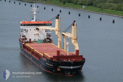
SEA EXPLORER
General Cargo
Current Trip
| Time Travelled | 2 days |
|---|---|
| Remaining Time | --- |
| Distance Travelled | 582.62 nm |
| Remaining Distance | --- |
| AVG Speed | 11.2 Knots |
| MAX Speed | 12.6 Knots |
| AVG Wind | 11.7 knots |
| MAX Wind | 21.9 knots |
| MIN Temp | 9.3°C / 48.74°F |
| MAX Temp | 17.1°C / 62.78°F |
| Draught | 8.1 m |
| Position Received | 1 m ago |
Current Position
| Longitude | 10.75253° |
|---|---|
| Latitude | 57.84584° |
| Status | Under way using engine |
| Speed | 11.3 Knots |
| Course | 277.4° |
| Area | Skaggerak |
| Station | T-AIS |
| Position Received | 1 m ago |
Info
Information
The current position of SEA EXPLORER is in Skaggerak with coordinates 57.84584° / 10.75253° as reported on 2024-05-19 08:59 by AIS to our vessel tracker app. The vessel's current speed is 11.3 Knots and is heading at the port of BEJAIA. The estimated time of arrival as calculated by vessel tracking app is 2024-05-28 04:00 LT
The vessel SEA EXPLORER (IMO: 9516155, MMSI: 257223000) is a General Cargo that was built in 2012 ( 12 years old ). It's sailing under the flag of [NO] Norway.
In this page you can find informations about the vessels current position, last detected port calls, and current voyage information. If the vessels is not in coverage by AIS you will find the latest position.
The current position of SEA EXPLORER is detected by our AIS receivers and we are not responsible for the reliability of the data. The last position was recorded while the vessel was in Coverage by the Ais receivers of our vessel tracking app.
The current draught of SEA EXPLORER as reported by AIS is 8.1 meters
Weather
| Temperature | 13.1°C / 55.58°F |
|---|---|
| Wind Speed | 3 knots |
| Direction | 134° SE |
| Pressure | 1013.1 hPa |
| Humidity | 76.9 % |
| Cloud Coverage | 5 % |
Featured Company
Last Port Calls
| Port | Arrival | Departure | Time In Port |
|---|---|---|---|
| 2024-05-15 09:28 | 2024-05-16 21:42 | 1 d | |
| 2024-05-11 10:12 | 2024-05-13 22:28 | 2 d | |
| 2024-05-06 04:27 | 2024-05-09 15:58 | 3 d | |
| 2024-04-30 13:18 | 2024-04-30 13:20 | 2 m | |
| 2024-04-15 20:41 | 2024-04-22 15:08 | 6 d | |
| 2024-04-08 12:29 | 2024-04-09 07:20 | 18 h | |
| 2024-04-02 09:23 | 2024-04-03 14:31 | 1 d | |
| 2024-03-28 16:24 | 2024-03-29 17:23 | 1 d | |
| 2024-03-21 23:12 | 2024-03-22 01:11 | 1 h | |
| 2024-03-17 19:35 | 2024-03-19 07:07 | 1 d |
Most Visited Ports (Last year)
| Port | Arrivals | |
|---|---|---|
| 4 | ||
| 3 | ||
| 2 | ||
| 2 | ||
| 2 | ||
| 2 |
Last Trips
| Origin | Departure | Destination | Arrival | Distance | |
|---|---|---|---|---|---|
| 2024-05-14 00:28 | 2024-05-15 11:28 | 323.85 nm | |||
| 2024-05-09 17:58 | 2024-05-11 12:12 | 464.24 nm | |||
| 2024-04-30 15:20 | 2024-05-06 06:27 | 352.37 nm | |||
| 2024-04-22 16:08 | 2024-04-30 15:18 | 1954.57 nm | |||
| 2024-04-09 09:20 | 2024-04-15 21:41 | 1601.88 nm | |||
| 2024-04-03 16:31 | 2024-04-08 14:29 | 866.82 nm | |||
| 2024-03-29 17:23 | 2024-04-02 11:23 | 1088.25 nm | |||
| 2024-03-22 02:11 | 2024-03-28 16:24 | 1790.55 nm | |||
| 2024-03-19 08:07 | 2024-03-22 00:12 | 693.27 nm | |||
| 2024-03-17 17:17 | 2024-03-17 20:35 | 37.96 nm |
Events
| Time | Event | Details | Position / Dest | Info |
|---|---|---|---|---|
| 2024-05-19 08:23 | Change Sea Area | Danish part of the Skaggerak Danish part of the Kattegat |
57.80866 / 10.95055
Skaggerak
DZBJA
|
Speed: 11.8 kn Course: 309.5° |
| 2024-05-19 07:47 | Change Sea Area | Danish part of the Kattegat Swedish part of the Kattegat |
57.73654 / 11.12219
Kattegat
DZBJA
|
Speed: 11.7 kn Course: 308.3° |
| 2024-05-19 05:56 | START Moving | 3.64 nm, West of VRANGO |
57.58572 / 11.66672
DZBJA
|
Speed: 3.2 kn Course: 278° |
| 2024-05-19 05:47 | Status Changed | Under way using engine At anchor |
57.58458 / 11.67094
DZBJA
|
Speed: 0.2 kn Course: 307° |
| 2024-05-18 22:30 | Status Changed | At anchor Under way using engine |
57.58497 / 11.66936
DZBJA
|
Speed: 0.2 kn Course: 86° |
| 2024-05-18 22:26 | STOP Moving | 3.54 nm, West of VRANGO |
57.58469 / 11.66959
DZBJA
|
Speed: 0.3 kn Course: 78° |
| 2024-05-18 16:52 | Change Sea Area | Swedish part of the Kattegat Danish part of the Kattegat |
56.73907 / 11.97287
Kattegat
DZBJA
|
Speed: 10.9 kn Course: 34.4° |
| 2024-05-18 04:59 | Change Sea Area | Danish part of the Kattegat Danish part of the Baltic Sea |
54.75631 / 10.88069
Kattegat
DZBJA
|
Speed: 11.3 kn Course: 356.5° |
| 2024-05-18 04:01 | Change Sea Area | Danish part of the Baltic Sea German part of the Baltic Sea |
54.63629 / 11.08638
Baltic Sea
DZBJA
|
Speed: 11.9 kn Course: 297.4° |
| 2024-05-18 03:32 | Change Sea Area | German part of the Baltic Sea Danish part of the Baltic Sea |
54.59260 / 11.23895
Baltic Sea
DZBJA
|
Speed: 12.4 kn Course: 295.3° |