
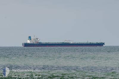
SEA GARNET
Tanker
Current Trip
| Time Travelled | 6 days |
|---|---|
| Remaining Time | 5 h, 2 mins |
| Distance Travelled | 1285.41 nm |
| Remaining Distance | 23.39 nm |
| AVG Speed | 8.9 Knots |
| MAX Speed | 13.2 Knots |
| AVG Wind | 7.7 knots |
| MAX Wind | 18.8 knots |
| MIN Temp | 13.2°C / 55.76°F |
| MAX Temp | 23.6°C / 74.48°F |
| Draught | 9.2 m |
| Position Received | 1 m ago |
Current Position
| Longitude | 28.65085° |
|---|---|
| Latitude | 40.74556° |
| Status | Under way using engine |
| Speed | 0.7 Knots |
| Course | 315° |
| Area | Sea of Marmara |
| Station | T-AIS |
| Position Received | 1 m ago |
Info
Information
The current position of SEA GARNET is in Sea of Marmara with coordinates 40.74556° / 28.65085° as reported on 2024-05-18 20:54 by AIS to our vessel tracker app. The vessel's current speed is 0.7 Knots and is heading at the port of ISTANBUL. The estimated time of arrival as calculated by vessel tracking app is 2024-05-19 01:58 LT
The vessel SEA GARNET (IMO: 9772943, MMSI: 538007654) is a Tanker It's sailing under the flag of [MH] Marshall Is.
In this page you can find informations about the vessels current position, last detected port calls, and current voyage information. If the vessels is not in coverage by AIS you will find the latest position.
The current position of SEA GARNET is detected by our AIS receivers and we are not responsible for the reliability of the data. The last position was recorded while the vessel was in Coverage by the Ais receivers of our vessel tracking app.
The current draught of SEA GARNET as reported by AIS is 9.2 meters
Weather
| Temperature | 16.5°C / 61.7°F |
|---|---|
| Wind Speed | 10 knots |
| Direction | 70° ENE |
| Pressure | 1017.2 hPa |
| Humidity | 75.3 % |
| Cloud Coverage | 71 % |
Featured Company
Last Port Calls
| Port | Arrival | Departure | Time In Port |
|---|---|---|---|
| 2024-05-09 14:43 | 2024-05-11 21:23 | 2 d | |
| 2024-04-29 12:09 | 2024-05-02 13:43 | 3 d | |
| 2024-04-21 05:52 | 2024-04-22 17:00 | 1 d | |
| 2024-03-16 00:01 | 2024-03-18 08:59 | 2 d |
Last Trips
| Origin | Departure | Destination | Arrival | Distance | |
|---|---|---|---|---|---|
| 2024-05-02 15:43 | 2024-05-09 16:43 | 1002.47 nm | |||
| 2024-04-22 20:00 | 2024-04-29 14:09 | 672.40 nm | |||
| 2024-03-18 09:59 | 2024-04-21 08:52 | 7768.84 nm | |||
| 2024-01-13 12:09 | 2024-03-16 01:01 | 9273.77 nm |
Events
| Time | Event | Details | Position / Dest | Info |
|---|---|---|---|---|
| 2024-05-18 11:04 | START Moving | 3.4 nm, East of AMBARLI |
40.94469 / 28.74658
ISTANBUL
|
Speed: 3.2 kn Course: 174° |
| 2024-05-18 10:48 | Status Changed | Under way using engine At anchor |
40.95049 / 28.73859
ISTANBUL
|
Speed: 0.3 kn Course: 89° |
| 2024-05-18 04:14 | Status Changed | At anchor Default |
40.94756 / 28.73832
ISTANBUL
|
Speed: Course: 32° |
| 2024-05-18 04:08 | Status Changed | Default At anchor |
40.94756 / 28.73830
ISTANBUL
|
Speed: Course: 31° |
| 2024-05-17 22:11 | Status Changed | At anchor Under way using engine |
40.94745 / 28.73992
ISTANBUL
|
Speed: 0.4 kn Course: 342° |
| 2024-05-17 21:54 | STOP Moving | 3.1 nm, East of AMBARLI |
40.94821 / 28.74077
ISTANBUL
|
Speed: 0.2 kn Course: 8° |
| 2024-05-17 18:26 | Destination Changed | ISTANBUL CANAKKALE |
40.78269 / 28.16251
ISTANBUL
|
Speed: 12.1 kn Course: 81° |
| 2024-05-17 18:26 | ETA Changed | 2024/05/17 21:01 2024/05/17 15:00 |
40.78269 / 28.16251
ISTANBUL
|
Speed: 12.1 kn Course: 81° |
| 2024-05-17 13:54 | Status Changed | Under way using engine Default |
40.51897 / 27.02175
CANAKKALE
|
Speed: 12 kn Course: 67° |
| 2024-05-17 13:41 | IN Coverage |
40.52204 / 27.03134
Sea of Marmara
CANAKKALE
|
Speed: 12.3 kn Course: 67.5° |