
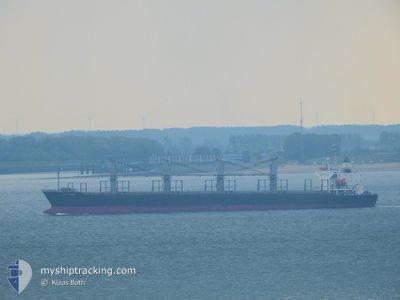
SEA MOON
Bulk Carrier
Current Trip
| Time Travelled | 13 days |
|---|---|
| Remaining Time | --- |
| Distance Travelled | 847.47 nm |
| Remaining Distance | --- |
| AVG Speed | 9.9 Knots |
| MAX Speed | 13.3 Knots |
| AVG Wind | 9.4 knots |
| MAX Wind | 27 knots |
| MIN Temp | 18.2°C / 64.76°F |
| MAX Temp | 26.4°C / 79.52°F |
| Draught | 5.8 m |
| Position Received | 1 m ago |
Current Position
| Longitude | 25.56092° |
|---|---|
| Latitude | 39.35229° |
| Status | Not under command |
| Speed | 0.3 Knots |
| Course | 286° |
| Area | Aegean Sea |
| Station | T-AIS |
| Position Received | 1 m ago |
Info
Information
The current position of SEA MOON is in Aegean Sea with coordinates 39.35229° / 25.56092° as reported on 2024-06-01 19:15 by AIS to our vessel tracker app. The vessel's current speed is 0.3 Knots and is heading at the port of TERNEUZEN. The estimated time of arrival as calculated by vessel tracking app is 2024-05-30 03:00 LT
The vessel SEA MOON (IMO: 9228227, MMSI: 636016427) is a Bulk Carrier that was built in 2002 ( 22 years old ). It's sailing under the flag of [LR] Liberia.
In this page you can find informations about the vessels current position, last detected port calls, and current voyage information. If the vessels is not in coverage by AIS you will find the latest position.
The current position of SEA MOON is detected by our AIS receivers and we are not responsible for the reliability of the data. The last position was recorded while the vessel was in Coverage by the Ais receivers of our vessel tracking app.
The current draught of SEA MOON as reported by AIS is 5.8 meters
Weather
| Temperature | 21.6°C / 70.88°F |
|---|---|
| Wind Speed | 9 knots |
| Direction | 178° S |
| Pressure | 1017.5 hPa |
| Humidity | 77.3 % |
| Cloud Coverage | 3 % |
Featured Company
Last Port Calls
| Port | Arrival | Departure | Time In Port |
|---|---|---|---|
| 2024-05-15 06:48 | 2024-05-19 02:36 | 3 d | |
| 2024-04-06 13:52 | 2024-04-12 01:16 | 5 d |
Most Visited Ports (Last year)
| Port | Arrivals | |
|---|---|---|
| 2 | ||
| 1 | ||
| 1 | ||
| 1 | ||
| 1 | ||
| 1 |
Last Trips
| Origin | Departure | Destination | Arrival | Distance | |
|---|---|---|---|---|---|
| 2024-04-12 03:16 | 2024-05-15 09:48 | 8108.31 nm |
Events
| Time | Event | Details | Position / Dest | Info |
|---|---|---|---|---|
| 2024-06-01 00:00 | ETA Changed | 2025/05/30 03:00 2024/05/30 03:00 |
39.14845 / 25.67444
FOR ORDER
|
Speed: 0.7 kn Course: 247° |
| 2024-05-31 23:48 | Status Changed | Not under command Under way using engine |
39.14617 / 25.67632
FOR ORDER
|
Speed: 0.8 kn Course: 253° |
| 2024-05-31 23:37 | Status Changed | Under way using engine Not under command |
39.14397 / 25.67783
FOR ORDER
|
Speed: 0.8 kn Course: 259° |
| 2024-05-31 23:36 | Status Changed | Not under command Under way using engine |
39.14391 / 25.67787
FOR ORDER
|
Speed: 0.8 kn Course: 259° |
| 2024-05-30 19:37 | STOP Moving | 15.55 nm, South of SKALA ERESOU |
38.87702 / 25.86896
FOR ORDER
|
Speed: 0.3 kn Course: 60° |
| 2024-05-30 06:46 | START Moving | 16.27 nm, North of PSARA |
38.80254 / 25.65748
FOR ORDER
|
Speed: 3.1 kn Course: 67° |
| 2024-05-30 00:11 | STOP Moving | 13.63 nm, North of PSARA |
38.75162 / 25.67601
FOR ORDER
|
Speed: 0.1 kn Course: 182° |
| 2024-05-29 23:59 | START Moving | 14.07 nm, North of PSARA |
38.75930 / 25.67640
FOR ORDER
|
Speed: 3.1 kn Course: 191° |
| 2024-05-29 22:10 | STOP Moving | 13.5 nm, North of PSARA |
38.74880 / 25.67741
FOR ORDER
|
Speed: 0.3 kn Course: 259° |
| 2024-05-29 11:01 | Destination Changed | FOR ORDER CHIOS |
37.49963 / 24.00679
FOR ORDER
|
Speed: 9.8 kn Course: 88.9° |