
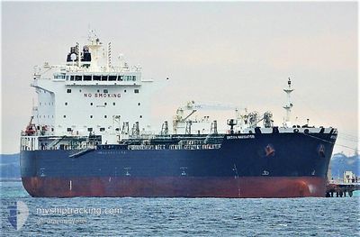
SEA NAVIGATOR
Tanker
Current Trip
PAPBM>COMAM
| Time Travelled | 1 day |
|---|---|
| Remaining Time | --- |
| Distance Travelled | 273.71 nm |
| Remaining Distance | --- |
| AVG Speed | 10.6 Knots |
| MAX Speed | 13.4 Knots |
| AVG Wind | 7.9 knots |
| MAX Wind | 15.8 knots |
| MIN Temp | 26.6°C / 79.88°F |
| MAX Temp | 33.1°C / 91.58°F |
| Draught | 7.5 m |
| Position Received | 2 m ago |
Current Position
| Longitude | -75.52187° |
|---|---|
| Latitude | 10.31946° |
| Status | At anchor |
| Speed | |
| Course | 280° |
| Area | Caribbean Sea |
| Station | T-AIS |
| Position Received | 2 m ago |
Info
Information
The current position of SEA NAVIGATOR is in Caribbean Sea with coordinates 10.31946° / -75.52187° as reported on 2024-05-20 18:46 by AIS to our vessel tracker app. The vessel's current speed is 0 Knots
The vessel SEA NAVIGATOR (IMO: 9724594, MMSI: 538010130) is a Tanker It's sailing under the flag of [MH] Marshall Is.
In this page you can find informations about the vessels current position, last detected port calls, and current voyage information. If the vessels is not in coverage by AIS you will find the latest position.
The current position of SEA NAVIGATOR is detected by our AIS receivers and we are not responsible for the reliability of the data. The last position was recorded while the vessel was in Coverage by the Ais receivers of our vessel tracking app.
The current draught of SEA NAVIGATOR as reported by AIS is 7.5 meters
Weather
| Temperature | 32.7°C / 90.86°F |
|---|---|
| Wind Speed | 7 knots |
| Direction | 273° W |
| Pressure | 1004.4 hPa |
| Humidity | 65 % |
| Cloud Coverage | 51 % |
Featured Company
Last Port Calls
| Port | Arrival | Departure | Time In Port |
|---|---|---|---|
| 2024-05-17 03:38 | 2024-05-19 09:38 | 2 d | |
| 2024-05-08 05:40 | 2024-05-11 04:14 | 2 d | |
| 2024-04-30 13:41 | 2024-05-02 05:06 | 1 d | |
| 2024-04-22 07:08 | 2024-04-24 10:51 | 2 d | |
| 2024-03-10 19:28 | 2024-03-14 06:24 | 3 d | |
| 2024-03-01 03:50 | 2024-03-02 21:53 | 1 d |
Most Visited Ports (Last year)
| Port | Arrivals | |
|---|---|---|
| 4 | ||
| 2 | ||
| 2 | ||
| 1 | ||
| 1 | ||
| 1 |
Last Trips
| Origin | Departure | Destination | Arrival | Distance | |
|---|---|---|---|---|---|
| 2024-05-10 23:14 | 2024-05-16 22:38 | 1630.70 nm | |||
| 2024-05-01 23:06 | 2024-05-08 00:40 | 1671.61 nm | |||
| 2024-04-24 05:51 | 2024-04-30 07:41 | 1670.58 nm | |||
| 2024-03-14 07:24 | 2024-04-22 02:08 | 6526.37 nm | |||
| 2024-03-02 22:53 | 2024-03-10 20:28 | 468.06 nm | |||
| 2024-02-26 23:17 | 2024-03-01 04:50 | 561.31 nm |
Events
| Time | Event | Details | Position / Dest | Info |
|---|---|---|---|---|
| 2024-05-20 09:31 | Status Changed | At anchor Default |
10.32104 / -75.52328
PAPBM>COMAM
|
Speed: Course: 205° |
| 2024-05-20 09:28 | Status Changed | Default At anchor |
10.32102 / -75.52327
PAPBM>COMAM
|
Speed: Course: 205° |
| 2024-05-20 08:01 | Status Changed | At anchor Under way using engine |
10.31987 / -75.52431
PAPBM>COMAM
|
Speed: 0.5 kn Course: 141° |
| 2024-05-20 07:59 | STOP Moving | 4.22 nm, South of CARTAGENA |
10.31971 / -75.52424
PAPBM>COMAM
|
Speed: 0.2 kn Course: 143° |
| 2024-05-20 05:09 | ETA Changed | 2024/05/20 07:00 2024/05/20 06:30 |
10.26993 / -75.97552
PAPBM>COMAM
|
Speed: 12.2 kn Course: 82.7° |
| 2024-05-20 05:01 | Destination Changed | PAPBM>COMAM USBPT>PAMNL |
10.26675 / -76.00052
PAPBM>COMAM
|
Speed: 12.1 kn Course: 82.8° |
| 2024-05-20 05:01 | ETA Changed | 2024/05/20 06:30 2024/05/16 11:00 |
10.26675 / -76.00052
PAPBM>COMAM
|
Speed: 12.1 kn Course: 82.8° |
| 2024-05-20 05:01 | Draught Changed | 7.5 11.9 |
10.26675 / -76.00052
PAPBM>COMAM
|
Speed: 12.1 kn Course: 82.8° |
| 2024-05-20 04:12 | Status Changed | Under way using engine Default |
10.24470 / -76.16815
USBPT>PAMNL
|
Speed: 11.7 kn Course: 85° |
| 2024-05-20 04:06 | Status Changed | Default Under way using engine |
10.24274 / -76.18744
USBPT>PAMNL
|
Speed: 11.8 kn Course: 84° |