
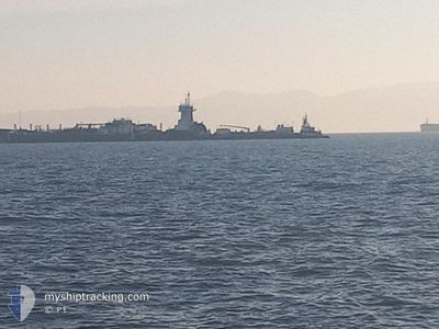
SEA RELIANCE
Articulated Pusher Tug
Current Trip
| Trip Time | 8 h, 38 mins |
|---|---|
| Trip Distance | 88.94 nm |
| AVG Speed | 10.1 Knots |
| MAX Speed | 12 Knots |
| Draught | 6.4 m |
| AVG Wind | 4 knots |
| MAX Wind | 16.5 knots |
| MIN Temp | 9.8°C / 49.64°F |
| MAX Temp | 11.4°C / 52.52°F |
| Position Received | 1 m ago |
Current Position
| Longitude | -122.42445° |
|---|---|
| Latitude | 47.28762° |
| Status | At anchor |
| Speed | |
| Course | 59° |
| Area | The Coastal Waters of Southeast Alaska and British Columbia |
| Station | T-AIS |
| Position Received | 1 m ago |
Info
Information
The current position of SEA RELIANCE is in The Coastal Waters of Southeast Alaska and British Columbia with coordinates 47.28762° / -122.42445° as reported on 2024-06-01 22:23 by AIS to our vessel tracker app. The vessel's current speed is 0 Knots and is currently inside the port of TACOMA.
The vessel SEA RELIANCE (IMO: 9275878, MMSI: 369567000) is a Articulated Pusher Tug that was built in 2002 ( 22 years old ). It's sailing under the flag of [US] USA.
In this page you can find informations about the vessels current position, last detected port calls, and current voyage information. If the vessels is not in coverage by AIS you will find the latest position.
The current position of SEA RELIANCE is detected by our AIS receivers and we are not responsible for the reliability of the data. The last position was recorded while the vessel was in Coverage by the Ais receivers of our vessel tracking app.
The current draught of SEA RELIANCE as reported by AIS is 6.4 meters
Weather
| Temperature | 13.1°C / 55.58°F |
|---|---|
| Wind Speed | 2 knots |
| Direction | 244° WSW |
| Pressure | 1014 hPa |
| Humidity | 91 % |
| Cloud Coverage | 100 % |
Featured Company
Last Port Calls
| Port | Arrival | Departure | Time In Port |
|---|---|---|---|
| 2024-06-01 14:21 | |||
| 2024-05-31 04:39 | 2024-06-01 05:43 | 1 d | |
| 2024-05-28 04:40 | 2024-05-28 22:52 | 18 h | |
| 2024-05-27 07:30 | 2024-05-27 21:19 | 13 h | |
| 2024-05-26 14:41 | 2024-05-27 03:36 | 12 h | |
| 2024-05-20 02:30 | 2024-05-20 23:14 | 20 h | |
| 2024-05-14 16:11 | 2024-05-17 20:27 | 3 d | |
| 2024-05-11 00:34 | 2024-05-12 06:18 | 1 d | |
| 2024-05-09 05:30 | 2024-05-10 12:21 | 1 d | |
| 2024-04-21 19:06 | 2024-05-07 02:07 | 15 d |
Most Visited Ports (Last year)
| Port | Arrivals | |
|---|---|---|
| 26 | ||
| 18 | ||
| 2 | ||
| 2 | ||
| 2 | ||
| 1 |
Last Trips
| Origin | Departure | Destination | Arrival | Distance | |
|---|---|---|---|---|---|
| 2024-05-31 22:43 | 2024-06-01 07:21 | 88.94 nm | |||
| 2024-05-28 15:52 | 2024-05-30 21:39 | 114.00 nm | |||
| 2024-05-27 14:19 | 2024-05-27 21:40 | 88.81 nm | |||
| 2024-05-26 20:36 | 2024-05-27 00:30 | 40.98 nm | |||
| 2024-05-20 16:14 | 2024-05-26 07:41 | 860.54 nm | |||
| 2024-05-17 13:27 | 2024-05-19 19:30 | 454.72 nm | |||
| 2024-05-11 23:18 | 2024-05-14 09:11 | 486.00 nm | |||
| 2024-05-10 05:21 | 2024-05-10 17:34 | 61.37 nm | |||
| 2024-05-06 19:07 | 2024-05-08 22:30 | 474.20 nm | |||
| 2024-04-19 07:14 | 2024-04-21 12:06 | 482.56 nm |
Events
| Time | Event | Details | Position / Dest | Info |
|---|---|---|---|---|
| 2024-06-01 14:32 | Status Changed | At anchor Under way using engine |
47.28866 / -122.42359
[US] TACOMA
|
Speed: 0.3 kn Course: 97° |
| 2024-06-01 14:31 | STOP Moving |
47.28866 / -122.42361
[US] TACOMA
|
Speed: 0.3 kn Course: 97° |
|
| 2024-06-01 14:21 | PORT ARRIVAL |
|
47.29031 / -122.43770
[US] TACOMA
|
Speed: 5.3 kn Course: 102° |
| 2024-06-01 12:06 | Draught Changed | 6.4 6 |
47.61872 / -122.44936
TACOMA
|
Speed: 11.5 kn Course: 132.3° |
| 2024-06-01 12:06 | ETA Changed | 2024/06/01 14:00 |
47.61872 / -122.44936
TACOMA
|
Speed: 11.5 kn Course: 132.3° |
| 2024-06-01 12:00 | Draught Changed | 6 6.4 |
47.63296 / -122.46867
TACOMA
|
Speed: 11.3 kn Course: 156.9° |
| 2024-06-01 11:18 | Draught Changed | 6.4 6 |
47.76561 / -122.45104
TACOMA
|
Speed: 11.6 kn Course: 178.1° |
| 2024-06-01 11:18 | ETA Changed | 2024/06/01 14:00 |
47.76561 / -122.45104
TACOMA
|
Speed: 11.6 kn Course: 178.1° |
| 2024-06-01 11:00 | Draught Changed | 6 6.4 |
47.82153 / -122.46858
TACOMA
|
Speed: 10.9 kn Course: 165° |
| 2024-06-01 05:43 | PORT DEPARTURE |
|
48.52024 / -122.58776
TACOMA
|
Speed: 5.3 kn Course: 334° |