
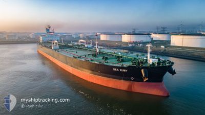
SEA RUBY
Tanker
Current Trip
MYMKZ
| Time Travelled | --- |
|---|---|
| Remaining Time | --- |
| Distance Travelled | 6964.20 nm |
| Remaining Distance | --- |
| AVG Speed | 10.5 Knots |
| MAX Speed | 10.5 Knots |
| AVG Wind | 7.7 knots |
| MAX Wind | 26.2 knots |
| MIN Temp | 20.9°C / 69.62°F |
| MAX Temp | 30.8°C / 87.44°F |
| Draught | 20.9 m |
| Position Received | 9 d ago |
Current Position
| Longitude | 77.37082° |
|---|---|
| Latitude | 6.71544° |
| Status | Under way using engine |
| Speed | 12.6 Knots |
| Course | 117.9° |
| Area | Laccadive Sea |
| Station | T-AIS |
| Position Received | 9 d ago |
Info
Information
The current position of SEA RUBY is in Laccadive Sea with coordinates 6.71544° / 77.37082° as reported on 2024-05-15 07:47 by AIS to our vessel tracker app. The vessel's current speed is 12.6 Knots
The vessel SEA RUBY (IMO: 9779616, MMSI: 538007275) is a Tanker It's sailing under the flag of [MH] Marshall Is.
In this page you can find informations about the vessels current position, last detected port calls, and current voyage information. If the vessels is not in coverage by AIS you will find the latest position.
The current position of SEA RUBY is detected by our AIS receivers and we are not responsible for the reliability of the data. The last position was recorded while the vessel was in Coverage by the Ais receivers of our vessel tracking app.
The current draught of SEA RUBY as reported by AIS is 20.9 meters
Weather
| Temperature | 27.2°C / 80.96°F |
|---|---|
| Wind Speed | 5 knots |
| Direction | 273° W |
| Pressure | 1007.8 hPa |
| Humidity | 78.4 % |
| Cloud Coverage | 100 % |
Featured Company
Events
| Time | Event | Details | Position / Dest | Info |
|---|---|---|---|---|
| 2024-05-24 17:53 | STOP Moving | 3.13 nm, South of SUNGAI UDANG |
2.19696 / 102.10873
MYMKZ
|
Speed: Course: 113° |
| 2024-05-24 17:41 | START Moving | 3.12 nm, South of SUNGAI UDANG |
2.19703 / 102.10873
MYMKZ
|
Speed: 15.4 kn Course: 317° |
| 2024-05-24 01:29 | STOP Moving | 3.67 nm, South of SUNGAI UDANG |
2.18609 / 102.11234
MYMKZ
|
Speed: 0.1 kn Course: 37° |
| 2024-05-24 00:49 | START Moving | 3.82 nm, South West of SUNGAI UDANG |
2.20371 / 102.08017
MYMKZ
|
Speed: 3.2 kn Course: 181° |
| 2024-05-22 17:21 | STOP Moving | 3.61 nm, South West of SUNGAI UDANG |
2.20916 / 102.08037
MYMKZ
|
Speed: 0.1 kn Course: 121° |
| 2024-05-22 16:17 | START Moving | 3.32 nm, South West of SUNGAI UDANG |
2.19609 / 102.10313
MYMKZ
|
Speed: 3.9 kn Course: 208° |
| 2024-05-20 20:28 | STOP Moving | 3.63 nm, South West of SUNGAI UDANG |
2.20018 / 102.08805
MYMKZ
|
Speed: 0.1 kn Course: 15° |
| 2024-05-15 07:48 | Status Changed | Default Under way using engine |
6.71464 / 77.37228
MYMKZ
|
Speed: 12.6 kn Course: 117.9° |
| 2024-05-15 07:47 | OUT of Coverage |
6.71544 / 77.37082
Laccadive Sea
MYMKZ
|
Speed: 12.6 kn Course: 117.9° |
|
| 2024-05-15 07:47 | Change Sea Area | Indian part of the Laccadive Sea Iranian part of the Gulf of Oman |
6.71544 / 77.37082
Laccadive Sea
MYMKZ
|
Speed: 12.6 kn Course: 117.9° |