
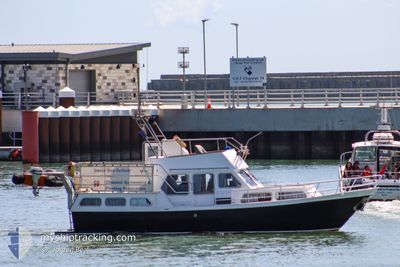
SEA SATIN
Pleasure Craft
Current Trip
| Trip Time | 1 h, 32 mins |
|---|---|
| Trip Distance | 13.06 nm |
| AVG Speed | 8.3 Knots |
| MAX Speed | 9.9 Knots |
| Draught | 1.2 m |
| AVG Wind | 12.3 knots |
| MAX Wind | 13.4 knots |
| MIN Temp | 12.5°C / 54.5°F |
| MAX Temp | 14.7°C / 58.46°F |
| Position Received | 1 d ago |
Current Position
| Longitude | 1.42030° |
|---|---|
| Latitude | 51.33013° |
| Status | Under way using engine |
| Speed | |
| Course | 326° |
| Area | North Sea |
| Station | T-AIS |
| Position Received | 1 d ago |
Info
Information
The current position of SEA SATIN is in North Sea with coordinates 51.33013° / 1.42030° as reported on 2024-06-18 23:47 by AIS to our vessel tracker app. The vessel's current speed is 0 Knots and is currently inside the port of RAMSGATE.
The vessel SEA SATIN (MMSI: 235019388) is a Pleasure Craft It's sailing under the flag of [GB] United Kingdom.
In this page you can find informations about the vessels current position, last detected port calls, and current voyage information. If the vessels is not in coverage by AIS you will find the latest position.
The current position of SEA SATIN is detected by our AIS receivers and we are not responsible for the reliability of the data. The last position was recorded while the vessel was in Coverage by the Ais receivers of our vessel tracking app.
The current draught of SEA SATIN as reported by AIS is 1.2 meters
Weather
| Temperature | 14.7°C / 58.46°F |
|---|---|
| Wind Speed | 13 knots |
| Direction | 23° NNE |
| Pressure | 1016.1 hPa |
| Humidity | 87.2 % |
| Cloud Coverage | 99 % |
Featured Company
Last Port Calls
| Port | Arrival | Departure | Time In Port |
|---|---|---|---|
| 2024-06-18 23:35 | |||
| 2024-06-18 21:29 | 2024-06-18 22:03 | 34 m | |
| 2024-06-17 15:49 | 2024-06-18 05:27 | 13 h | |
| 2024-06-08 13:14 | 2024-06-17 14:08 | 9 d | |
| 2024-06-07 11:45 | 2024-06-08 08:55 | 21 h | |
| 2024-06-06 23:08 | 2024-06-07 10:17 | 11 h | |
| 2024-06-06 19:54 | 2024-06-06 20:15 | 20 m | |
| 2024-06-05 15:08 | 2024-06-05 21:04 | 5 h | |
| 2024-05-27 11:02 | 2024-06-05 13:05 | 9 d | |
| 2024-05-26 17:28 | 2024-05-27 09:05 | 15 h |
Last Trips
| Origin | Departure | Destination | Arrival | Distance | |
|---|---|---|---|---|---|
| 2024-06-18 23:03 | 2024-06-19 00:35 | 13.06 nm | |||
| 2024-06-18 06:27 | 2024-06-18 22:29 | 44.28 nm | |||
| 2024-06-17 15:08 | 2024-06-17 16:49 | 14.04 nm | |||
| 2024-06-08 09:55 | 2024-06-08 14:14 | 11.73 nm | |||
| 2024-06-07 11:17 | 2024-06-07 12:45 | 11.99 nm | |||
| 2024-06-06 22:15 | 2024-06-07 00:08 | 21.08 nm | |||
| 2024-06-05 22:04 | 2024-06-06 21:54 | 49.11 nm | |||
| 2024-06-05 14:05 | 2024-06-05 16:08 | 15.74 nm | |||
| 2024-05-27 10:05 | 2024-05-27 12:02 | 7.05 nm | |||
| 2024-05-26 10:30 | 2024-05-26 18:28 | 19.82 nm |
Events
| Time | Event | Details | Position / Dest | Info |
|---|---|---|---|---|
| 2024-06-18 23:47 | OUT of Coverage |
51.33013 / 1.42030
North Sea
[GB] RAMSGATE
|
Speed: Course: 0° |
|
| 2024-06-18 23:41 | STOP Moving |
51.33011 / 1.42033
[GB] RAMSGATE
|
Speed: Course: 334° |
|
| 2024-06-18 23:35 | PORT ARRIVAL |
|
51.32471 / 1.42390
[GB] RAMSGATE
|
Speed: 7.7 kn Course: 36° |
| 2024-06-18 22:51 | Destination Changed | GBRMG GBDVR |
51.22736 / 1.42689
GBRMG
|
Speed: 8.9 kn Course: 10° |
| 2024-06-18 22:16 | Change Sea Area | United Kingdom part of the North Sea United Kingdom part of the English Channel |
51.14621 / 1.39388
North Sea
|
Speed: 9.2 kn Course: 31.3° |
| 2024-06-18 22:03 | PORT DEPARTURE |
|
51.12693 / 1.35702
GBDVR
|
Speed: 5.7 kn Course: 107° |
| 2024-06-18 21:29 | PORT ARRIVAL |
|
51.11321 / 1.32697
[GB] DOVER
|
Speed: 6.6 kn Course: 330.5° |
| 2024-06-18 20:20 | Detected in Sea | United Kingdom part of the English Channel |
50.99141 / 1.44016
English Channel
|
Speed: 7.6 kn Course: 330.4° |
| 2024-06-18 19:10 | Status Changed | Under way using engine Restricted manoeuverability |
50.85493 / 1.57301
GBDVR
|
Speed: 6.5 kn Course: 271.9° |
| 2024-06-18 19:09 | START Moving | 7.65 nm, North of BOULOGNE-SUR-MER |
50.85489 / 1.57468
GBDVR
|
Speed: 6.1 kn Course: 270.5° |