
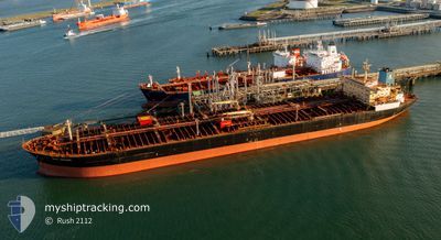
SEA SENOR
Crude Oil Tanker
Current Trip
FOR_ORDERS
| Time Travelled | 5 days |
|---|---|
| Remaining Time | --- |
| Distance Travelled | 285.84 nm |
| Remaining Distance | --- |
| AVG Speed | 8.2 Knots |
| MAX Speed | 12.7 Knots |
| AVG Wind | 15.7 knots |
| MAX Wind | 22 knots |
| MIN Temp | 9.8°C / 49.64°F |
| MAX Temp | 14.4°C / 57.92°F |
| Draught | 9 m |
| Position Received | 1 m ago |
Current Position
| Longitude | -5.51059° |
|---|---|
| Latitude | 50.85533° |
| Status | Under way using engine |
| Speed | 0.7 Knots |
| Course | 295° |
| Area | Celtic Sea |
| Station | T-AIS |
| Position Received | 1 m ago |
Info
Information
The current position of SEA SENOR is in Celtic Sea with coordinates 50.85533° / -5.51059° as reported on 2024-06-10 05:58 by AIS to our vessel tracker app. The vessel's current speed is 0.7 Knots
The vessel SEA SENOR (IMO: 9308950, MMSI: 538008798) is a Crude Oil Tanker that was built in 2006 ( 18 years old ). It's sailing under the flag of [MH] Marshall Is.
In this page you can find informations about the vessels current position, last detected port calls, and current voyage information. If the vessels is not in coverage by AIS you will find the latest position.
The current position of SEA SENOR is detected by our AIS receivers and we are not responsible for the reliability of the data. The last position was recorded while the vessel was in Coverage by the Ais receivers of our vessel tracking app.
The current draught of SEA SENOR as reported by AIS is 9 meters
Weather
| Temperature | 12.8°C / 55.04°F |
|---|---|
| Wind Speed | 21 knots |
| Direction | 359° N |
| Pressure | 1012 hPa |
| Humidity | 88.3 % |
| Cloud Coverage | 100 % |
Featured Company
Most Visited Ports (Last year)
| Port | Arrivals | |
|---|---|---|
| 2 | ||
| 1 | ||
| 1 | ||
| 1 | ||
| 1 | ||
| 1 |
Events
| Time | Event | Details | Position / Dest | Info |
|---|---|---|---|---|
| 2024-06-10 04:40 | Status Changed | Under way using engine Default |
50.87291 / -5.47062
FOR_ORDERS
|
Speed: 1.7 kn Course: 262° |
| 2024-06-10 04:39 | Status Changed | Default Under way using engine |
50.87309 / -5.47078
FOR_ORDERS
|
Speed: 1.7 kn Course: 266° |
| 2024-06-10 03:23 | Status Changed | Under way using engine Default |
50.91675 / -5.50378
FOR_ORDERS
|
Speed: 2.5 kn Course: 212° |
| 2024-06-10 03:19 | Status Changed | Default Under way using engine |
50.91893 / -5.50499
FOR_ORDERS
|
Speed: 2.6 kn Course: 215° |
| 2024-06-10 02:48 | Status Changed | Under way using engine Default |
50.94018 / -5.51701
FOR_ORDERS
|
Speed: 2.4 kn Course: 217° |
| 2024-06-10 02:47 | Status Changed | Default Under way using engine |
50.94064 / -5.51724
FOR_ORDERS
|
Speed: 2.5 kn Course: 208° |
| 2024-06-10 02:34 | Status Changed | Under way using engine Default |
50.94942 / -5.52210
FOR_ORDERS
|
Speed: 2.4 kn Course: 215° |
| 2024-06-10 02:31 | Status Changed | Default Under way using engine |
50.95130 / -5.52306
FOR_ORDERS
|
Speed: 2.4 kn Course: 211° |
| 2024-06-10 02:11 | Status Changed | Under way using engine Default |
50.96530 / -5.52973
FOR_ORDERS
|
Speed: 2.4 kn Course: 213° |
| 2024-06-10 02:07 | Status Changed | Default Under way using engine |
50.96742 / -5.53066
FOR_ORDERS
|
Speed: 2.3 kn Course: 211° |