
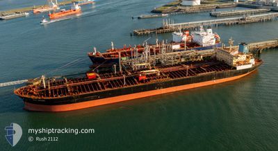
SEA SENOR
Crude Oil Tanker
Current Trip
FOR_ORDERS
| Time Travelled | 4 days |
|---|---|
| Remaining Time | --- |
| Distance Travelled | 245.09 nm |
| Remaining Distance | --- |
| AVG Speed | 9.2 Knots |
| MAX Speed | 12.7 Knots |
| AVG Wind | 14.5 knots |
| MAX Wind | 18 knots |
| MIN Temp | 9.8°C / 49.64°F |
| MAX Temp | 14.3°C / 57.74°F |
| Draught | 9 m |
| Position Received | Now |
Current Position
| Longitude | -5.07025° |
|---|---|
| Latitude | 51.14719° |
| Status | Under way using engine |
| Speed | 2.2 Knots |
| Course | 349° |
| Area | Celtic Sea |
| Station | T-AIS |
| Position Received | Now |
Info
Information
The current position of SEA SENOR is in Celtic Sea with coordinates 51.14719° / -5.07025° as reported on 2024-06-09 19:45 by AIS to our vessel tracker app. The vessel's current speed is 2.2 Knots
The vessel SEA SENOR (IMO: 9308950, MMSI: 538008798) is a Crude Oil Tanker that was built in 2006 ( 18 years old ). It's sailing under the flag of [MH] Marshall Is.
In this page you can find informations about the vessels current position, last detected port calls, and current voyage information. If the vessels is not in coverage by AIS you will find the latest position.
The current position of SEA SENOR is detected by our AIS receivers and we are not responsible for the reliability of the data. The last position was recorded while the vessel was in Coverage by the Ais receivers of our vessel tracking app.
The current draught of SEA SENOR as reported by AIS is 9 meters
Weather
| Temperature | 13.8°C / 56.84°F |
|---|---|
| Wind Speed | 18 knots |
| Direction | 263° W |
| Pressure | 1013.7 hPa |
| Humidity | 81.3 % |
| Cloud Coverage | 100 % |
Featured Company
Events
| Time | Event | Details | Position / Dest | Info |
|---|---|---|---|---|
| 2024-06-09 11:04 | Status Changed | Under way using engine Default |
51.07198 / -5.37642
FOR_ORDERS
|
Speed: 0.2 kn Course: 27° |
| 2024-06-09 11:03 | Status Changed | Default Under way using engine |
51.07204 / -5.37657
FOR_ORDERS
|
Speed: 0.2 kn Course: 28° |
| 2024-06-09 00:19 | Status Changed | Under way using engine Default |
51.13485 / -5.77458
FOR_ORDERS
|
Speed: 1 kn Course: 30° |
| 2024-06-08 23:39 | Status Changed | Default Under way using engine |
51.13074 / -5.78578
FOR_ORDERS
|
Speed: 0.8 kn Course: 2° |
| 2024-06-08 23:20 | Status Changed | Under way using engine Default |
51.12673 / -5.78868
FOR_ORDERS
|
Speed: 0.8 kn Course: 2° |
| 2024-06-08 22:55 | Status Changed | Default Under way using engine |
51.12142 / -5.79247
FOR_ORDERS
|
Speed: 0.8 kn Course: 358° |
| 2024-06-08 22:11 | Status Changed | Under way using engine Default |
51.11191 / -5.79534
FOR_ORDERS
|
Speed: 0.7 kn Course: 354° |
| 2024-06-08 21:51 | Status Changed | Default Under way using engine |
51.10785 / -5.79702
FOR_ORDERS
|
Speed: 0.7 kn Course: 3° |
| 2024-06-08 21:51 | Status Changed | Under way using engine Default |
51.10781 / -5.79707
FOR_ORDERS
|
Speed: 0.7 kn Course: 3° |
| 2024-06-08 21:22 | Status Changed | Default Under way using engine |
51.10323 / -5.79986
FOR_ORDERS
|
Speed: 0.5 kn Course: 18° |