
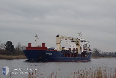
SEA STEAMER
General Cargo
Current Trip
| Time Travelled | 2 days |
|---|---|
| Remaining Time | 3 days |
| Distance Travelled | 705.65 nm |
| Remaining Distance | 1218.84 nm |
| AVG Speed | 11.3 Knots |
| MAX Speed | 14.8 Knots |
| AVG Wind | 11.3 knots |
| MAX Wind | 22.8 knots |
| MIN Temp | 11°C / 51.8°F |
| MAX Temp | 15.2°C / 59.36°F |
| Draught | 8.7 m |
| Position Received | 5 h, 19 m ago |
Current Position
| Longitude | -6.21580° |
|---|---|
| Latitude | 48.39811° |
| Status | Under way using engine |
| Speed | 10.6 Knots |
| Course | 206.7° |
| Area | Celtic Sea |
| Station | T-AIS |
| Position Received | 5 h, 19 m ago |
Info
Information
The current position of SEA STEAMER is in Celtic Sea with coordinates 48.39811° / -6.21580° as reported on 2024-06-06 13:10 by AIS to our vessel tracker app. The vessel's current speed is 10.6 Knots and is heading at the port of MOSTAGANEM. The estimated time of arrival as calculated by vessel tracking app is 2024-06-10 14:50 LT
The vessel SEA STEAMER (IMO: 9366158, MMSI: 258045000) is a General Cargo that was built in 2011 ( 13 years old ). It's sailing under the flag of [NO] Norway.
In this page you can find informations about the vessels current position, last detected port calls, and current voyage information. If the vessels is not in coverage by AIS you will find the latest position.
The current position of SEA STEAMER is detected by our AIS receivers and we are not responsible for the reliability of the data. The last position was recorded while the vessel was in Coverage by the Ais receivers of our vessel tracking app.
The current draught of SEA STEAMER as reported by AIS is 8.7 meters
Weather
| Temperature | 13.8°C / 56.84°F |
|---|---|
| Wind Speed | 10 knots |
| Direction | 334° NNW |
| Pressure | 1021.8 hPa |
| Humidity | 65.2 % |
| Cloud Coverage | 6 % |
Featured Company
Last Port Calls
| Port | Arrival | Departure | Time In Port |
|---|---|---|---|
| 2024-06-03 19:59 | 2024-06-03 21:54 | 1 h | |
| 2024-06-03 08:59 | 2024-06-03 10:55 | 1 h | |
| 2024-05-28 18:50 | 2024-05-31 17:42 | 2 d | |
| 2024-04-28 20:45 | 2024-05-11 12:48 | 12 d | |
| 2024-04-23 00:14 | 2024-04-26 00:16 | 3 d | |
| 2024-04-16 01:27 | 2024-04-16 05:29 | 4 h | |
| 2024-04-08 23:27 | |||
| 2024-04-03 22:33 | 2024-04-06 05:21 | 2 d | |
| 2024-04-03 14:44 |
Most Visited Ports (Last year)
| Port | Arrivals | |
|---|---|---|
| 4 | ||
| 3 | ||
| 3 | ||
| 2 | ||
| 2 | ||
| 2 |
Last Trips
| Origin | Departure | Destination | Arrival | Distance | |
|---|---|---|---|---|---|
| 2024-06-03 12:55 | 2024-06-03 21:59 | 49.76 nm | |||
| 2024-05-31 20:42 | 2024-06-03 10:59 | 714.86 nm | |||
| 2024-05-11 14:48 | 2024-05-28 21:50 | 3676.64 nm | |||
| 2024-04-26 02:16 | 2024-04-28 22:45 | 814.42 nm | |||
| 2024-04-16 07:29 | 2024-04-23 02:14 | 1808.48 nm | |||
| 2024-04-06 07:21 | 2024-04-16 03:27 | 2416.97 nm | |||
| 2024-04-06 07:21 | 2024-04-09 01:27 | 699.32 nm | |||
| 2024-04-03 16:44 | 2024-04-04 00:33 | 71.55 nm |
Events
| Time | Event | Details | Position / Dest | Info |
|---|---|---|---|---|
| 2024-06-06 13:10 | OUT of Coverage |
48.39811 / -6.21580
Celtic Sea
MOSTAGANEM
|
Speed: 10.6 kn Course: 206.7° |
|
| 2024-06-06 10:17 | Status Changed | Under way using engine Default |
48.89656 / -5.82885
MOSTAGANEM
|
Speed: 12.8 kn Course: 236° |
| 2024-06-06 10:17 | IN Coverage |
48.89526 / -5.83006
Celtic Sea
MOSTAGANEM
|
Speed: 12.6 kn Course: 210.8° |
|
| 2024-06-06 09:27 | Status Changed | Default Under way using engine |
48.99538 / -5.60158
MOSTAGANEM
|
Speed: 13.2 kn Course: 236° |
| 2024-06-06 09:14 | OUT of Coverage |
49.02181 / -5.54123
Celtic Sea
MOSTAGANEM
|
Speed: 13.2 kn Course: 236° |
|
| 2024-06-06 08:57 | Status Changed | Under way using engine Default |
49.05375 / -5.46520
MOSTAGANEM
|
Speed: 13 kn Course: 240° |
| 2024-06-06 08:41 | IN Coverage |
49.05375 / -5.46520
Celtic Sea
MOSTAGANEM
|
Speed: 12.9 kn Course: 238.7° |
|
| 2024-06-06 07:26 | Status Changed | Default Under way using engine |
49.21356 / -5.04333
MOSTAGANEM
|
Speed: 11.9 kn Course: 241.6° |
| 2024-06-06 07:26 | OUT of Coverage |
49.21408 / -5.04185
Celtic Sea
MOSTAGANEM
|
Speed: 11.9 kn Course: 241.6° |
|
| 2024-06-06 07:26 | Change Sea Area | French part of the Celtic Sea French part of the English Channel |
49.21408 / -5.04185
Celtic Sea
MOSTAGANEM
|
Speed: 11.9 kn Course: 241.6° |