
SEA TURTLE
Tanker
Current Trip
| Time Travelled | 32 days |
|---|---|
| Remaining Time | --- |
| Distance Travelled | 9311.09 nm |
| Remaining Distance | --- |
| AVG Speed | 11.8 Knots |
| MAX Speed | 14.6 Knots |
| AVG Wind | 14.3 knots |
| MAX Wind | 34.8 knots |
| MIN Temp | 7.6°C / 45.68°F |
| MAX Temp | 25.7°C / 78.26°F |
| Draught | 9.8 m |
| Position Received | 9 d ago |
Current Position
| Longitude | 17.88172° |
|---|---|
| Latitude | -34.64297° |
| Status | Under way using engine |
| Speed | 12.9 Knots |
| Course | 305.8° |
| Area | South Atlantic Ocean |
| Station | T-AIS |
| Position Received | 9 d ago |
Info
Information
The current position of SEA TURTLE is in South Atlantic Ocean with coordinates -34.64297° / 17.88172° as reported on 2024-06-10 23:27 by AIS to our vessel tracker app. The vessel's current speed is 12.9 Knots and is heading at the port of FOS. The estimated time of arrival as calculated by vessel tracking app is 2024-06-29 05:00 LT
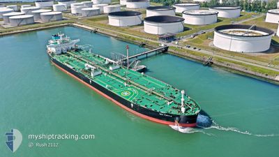
The vessel SEA TURTLE (IMO: 9886718, MMSI: 241731000) is a Tanker It's sailing under the flag of [GR] Greece.
In this page you can find informations about the vessels current position, last detected port calls, and current voyage information. If the vessels is not in coverage by AIS you will find the latest position.
The current position of SEA TURTLE is detected by our AIS receivers and we are not responsible for the reliability of the data. The last position was recorded while the vessel was in Coverage by the Ais receivers of our vessel tracking app.
The current draught of SEA TURTLE as reported by AIS is 9.8 meters
Weather
| Temperature | 25.4°C / 77.72°F |
|---|---|
| Wind Speed | 14 knots |
| Direction | 179° S |
| Pressure | 1013.3 hPa |
| Humidity | 74.1 % |
| Cloud Coverage | 74 % |
Featured Company
Last Port Calls
| Port | Arrival | Departure | Time In Port |
|---|---|---|---|
| 2024-05-09 22:06 | 2024-05-18 13:24 | 8 d | |
| 2024-04-08 11:16 | 2024-04-09 08:55 | 21 h |
Most Visited Ports (Last year)
| Port | Arrivals | |
|---|---|---|
| 2 | ||
| 2 | ||
| 2 | ||
| 2 | ||
| 1 | ||
| 1 |
Last Trips
| Origin | Departure | Destination | Arrival | Distance | |
|---|---|---|---|---|---|
| 2024-04-09 16:55 | 2024-05-10 08:06 | 5273.82 nm | |||
| 2024-03-22 14:12 | 2024-04-08 19:16 | 4120.78 nm |
Events
| Time | Event | Details | Position / Dest | Info |
|---|---|---|---|---|
| 2024-06-10 23:32 | Status Changed | Default Under way using engine |
-34.63204 / 17.86655
FRFOS
|
Speed: 12.9 kn Course: 305.8° |
| 2024-06-10 23:27 | OUT of Coverage |
-34.64297 / 17.88172
South Atlantic Ocean
FRFOS
|
Speed: 12.9 kn Course: 305.8° |
|
| 2024-06-10 23:26 | Status Changed | Under way using engine Default |
-34.64403 / 17.88349
FRFOS
|
Speed: 13.1 kn Course: 306° |
| 2024-06-10 23:22 | Status Changed | Default Under way using engine |
-34.65320 / 17.89892
FRFOS
|
Speed: 13 kn Course: 304.3° |
| 2024-06-10 23:12 | Status Changed | Under way using engine Default |
-34.67480 / 17.93568
FRFOS
|
Speed: 12.7 kn Course: 305° |
| 2024-06-10 23:07 | Status Changed | Default Under way using engine |
-34.68430 / 17.95230
FRFOS
|
Speed: 12.6 kn Course: 303.7° |
| 2024-06-10 22:59 | Status Changed | Under way using engine Default |
-34.69913 / 17.97900
FRFOS
|
Speed: 12.6 kn Course: 304° |
| 2024-06-10 22:50 | Status Changed | Default Under way using engine |
-34.71840 / 18.01308
FRFOS
|
Speed: 12.6 kn Course: 304.5° |
| 2024-06-10 22:46 | Status Changed | Under way using engine Default |
-34.72604 / 18.02654
FRFOS
|
Speed: 12.7 kn Course: 306° |
| 2024-06-10 22:44 | Status Changed | Default Under way using engine |
-34.73042 / 18.03421
FRFOS
|
Speed: 12.6 kn Course: 304.7° |