
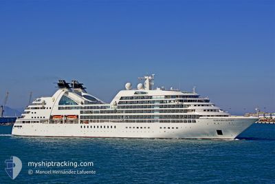
SEABOURN ODYSSEY
Passengers Ship
Current Trip
MISTYFJORD
| Time Travelled | 1 day |
|---|---|
| Remaining Time | --- |
| Distance Travelled | 226.75 nm |
| Remaining Distance | --- |
| AVG Speed | 14.4 Knots |
| MAX Speed | 15.7 Knots |
| AVG Wind | 5.2 knots |
| MAX Wind | 12.9 knots |
| MIN Temp | 6.7°C / 44.06°F |
| MAX Temp | 12.7°C / 54.86°F |
| Draught | 6.8 m |
| Position Received | 13 h, 36 m ago |
Current Position
| Longitude | -131.12803° |
|---|---|
| Latitude | 55.19457° |
| Status | Under way using engine |
| Speed | 15.3 Knots |
| Course | 37.7° |
| Area | The Coastal Waters of Southeast Alaska and British Columbia |
| Station | T-AIS |
| Position Received | 13 h, 36 m ago |
Info
Information
The current position of SEABOURN ODYSSEY is in The Coastal Waters of Southeast Alaska and British Columbia with coordinates 55.19457° / -131.12803° as reported on 2024-06-15 12:00 by AIS to our vessel tracker app. The vessel's current speed is 15.3 Knots
The vessel SEABOURN ODYSSEY (IMO: 9417086, MMSI: 309416000) is a Passengers Ship that was built in 2009 ( 15 years old ). It's sailing under the flag of [BS] Bahamas.
In this page you can find informations about the vessels current position, last detected port calls, and current voyage information. If the vessels is not in coverage by AIS you will find the latest position.
The current position of SEABOURN ODYSSEY is detected by our AIS receivers and we are not responsible for the reliability of the data. The last position was recorded while the vessel was in Coverage by the Ais receivers of our vessel tracking app.
The current draught of SEABOURN ODYSSEY as reported by AIS is 6.8 meters
Weather
| Temperature | 11.3°C / 52.34°F |
|---|---|
| Wind Speed | 5 knots |
| Direction | 194° SSW |
| Pressure | 1017.1 hPa |
| Humidity | 84.5 % |
| Cloud Coverage | 100 % |
Featured Company
Last Port Calls
| Port | Arrival | Departure | Time In Port |
|---|---|---|---|
| 2024-06-14 16:51 | 2024-06-15 01:03 | 8 h | |
| 2024-06-12 13:59 | 2024-06-13 07:07 | 17 h | |
| 2024-06-10 15:43 | 2024-06-11 01:27 | 9 h | |
| 2024-06-09 13:35 | 2024-06-09 23:59 | 10 h | |
| 2024-06-07 18:26 | 2024-06-08 00:17 | 5 h | |
| 2024-06-07 13:27 | 2024-06-07 13:54 | 26 m | |
| 2024-06-04 15:08 | 2024-06-05 05:51 | 14 h | |
| 2024-06-04 14:38 | 2024-06-04 14:45 | 6 m | |
| 2024-06-03 09:49 | 2024-06-03 10:41 | 52 m | |
| 2024-06-02 15:04 | 2024-06-03 02:00 | 10 h |
Last Trips
| Origin | Departure | Destination | Arrival | Distance | |
|---|---|---|---|---|---|
| 2024-06-12 23:07 | 2024-06-14 08:51 | 304.56 nm | |||
| 2024-06-10 17:27 | 2024-06-12 05:59 | 229.88 nm | |||
| 2024-06-09 15:59 | 2024-06-10 07:43 | 221.18 nm | |||
| 2024-06-07 17:17 | 2024-06-09 05:35 | 534.41 nm | |||
| 2024-06-07 06:54 | 2024-06-07 11:26 | 45.97 nm | |||
| 2024-06-04 22:51 | 2024-06-07 06:27 | 502.17 nm | |||
| 2024-06-04 07:45 | 2024-06-04 08:08 | 1.59 nm | |||
| 2024-06-03 02:41 | 2024-06-04 07:38 | 205.28 nm | |||
| 2024-06-02 18:00 | 2024-06-03 01:49 | 85.29 nm | |||
| 2024-05-31 21:32 | 2024-06-02 07:04 | 294.02 nm |
Events
| Time | Event | Details | Position / Dest | Info |
|---|---|---|---|---|
| 2024-06-15 23:03 | START Moving |
55.58890 / -130.74097
MISTYFJORD
|
Speed: 11.3 kn Course: 227° |
|
| 2024-06-15 17:18 | STOP Moving |
55.60969 / -130.70146
MISTYFJORD
|
Speed: 0.1 kn Course: 160° |
|
| 2024-06-15 14:43 | STOP Moving |
55.63258 / -130.70065
MISTYFJORD
|
Speed: 0.2 kn Course: 65° |
|
| 2024-06-15 12:05 | Status Changed | Default Under way using engine |
55.21011 / -131.10719
MISTYFJORD
|
Speed: 15.3 kn Course: 37.7° |
| 2024-06-15 12:00 | Status Changed | Under way using engine Default |
55.19457 / -131.12803
MISTYFJORD
|
Speed: 15.3 kn Course: 37° |
| 2024-06-15 12:00 | OUT of Coverage |
55.19457 / -131.12803
The Coastal Waters of Southeast Alaska and British Columbia
MISTYFJORD
|
Speed: 15.3 kn Course: 37.7° |
|
| 2024-06-15 11:15 | Status Changed | Default Under way using engine |
55.01694 / -131.11819
MISTYFJORD
|
Speed: 15.1 kn Course: 353.4° |
| 2024-06-15 08:12 | Destination Changed | MISTYFJORD US KTN |
54.56940 / -131.95416
MISTYFJORD
|
Speed: 14.2 kn Course: 93° |
| 2024-06-15 08:12 | ETA Changed | 2024/06/15 15:00 2024/06/09 12:00 |
54.56940 / -131.95416
MISTYFJORD
|
Speed: 14.2 kn Course: 93° |
| 2024-06-15 07:28 | Status Changed | Under way using engine Default |
54.57516 / -132.24171
US KTN
|
Speed: 13.8 kn Course: 90° |