
SEACALM
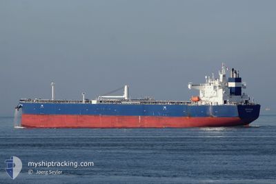
Tanker A
Current Trip
| Time Travelled | 1 day |
|---|---|
| Remaining Time | --- |
| Distance Travelled | 221.03 nm |
| Remaining Distance | --- |
| AVG Speed | 11.7 Knots |
| MAX Speed | 13.3 Knots |
| AVG Wind | 6 knots |
| MAX Wind | 11.3 knots |
| MIN Temp | 17.3°C / 63.14°F |
| MAX Temp | 22°C / 71.6°F |
| Draught | 13 m |
| Position Received | 14 h, 56 m ago |
Current Position
| Longitude | 36.82593° |
|---|---|
| Latitude | 42.34837° |
| Status | Under way using engine |
| Speed | 13.3 Knots |
| Course | 275.3° |
| Area | Black Sea |
| Station | T-AIS |
| Position Received | 14 h, 56 m ago |
Info
Information
The current position of SEACALM is in Black Sea with coordinates 42.34837° / 36.82593° as reported on 2024-06-01 15:07 by AIS to our vessel tracker app. The vessel's current speed is 13.3 Knots and is heading at the port of VALLETTA. The estimated time of arrival as calculated by vessel tracking app is 2024-06-07 23:00 LT
The vessel SEACALM (IMO: 9773753, MMSI: 538007376) is a Tanker A It's sailing under the flag of [MH] Marshall Is.
In this page you can find informations about the vessels current position, last detected port calls, and current voyage information. If the vessels is not in coverage by AIS you will find the latest position.
The current position of SEACALM is detected by our AIS receivers and we are not responsible for the reliability of the data. The last position was recorded while the vessel was in Coverage by the Ais receivers of our vessel tracking app.
The current draught of SEACALM as reported by AIS is 13 meters
Weather
| Temperature | 19.8°C / 67.64°F |
|---|---|
| Wind Speed | 11 knots |
| Direction | 136° SE |
| Pressure | 1020.2 hPa |
| Humidity | 79.8 % |
| Cloud Coverage | --- |
Featured Company
Last Trips
| Origin | Departure | Destination | Arrival | Distance | |
|---|---|---|---|---|---|
| 2024-05-13 02:58 | 2024-05-27 01:11 | 1947.04 nm | |||
| 2024-05-04 02:44 | 2024-05-11 21:17 | 1430.01 nm | |||
| 2024-05-02 23:51 | 2024-05-03 07:44 | 18.00 nm | |||
| 2024-04-26 19:30 | 2024-05-02 23:44 | 1446.53 nm | |||
| 2024-03-22 08:29 | 2024-04-25 15:07 | 2537.88 nm |
Events
| Time | Event | Details | Position / Dest | Info |
|---|---|---|---|---|
| 2024-06-01 15:07 | OUT of Coverage |
42.34837 / 36.82593
Black Sea
MTMLA
|
Speed: 13.3 kn Course: 275.3° |
|
| 2024-06-01 14:14 | Status Changed | Under way using engine Default |
42.30928 / 37.06976
MTMLA
|
Speed: 12 kn Course: 282° |
| 2024-06-01 14:10 | Status Changed | Default Under way using engine |
42.30664 / 37.08614
MTMLA
|
Speed: 12.3 kn Course: 282.2° |
| 2024-06-01 11:09 | Status Changed | Under way using engine Default |
42.17973 / 37.91891
MTMLA
|
Speed: 12.7 kn Course: 282° |
| 2024-06-01 11:02 | Status Changed | Default Under way using engine |
42.17403 / 37.95387
MTMLA
|
Speed: 12.7 kn Course: 282.2° |
| 2024-06-01 10:58 | Status Changed | Under way using engine Default |
42.17104 / 37.97249
MTMLA
|
Speed: 12.6 kn Course: 282° |
| 2024-06-01 10:50 | Status Changed | Default Under way using engine |
42.16534 / 38.00809
MTMLA
|
Speed: 12.6 kn Course: 281.3° |
| 2024-06-01 10:42 | Status Changed | Under way using engine Default |
42.15958 / 38.04686
MTMLA
|
Speed: 12.5 kn Course: 280° |
| 2024-06-01 10:34 | Status Changed | Default Under way using engine |
42.15515 / 38.08201
MTMLA
|
Speed: 12 kn Course: 279.9° |
| 2024-06-01 10:25 | Status Changed | Under way using engine Default |
42.15016 / 38.12275
MTMLA
|
Speed: 12.5 kn Course: 279° |