
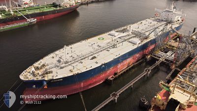
SEACHARM
Tanker A
Current Trip
| Time Travelled | 7 days |
|---|---|
| Remaining Time | -6 mins |
| Distance Travelled | 1366.60 nm |
| Remaining Distance | 16.49 nm |
| AVG Speed | 7.9 Knots |
| MAX Speed | 7.9 Knots |
| AVG Wind | 10.1 knots |
| MAX Wind | 22 knots |
| MIN Temp | 12.2°C / 53.96°F |
| MAX Temp | 22.3°C / 72.14°F |
| Draught | 8.2 m |
| Position Received | 54 m ago |
Current Position
| Longitude | 35.76773° |
|---|---|
| Latitude | 36.58238° |
| Status | Under way using engine |
| Speed | 4.6 Knots |
| Course | 51° |
| Area | Mediterranean Sea - Eastern Basin |
| Station | T-AIS |
| Position Received | 54 m ago |
Info
Information
The current position of SEACHARM is in Mediterranean Sea - Eastern Basin with coordinates 36.58238° / 35.76773° as reported on 2024-05-10 04:33 by AIS to our vessel tracker app. The vessel's current speed is 4.6 Knots and is heading at the port of CEYHAN. The estimated time of arrival as calculated by vessel tracking app is 2024-05-10 05:21 LT
The vessel SEACHARM (IMO: 9773765, MMSI: 538007825) is a Tanker A It's sailing under the flag of [MH] Marshall Is.
In this page you can find informations about the vessels current position, last detected port calls, and current voyage information. If the vessels is not in coverage by AIS you will find the latest position.
The current position of SEACHARM is detected by our AIS receivers and we are not responsible for the reliability of the data. The last position was recorded while the vessel was in Coverage by the Ais receivers of our vessel tracking app.
The current draught of SEACHARM as reported by AIS is 8.2 meters
Weather
| Temperature | 22.3°C / 72.14°F |
|---|---|
| Wind Speed | 14 knots |
| Direction | 42° NE |
| Pressure | 1009 hPa |
| Humidity | 60.8 % |
| Cloud Coverage | 75 % |
Featured Company
Last Trips
Events
| Time | Event | Details | Position / Dest | Info |
|---|---|---|---|---|
| 2024-05-10 04:38 | Status Changed | Default Under way using engine |
36.58675 / 35.77443
TRCEY
|
Speed: 4.6 kn Course: 51° |
| 2024-05-09 21:01 | Change Sea Area | Turkish part of the Mediterranean Sea - Eastern Basin Cypriote part of the Mediterranean Sea - Eastern Basin |
36.19629 / 34.82375
Mediterranean Sea - Eastern Basin
TRCEY
|
Speed: 11.1 kn Course: 73.3° |
| 2024-05-09 20:34 | Detected in Sea | Cypriote part of the Mediterranean Sea - Eastern Basin |
36.17326 / 34.72071
Mediterranean Sea - Eastern Basin
TRCEY
|
Speed: 11.2 kn Course: 75.6° |
| 2024-05-09 20:34 | Status Changed | Under way using engine Default |
36.17326 / 34.72071
TRCEY
|
Speed: 11.3 kn Course: 75° |
| 2024-05-09 20:20 | IN Coverage |
36.17326 / 34.72071
Mediterranean Sea - Eastern Basin
TRCEY
|
Speed: 11.2 kn Course: 75.6° |
|
| 2024-05-09 16:47 | Status Changed | Default Under way using engine |
36.03275 / 34.02969
TRCEY
|
Speed: 7.9 kn Course: 75.4° |
| 2024-05-09 16:42 | OUT of Coverage |
36.02968 / 34.01537
Mediterranean Sea - Eastern Basin
TRCEY
|
Speed: 7.9 kn Course: 75.4° |
|
| 2024-05-09 16:21 | Status Changed | Under way using engine Default |
36.01833 / 33.96375
TRCEY
|
Speed: 7.7 kn Course: 76° |
| 2024-05-09 16:16 | Status Changed | Default Under way using engine |
36.01560 / 33.95103
TRCEY
|
Speed: 7.6 kn Course: 75.6° |
| 2024-05-09 15:51 | Status Changed | Under way using engine Default |
36.00231 / 33.88686
TRCEY
|
Speed: 7.5 kn Course: 76° |