
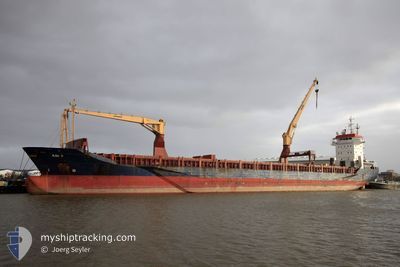
SEADRAGON
General Cargo
Current Trip
| Time Travelled | 3 days |
|---|---|
| Remaining Time | 5 h, 20 mins |
| Distance Travelled | 314.09 nm |
| Remaining Distance | 54.08 nm |
| AVG Speed | 9.3 Knots |
| MAX Speed | 12.9 Knots |
| AVG Wind | 11.5 knots |
| MAX Wind | 17.4 knots |
| MIN Temp | 15.9°C / 60.62°F |
| MAX Temp | 31.1°C / 87.98°F |
| Draught | 7 m |
| Position Received | Now |
Current Position
| Longitude | 26.20081° |
|---|---|
| Latitude | 38.88148° |
| Status | Under way using engine |
| Speed | 9.4 Knots |
| Course | 127.9° |
| Area | Aegean Sea |
| Station | T-AIS |
| Position Received | Now |
Info
Information
The current position of SEADRAGON is in Aegean Sea with coordinates 38.88148° / 26.20081° as reported on 2024-06-09 12:17 by AIS to our vessel tracker app. The vessel's current speed is 9.4 Knots and is heading at the port of IZMIR. The estimated time of arrival as calculated by vessel tracking app is 2024-06-09 17:37 LT
The vessel SEADRAGON (IMO: 9239288, MMSI: 636022026) is a General Cargo that was built in 2001 ( 23 years old ). It's sailing under the flag of [LR] Liberia.
In this page you can find informations about the vessels current position, last detected port calls, and current voyage information. If the vessels is not in coverage by AIS you will find the latest position.
The current position of SEADRAGON is detected by our AIS receivers and we are not responsible for the reliability of the data. The last position was recorded while the vessel was in Coverage by the Ais receivers of our vessel tracking app.
The current draught of SEADRAGON as reported by AIS is 7 meters
Weather
| Temperature | 31.1°C / 87.98°F |
|---|---|
| Wind Speed | 4 knots |
| Direction | 339° NNW |
| Pressure | 1008.8 hPa |
| Humidity | 32 % |
| Cloud Coverage | 39 % |
Featured Company
Last Port Calls
| Port | Arrival | Departure | Time In Port |
|---|---|---|---|
| 2024-06-04 23:15 | 2024-06-06 04:26 | 1 d | |
| 2024-06-01 03:37 | 2024-06-02 20:38 | 1 d | |
| 2024-05-27 07:29 | 2024-05-29 11:33 | 2 d | |
| 2024-05-24 02:56 | 2024-05-24 17:48 | 14 h | |
| 2024-05-20 00:38 | 2024-05-20 13:47 | 13 h | |
| 2024-05-15 13:24 | 2024-05-16 18:37 | 1 d | |
| 2024-05-12 12:28 | 2024-05-12 23:44 | 11 h | |
| 2024-05-07 15:56 | 2024-05-08 02:55 | 10 h |
Last Trips
| Origin | Departure | Destination | Arrival | Distance | |
|---|---|---|---|---|---|
| 2024-06-02 23:38 | 2024-06-05 02:15 | 292.49 nm | |||
| 2024-05-29 13:33 | 2024-06-01 06:37 | 575.49 nm | |||
| 2024-05-24 20:48 | 2024-05-27 09:29 | 573.57 nm | |||
| 2024-05-20 16:47 | 2024-05-24 05:56 | 368.53 nm | |||
| 2024-05-16 20:37 | 2024-05-20 03:38 | 737.71 nm | |||
| 2024-05-13 02:44 | 2024-05-15 15:24 | 571.17 nm | |||
| 2024-05-08 05:55 | 2024-05-12 15:28 | 373.73 nm | |||
| 2024-03-15 17:53 | 2024-05-07 18:56 | 57.90 nm |
Events
| Time | Event | Details | Position / Dest | Info |
|---|---|---|---|---|
| 2024-06-09 05:50 | Change Sea Area | Greek part of the Aegean Sea Turkish part of the Aegean Sea |
39.74903 / 25.78868
Aegean Sea
TRIZM
|
Speed: 9.9 kn Course: 172.5° |
| 2024-06-09 05:47 | Status Changed | Under way using engine Default |
39.75630 / 25.78771
TRIZM
|
Speed: 9.8 kn Course: 173° |
| 2024-06-09 05:47 | IN Coverage |
39.74903 / 25.78868
Aegean Sea
TRIZM
|
Speed: 9.9 kn Course: 172.5° |
|
| 2024-06-09 04:35 | Status Changed | Default Under way using engine |
39.95330 / 25.78897
TRIZM
|
Speed: 10 kn Course: 187.7° |
| 2024-06-09 04:31 | OUT of Coverage |
39.96256 / 25.79063
Aegean Sea
TRIZM
|
Speed: 10 kn Course: 187.7° |
|
| 2024-06-09 04:20 | Status Changed | Under way using engine Default |
39.98627 / 25.80002
TRIZM
|
Speed: 3.4 kn Course: 259° |
| 2024-06-09 04:20 | IN Coverage |
39.98498 / 25.79596
Aegean Sea
TRIZM
|
Speed: 6.4 kn Course: 216.5° |
|
| 2024-06-09 03:35 | Status Changed | Default Under way using engine |
39.99903 / 25.91394
TRIZM
|
Speed: 11.3 kn Course: 263.8° |
| 2024-06-09 03:20 | OUT of Coverage |
40.00386 / 25.97340
Aegean Sea
TRIZM
|
Speed: 11.3 kn Course: 263.8° |
|
| 2024-06-09 02:43 | Change Sea Area | Turkish part of the Aegean Sea Turkish part of the Sea of Marmara |
40.02264 / 26.12899
Aegean Sea
TRIZM
|
Speed: 12.2 kn Course: 261.9° |