
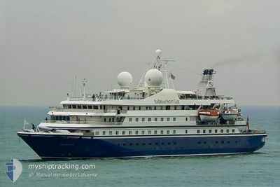
SEADREAM II
Passengers Ship
Current Trip
| Trip Time | 12 h, 48 mins |
|---|---|
| Trip Distance | 185.01 nm |
| AVG Speed | 13.1 Knots |
| MAX Speed | 15.1 Knots |
| Draught | 4.4 m |
| AVG Wind | 6.9 knots |
| MAX Wind | 13 knots |
| MIN Temp | 22.4°C / 72.32°F |
| MAX Temp | 26.7°C / 80.06°F |
| Position Received | 3 m ago |
Current Position
| Longitude | 12.50819° |
|---|---|
| Latitude | 38.01371° |
| Status | Moored |
| Speed | |
| Course | 293° |
| Area | Tyrrhenian Sea |
| Station | T-AIS |
| Position Received | 3 m ago |
Info
Information
The current position of SEADREAM II is in Tyrrhenian Sea with coordinates 38.01371° / 12.50819° as reported on 2024-06-18 11:35 by AIS to our vessel tracker app. The vessel's current speed is 0 Knots and is currently inside the port of TRAPANI.
The vessel SEADREAM II (IMO: 8203440, MMSI: 308311000) is a Passengers Ship that was built in 1985 ( 39 years old ). It's sailing under the flag of [BS] Bahamas.
In this page you can find informations about the vessels current position, last detected port calls, and current voyage information. If the vessels is not in coverage by AIS you will find the latest position.
The current position of SEADREAM II is detected by our AIS receivers and we are not responsible for the reliability of the data. The last position was recorded while the vessel was in Coverage by the Ais receivers of our vessel tracking app.
The current draught of SEADREAM II as reported by AIS is 4.4 meters
Weather
| Temperature | 26.7°C / 80.06°F |
|---|---|
| Wind Speed | 4 knots |
| Direction | 217° SW |
| Pressure | 1017 hPa |
| Humidity | 54.9 % |
| Cloud Coverage | --- |
Featured Company
Last Port Calls
| Port | Arrival | Departure | Time In Port |
|---|---|---|---|
| 2024-06-18 09:57 | |||
| 2024-06-17 19:05 | 2024-06-17 21:09 | 2 h | |
| 2024-06-16 05:05 | 2024-06-17 09:05 | 1 d | |
| 2024-06-10 06:02 | 2024-06-10 20:05 | 14 h | |
| 2024-06-09 05:29 | 2024-06-09 16:10 | 10 h | |
| 2024-06-02 05:15 | 2024-06-02 16:49 | 11 h | |
| 2024-05-31 05:42 | 2024-05-31 21:14 | 15 h | |
| 2024-05-26 04:54 | 2024-05-26 16:05 | 11 h | |
| 2024-05-21 05:52 | 2024-05-21 21:12 | 15 h | |
| 2024-05-19 04:24 | 2024-05-19 17:01 | 12 h |
Most Visited Ports (Last year)
| Port | Arrivals | |
|---|---|---|
| 96 | ||
| 48 | ||
| 22 | ||
| 19 | ||
| 16 | ||
| 15 |
Last Trips
| Origin | Departure | Destination | Arrival | Distance | |
|---|---|---|---|---|---|
| 2024-06-17 23:09 | 2024-06-18 11:57 | 185.01 nm | |||
| 2024-06-17 11:05 | 2024-06-17 21:05 | 39.45 nm | |||
| 2024-06-10 22:05 | 2024-06-16 07:05 | 679.96 nm | |||
| 2024-06-09 18:10 | 2024-06-10 08:02 | 108.28 nm | |||
| 2024-06-02 18:49 | 2024-06-09 07:29 | 582.75 nm | |||
| 2024-05-31 23:14 | 2024-06-02 07:15 | 125.14 nm | |||
| 2024-05-26 18:05 | 2024-05-31 07:42 | 381.94 nm | |||
| 2024-05-21 23:12 | 2024-05-26 06:54 | 343.58 nm | |||
| 2024-05-19 19:01 | 2024-05-21 07:52 | 62.99 nm | |||
| 2024-05-18 17:55 | 2024-05-19 06:24 | 132.53 nm |
Events
| Time | Event | Details | Position / Dest | Info |
|---|---|---|---|---|
| 2024-06-18 10:14 | Status Changed | Moored Under way using engine |
38.01371 / 12.50816
[IT] TRAPANI
|
Speed: 0.1 kn Course: 295° |
| 2024-06-18 10:13 | STOP Moving |
38.01369 / 12.50819
[IT] TRAPANI
|
Speed: 0.3 kn Course: 295° |
|
| 2024-06-18 09:57 | PORT ARRIVAL |
|
38.00385 / 12.49737
[IT] TRAPANI
|
Speed: 7.8 kn Course: 52° |
| 2024-06-18 08:20 | Change Sea Area | Italian part of the Tyrrhenian Sea Italian part of the Mediterranean Sea - Western Basin |
37.85826 / 12.24286
Tyrrhenian Sea
IT TPS
|
Speed: 14.1 kn Course: 333.4° |
| 2024-06-18 07:49 | Change Sea Area | Italian part of the Mediterranean Sea - Western Basin Italian part of the Mediterranean Sea - Eastern Basin |
37.74921 / 12.30905
Mediterranean Sea - Western Basin
IT TPS
|
Speed: 14 kn Course: 331.6° |
| 2024-06-18 06:05 | Status Changed | Under way using engine Default |
37.41636 / 12.58829
IT TPS
|
Speed: 14.4 kn Course: 314° |
| 2024-06-18 05:45 | Status Changed | Default Under way using engine |
37.36177 / 12.65943
IT TPS
|
Speed: 14.4 kn Course: 313.3° |
| 2024-06-18 05:35 | Detected in Sea | Italian part of the Mediterranean Sea - Eastern Basin |
37.33378 / 12.69650
Mediterranean Sea - Eastern Basin
IT TPS
|
Speed: 14.4 kn Course: 313.3° |
| 2024-06-18 05:35 | Status Changed | Under way using engine Default |
37.33378 / 12.69650
IT TPS
|
Speed: 14.5 kn Course: 314° |
| 2024-06-18 05:30 | IN Coverage |
37.33378 / 12.69650
Mediterranean Sea - Eastern Basin
IT TPS
|
Speed: 14.4 kn Course: 313.3° |