
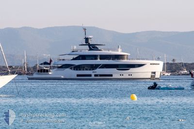
SEAESTA
Pleasure Craft
Current Trip
Current Position
| Longitude | 23.67976° |
|---|---|
| Latitude | 37.93304° |
| Status | At anchor |
| Speed | 0.1 Knots |
| Course | 87° |
| Area | Aegean Sea |
| Station | T-AIS |
| Position Received | 2 m ago |
Info
Information
The current position of SEAESTA is in Aegean Sea with coordinates 37.93304° / 23.67976° as reported on 2024-05-28 06:22 by AIS to our vessel tracker app. The vessel's current speed is 0.1 Knots and is currently inside the port of FLISVOS.
The vessel SEAESTA (IMO: 9973171, MMSI: 319244400) is a Pleasure Craft It's sailing under the flag of [KY] Cayman Is.
In this page you can find informations about the vessels current position, last detected port calls, and current voyage information. If the vessels is not in coverage by AIS you will find the latest position.
The current position of SEAESTA is detected by our AIS receivers and we are not responsible for the reliability of the data. The last position was recorded while the vessel was in Coverage by the Ais receivers of our vessel tracking app.
The current draught of SEAESTA as reported by AIS is 2 meters
Weather
| Temperature | 21.2°C / 70.16°F |
|---|---|
| Wind Speed | --- |
| Direction | 352° N |
| Pressure | 1014.9 hPa |
| Humidity | 33.8 % |
| Cloud Coverage | 4 % |
Featured Company
Last Port Calls
| Port | Arrival | Departure | Time In Port |
|---|---|---|---|
| 2024-05-28 04:59 | |||
| 2024-05-23 16:39 | 2024-05-24 12:40 | 20 h | |
| 2024-05-15 04:16 | 2024-05-15 13:49 | 9 h | |
| 2024-04-15 12:53 | 2024-05-04 14:39 | 19 d | |
| 2024-04-10 19:16 | 2024-04-14 06:16 | 3 d | |
| 2024-03-23 07:34 | 2024-04-10 16:23 | 18 d | |
| 2024-03-23 05:54 |
Last Trips
| Origin | Departure | Destination | Arrival | Distance | |
|---|---|---|---|---|---|
| 2024-05-24 15:40 | 2024-05-28 07:59 | 39.76 nm | |||
| 2024-05-15 16:49 | 2024-05-23 19:39 | 49.86 nm | |||
| 2024-05-04 17:39 | 2024-05-15 07:16 | 76.87 nm | |||
| 2024-04-14 09:16 | 2024-04-15 15:53 | 25.69 nm | |||
| 2024-04-10 19:23 | 2024-04-10 22:16 | 31.89 nm | |||
| 2024-03-23 07:54 | 2024-03-23 09:34 | 18.32 nm |
Events
| Time | Event | Details | Position / Dest | Info |
|---|---|---|---|---|
| 2024-05-28 05:03 | STOP Moving |
37.93299 / 23.68070
[GR] FLISVOS
|
Speed: 0.3 kn Course: 84° |
|
| 2024-05-28 04:59 | PORT ARRIVAL |
|
37.93535 / 23.67913
[GR] FLISVOS
|
Speed: 5.2 kn Course: 116.5° |
| 2024-05-28 03:47 | START Moving | 1 nm, South of VARKIZA |
37.80022 / 23.80398
VARKIZA
|
Speed: 7.5 kn Course: 237.2° |
| 2024-05-26 11:04 | IN Coverage |
37.81359 / 23.81331
Aegean Sea
|
Speed: 0.5 kn Course: 218° |
|
| 2024-05-26 09:13 | OUT of Coverage |
37.81385 / 23.81433
Aegean Sea
|
Speed: 0.6 kn Course: 23.1° |
|
| 2024-05-25 19:52 | Status Changed | At anchor Under way using engine |
37.81376 / 23.81407
VARKIZA
|
Speed: 0.2 kn Course: 299° |
| 2024-05-25 16:11 | STOP Moving | 0.51 nm, East of VARKIZA |
37.81427 / 23.81333
VARKIZA
|
Speed: 0.2 kn Course: 28° |
| 2024-05-25 15:44 | START Moving | 0.83 nm, North West of VOULIAGMENI |
37.81096 / 23.75907
VARKIZA
|
Speed: 6.7 kn Course: 254.3° |
| 2024-05-25 13:31 | ETA Changed | 2025/02/18 18:30 2025/01/01 18:30 |
37.80981 / 23.76105
VARKIZA
|
Speed: 0.8 kn Course: 92° |
| 2024-05-25 13:25 | ETA Changed | 2025/01/01 18:30 2025/02/18 18:30 |
37.81016 / 23.76076
VARKIZA
|
Speed: 1 kn Course: 38° |