
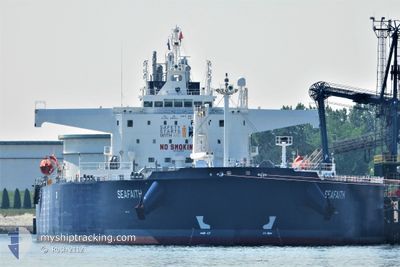
SEAFAITH
Tanker
Current Trip
| Time Travelled | 4 days |
|---|---|
| Remaining Time | 1 day |
| Distance Travelled | 1312.23 nm |
| Remaining Distance | 458.08 nm |
| AVG Speed | 11.2 Knots |
| MAX Speed | 13.8 Knots |
| AVG Wind | 12.1 knots |
| MAX Wind | 22.3 knots |
| MIN Temp | 12.1°C / 53.78°F |
| MAX Temp | 16.7°C / 62.06°F |
| Draught | 14.5 m |
| Position Received | 3 d ago |
Current Position
| Longitude | -4.01200° |
|---|---|
| Latitude | 49.57896° |
| Status | Under way using engine |
| Speed | 11.1 Knots |
| Course | 239.7° |
| Area | English Channel |
| Station | T-AIS |
| Position Received | 3 d ago |
Info
Information
The current position of SEAFAITH is in English Channel with coordinates 49.57896° / -4.01200° as reported on 2024-05-14 23:52 by AIS to our vessel tracker app. The vessel's current speed is 11.1 Knots and is heading at the port of LAS PALMAS. The estimated time of arrival as calculated by vessel tracking app is 2024-05-19 19:21 LT
The vessel SEAFAITH (IMO: 9843209, MMSI: 215515000) is a Tanker It's sailing under the flag of [MT] Malta.
In this page you can find informations about the vessels current position, last detected port calls, and current voyage information. If the vessels is not in coverage by AIS you will find the latest position.
The current position of SEAFAITH is detected by our AIS receivers and we are not responsible for the reliability of the data. The last position was recorded while the vessel was in Coverage by the Ais receivers of our vessel tracking app.
The current draught of SEAFAITH as reported by AIS is 14.5 meters
Weather
| Temperature | 16.8°C / 62.24°F |
|---|---|
| Wind Speed | 12 knots |
| Direction | 12° NNE |
| Pressure | 1017.5 hPa |
| Humidity | 69.2 % |
| Cloud Coverage | 1 % |
Featured Company
Last Port Calls
Most Visited Ports (Last year)
| Port | Arrivals | |
|---|---|---|
| 3 | ||
| 2 | ||
| 2 | ||
| 2 | ||
| 1 | ||
| 1 |
Last Trips
| Origin | Departure | Destination | Arrival | Distance | |
|---|---|---|---|---|---|
| 2024-05-09 15:39 | 2024-05-09 16:27 | 2.81 nm | |||
| 2024-05-01 22:01 | 2024-05-07 15:14 | 184.08 nm | |||
| 2024-04-10 01:37 | 2024-04-30 17:19 | 4485.66 nm | |||
| 2024-03-28 16:12 | 2024-04-08 18:35 | 1695.14 nm | |||
| 2024-01-20 20:40 | 2024-03-27 08:39 | 13633.44 nm |
Events
| Time | Event | Details | Position / Dest | Info |
|---|---|---|---|---|
| 2024-05-14 23:58 | Status Changed | Default Under way using engine |
49.56842 / -4.04037
ESLPA
|
Speed: 11.1 kn Course: 239.7° |
| 2024-05-14 23:52 | OUT of Coverage |
49.57896 / -4.01200
English Channel
ESLPA
|
Speed: 11.1 kn Course: 239.7° |
|
| 2024-05-14 22:56 | Status Changed | Under way using engine Default |
49.66465 / -3.78513
ESLPA
|
Speed: 10.8 kn Course: 240° |
| 2024-05-14 22:30 | Status Changed | Default Under way using engine |
49.70364 / -3.68058
ESLPA
|
Speed: 11.1 kn Course: 240.6° |
| 2024-05-14 22:21 | Status Changed | Under way using engine Default |
49.71796 / -3.64137
ESLPA
|
Speed: 11.1 kn Course: 240° |
| 2024-05-14 21:54 | Status Changed | Default Under way using engine |
49.75830 / -3.53102
ESLPA
|
Speed: 11.3 kn Course: 240.3° |
| 2024-05-14 21:03 | Status Changed | Under way using engine Default |
49.83750 / -3.31542
ESLPA
|
Speed: 11.7 kn Course: 240° |
| 2024-05-14 20:47 | Status Changed | Default Under way using engine |
49.86459 / -3.24317
ESLPA
|
Speed: 11.9 kn Course: 239.2° |
| 2024-05-14 20:07 | Change Sea Area | United Kingdom part of the English Channel Guernsey part of the English Channel |
49.93159 / -3.06916
English Channel
ESLPA
|
Speed: 12.3 kn Course: 239° |
| 2024-05-14 20:05 | Status Changed | Under way using engine Default |
49.93509 / -3.06006
ESLPA
|
Speed: 12.3 kn Course: 239° |