
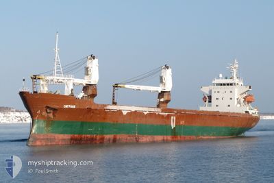
SEAGRAND
General Cargo
Current Trip
| Time Travelled | 1 day |
|---|---|
| Remaining Time | 11 h, 32 mins |
| Distance Travelled | 370.33 nm |
| Remaining Distance | 173.42 nm |
| AVG Speed | 10.4 Knots |
| MAX Speed | 11.5 Knots |
| AVG Wind | 6.6 knots |
| MAX Wind | 17.8 knots |
| MIN Temp | 14.8°C / 58.64°F |
| MAX Temp | 22.9°C / 73.22°F |
| Draught | 4.8 m |
| Position Received | 20 h, 58 m ago |
Current Position
| Longitude | 131.11434° |
|---|---|
| Latitude | 40.33540° |
| Status | Under way using engine |
| Speed | 10.8 Knots |
| Course | 195° |
| Area | Japan Sea |
| Station | T-AIS |
| Position Received | 20 h, 58 m ago |
Info
Information
The current position of SEAGRAND is in Japan Sea with coordinates 40.33540° / 131.11434° as reported on 2024-06-19 10:01 by AIS to our vessel tracker app. The vessel's current speed is 10.8 Knots and is heading at the port of BUSAN. The estimated time of arrival as calculated by vessel tracking app is 2024-06-20 18:32 LT
The vessel SEAGRAND (IMO: 8520202, MMSI: 457120000) is a General Cargo that was built in 1986 ( 38 years old ). It's sailing under the flag of [MN] Mongolia.
In this page you can find informations about the vessels current position, last detected port calls, and current voyage information. If the vessels is not in coverage by AIS you will find the latest position.
The current position of SEAGRAND is detected by our AIS receivers and we are not responsible for the reliability of the data. The last position was recorded while the vessel was in Coverage by the Ais receivers of our vessel tracking app.
The current draught of SEAGRAND as reported by AIS is 4.8 meters
Weather
| Temperature | 22.9°C / 73.22°F |
|---|---|
| Wind Speed | 22 knots |
| Direction | 176° S |
| Pressure | 1005 hPa |
| Humidity | 74.1 % |
| Cloud Coverage | 89 % |
Featured Company
Last Port Calls
| Port | Arrival | Departure | Time In Port |
|---|---|---|---|
| 2024-06-16 23:39 | 2024-06-18 16:29 | 1 d | |
| 2024-06-14 03:05 | 2024-06-15 00:02 | 20 h | |
| 2024-06-11 04:20 | 2024-06-12 06:49 | 1 d | |
| 2024-06-04 06:13 | 2024-06-07 14:02 | 3 d | |
| 2024-05-31 23:23 | 2024-06-01 22:07 | 22 h | |
| 2024-05-28 23:46 | 2024-05-30 02:58 | 1 d | |
| 2024-05-25 00:36 | 2024-05-27 03:29 | 2 d | |
| 2024-05-21 04:00 | 2024-05-23 02:17 | 1 d | |
| 2024-04-28 23:39 | 2024-04-29 11:37 | 11 h | |
| 2024-04-22 22:00 | 2024-04-25 09:47 | 2 d |
Last Trips
| Origin | Departure | Destination | Arrival | Distance | |
|---|---|---|---|---|---|
| 2024-06-15 09:02 | 2024-06-17 09:39 | 525.65 nm | |||
| 2024-06-12 16:49 | 2024-06-14 12:05 | 519.17 nm | |||
| 2024-06-07 23:02 | 2024-06-11 14:20 | 530.24 nm | |||
| 2024-06-02 08:07 | 2024-06-04 15:13 | 530.06 nm | |||
| 2024-05-30 11:58 | 2024-06-01 09:23 | 464.62 nm | |||
| 2024-05-27 13:29 | 2024-05-29 08:46 | 458.73 nm | |||
| 2024-05-23 11:17 | 2024-05-25 10:36 | 462.96 nm | |||
| 2024-04-29 21:37 | 2024-05-21 13:00 | 512.86 nm | |||
| 2024-04-25 18:47 | 2024-04-29 09:39 | 822.19 nm | |||
| 2024-04-20 03:43 | 2024-04-23 07:00 | 816.17 nm |
Events
| Time | Event | Details | Position / Dest | Info |
|---|---|---|---|---|
| 2024-06-19 10:09 | Status Changed | Default Under way using engine |
40.31242 / 131.10649
KR PUS
|
Speed: 10.8 kn Course: 195° |
| 2024-06-19 10:01 | OUT of Coverage |
40.33540 / 131.11434
Japan Sea
KR PUS
|
Speed: 10.8 kn Course: 195° |
|
| 2024-06-19 10:00 | Status Changed | Under way using engine Default |
40.33681 / 131.11482
KR PUS
|
Speed: 10.6 kn Course: 196° |
| 2024-06-19 10:00 | IN Coverage |
40.33540 / 131.11434
Japan Sea
KR PUS
|
Speed: 10.8 kn Course: 195° |
|
| 2024-06-19 08:10 | Status Changed | Default Under way using engine |
40.64739 / 131.19948
KR PUS
|
Speed: 10.3 kn Course: 197.3° |
| 2024-06-19 07:53 | OUT of Coverage |
40.69403 / 131.21924
Japan Sea
KR PUS
|
Speed: 10.3 kn Course: 197.3° |
|
| 2024-06-19 07:49 | Change Sea Area | North Korean part of the Japan Sea Russian part of the Japan Sea |
40.70354 / 131.22302
Japan Sea
KR PUS
|
Speed: 10.1 kn Course: 196.8° |
| 2024-06-19 07:48 | Status Changed | Under way using engine Default |
40.70718 / 131.22445
KR PUS
|
Speed: 10.3 kn Course: 195° |
| 2024-06-19 07:48 | IN Coverage |
40.70354 / 131.22302
Japan Sea
KR PUS
|
Speed: 10.1 kn Course: 196.8° |
|
| 2024-06-18 23:31 | OUT of Coverage |
42.07891 / 131.53327
Japan Sea
KR PUS
|
Speed: 9.9 kn Course: 182.2° |