
SEALEGEND
Tanker
Current Trip
| Time Travelled | 55 days |
|---|---|
| Remaining Time | --- |
| Distance Travelled | 10666.92 nm |
| Remaining Distance | --- |
| AVG Speed | 13.1 Knots |
| MAX Speed | 13.1 Knots |
| AVG Wind | 8.3 knots |
| MAX Wind | 24.4 knots |
| MIN Temp | 21.9°C / 71.42°F |
| MAX Temp | 31.7°C / 89.06°F |
| Draught | 12.1 m |
| Position Received | 5 d ago |
Current Position
| Longitude | 104.23272° |
|---|---|
| Latitude | 1.26049° |
| Status | Under way using engine |
| Speed | 15.8 Knots |
| Course | 79.8° |
| Area | Singapore Strait |
| Station | T-AIS |
| Position Received | 5 d ago |
Info
Information
The current position of SEALEGEND is in Singapore Strait with coordinates 1.26049° / 104.23272° as reported on 2024-05-10 19:15 by AIS to our vessel tracker app. The vessel's current speed is 15.8 Knots and is heading at the port of YEOSU. The estimated time of arrival as calculated by vessel tracking app is 2024-05-19 21:00 LT
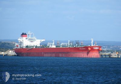
The vessel SEALEGEND (IMO: 9906568, MMSI: 538009056) is a Tanker It's sailing under the flag of [MH] Marshall Is.
In this page you can find informations about the vessels current position, last detected port calls, and current voyage information. If the vessels is not in coverage by AIS you will find the latest position.
The current position of SEALEGEND is detected by our AIS receivers and we are not responsible for the reliability of the data. The last position was recorded while the vessel was in Coverage by the Ais receivers of our vessel tracking app.
The current draught of SEALEGEND as reported by AIS is 12.1 meters
Weather
| Temperature | 24.3°C / 75.74°F |
|---|---|
| Wind Speed | 11 knots |
| Direction | 72° ENE |
| Pressure | 1016.2 hPa |
| Humidity | 64.2 % |
| Cloud Coverage | 60 % |
Featured Company
Events
| Time | Event | Details | Position / Dest | Info |
|---|---|---|---|---|
| 2024-05-10 19:21 | Status Changed | Default Under way using engine |
1.26522 / 104.25791
AE FJR>KR YOS
|
Speed: 15.8 kn Course: 79.8° |
| 2024-05-10 19:15 | Change Sea Area | Malaysian part of the Singapore Strait Indonesian part of the Singapore Strait |
1.26049 / 104.23272
Singapore Strait
AE FJR>KR YOS
|
Speed: 15.8 kn Course: 79.8° |
| 2024-05-10 19:15 | OUT of Coverage |
1.26049 / 104.23272
Singapore Strait
AE FJR>KR YOS
|
Speed: 15.8 kn Course: 79.8° |
|
| 2024-05-10 18:53 | Status Changed | Under way using engine Default |
1.24994 / 104.13991
AE FJR>KR YOS
|
Speed: 15.8 kn Course: 85° |
| 2024-05-10 18:53 | Status Changed | Default Under way using engine |
1.24961 / 104.13643
AE FJR>KR YOS
|
Speed: 15.7 kn Course: 83.2° |
| 2024-05-10 18:47 | Status Changed | Under way using engine Default |
1.24717 / 104.11206
AE FJR>KR YOS
|
Speed: 15.7 kn Course: 81° |
| 2024-05-10 18:44 | Status Changed | Default Under way using engine |
1.24567 / 104.10127
AE FJR>KR YOS
|
Speed: 15.5 kn Course: 83.7° |
| 2024-05-10 16:50 | Status Changed | Under way using engine Default |
1.06297 / 103.68769
AE FJR>KR YOS
|
Speed: 13.7 kn Course: 65° |
| 2024-05-10 16:44 | Status Changed | Default Under way using engine |
1.05390 / 103.66900
AE FJR>KR YOS
|
Speed: 13.4 kn Course: 103.2° |
| 2024-05-10 15:51 | Status Changed | Under way using engine Default |
1.14224 / 103.50362
AE FJR>KR YOS
|
Speed: 13.3 kn Course: 127° |