
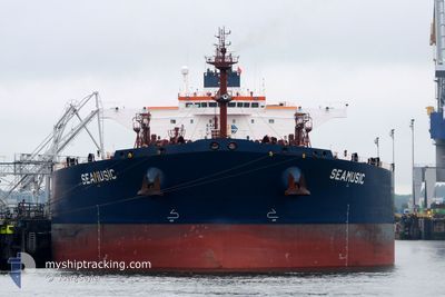
SEAMUSIC
Crude Oil Tanker
Current Trip
| Time Travelled | 6 days |
|---|---|
| Remaining Time | --- |
| Distance Travelled | 312.29 nm |
| Remaining Distance | 584.20 nm |
| AVG Speed | 9.4 Knots |
| MAX Speed | 9.4 Knots |
| AVG Wind | 6.9 knots |
| MAX Wind | 15.8 knots |
| MIN Temp | 15.1°C / 59.18°F |
| MAX Temp | 21.2°C / 70.16°F |
| Draught | 8.3 m |
| Position Received | 3 h, 33 m ago |
Current Position
| Longitude | 34.14010° |
|---|---|
| Latitude | 43.14051° |
| Status | Under way using engine |
| Speed | 0.1 Knots |
| Course | 200° |
| Area | Black Sea |
| Station | T-AIS |
| Position Received | 3 h, 33 m ago |
Info
Information
The current position of SEAMUSIC is in Black Sea with coordinates 43.14051° / 34.14010° as reported on 2024-06-01 13:24 by AIS to our vessel tracker app. The vessel's current speed is 0.1 Knots and is heading at the port of BATUMI. The estimated time of arrival as calculated by vessel tracking app is 2024-05-28 09:00 LT
The vessel SEAMUSIC (IMO: 9407445, MMSI: 249746000) is a Crude Oil Tanker that was built in 2009 ( 15 years old ). It's sailing under the flag of [MT] Malta.
In this page you can find informations about the vessels current position, last detected port calls, and current voyage information. If the vessels is not in coverage by AIS you will find the latest position.
The current position of SEAMUSIC is detected by our AIS receivers and we are not responsible for the reliability of the data. The last position was recorded while the vessel was in Coverage by the Ais receivers of our vessel tracking app.
The current draught of SEAMUSIC as reported by AIS is 8.3 meters
Weather
| Temperature | 21.2°C / 70.16°F |
|---|---|
| Wind Speed | 6 knots |
| Direction | 130° SE |
| Pressure | 1020.1 hPa |
| Humidity | 69 % |
| Cloud Coverage | 12 % |
Featured Company
Last Trips
| Origin | Departure | Destination | Arrival | Distance | |
|---|---|---|---|---|---|
| 2024-05-17 17:56 | 2024-05-23 07:57 | 1148.27 nm | |||
| 2024-05-07 06:38 | 2024-05-16 23:56 | 1759.56 nm | |||
| 2024-04-28 06:04 | 2024-05-05 06:26 | 1684.57 nm | |||
| 2024-04-19 02:52 | 2024-04-27 11:56 | 1820.60 nm | |||
| 2024-03-14 19:53 | 2024-04-17 16:07 | 2157.25 nm |
Events
| Time | Event | Details | Position / Dest | Info |
|---|---|---|---|---|
| 2024-06-01 13:31 | Status Changed | Default Under way using engine |
43.14067 / 34.13981
GE BUS
|
Speed: 0.1 kn Course: 200° |
| 2024-06-01 13:24 | OUT of Coverage |
43.14051 / 34.14010
Black Sea
|
Speed: 0.1 kn Course: 200° |
|
| 2024-06-01 13:22 | Change Sea Area | Turkish part of the Black Sea Romanian part of the Black Sea |
43.14053 / 34.14025
Black Sea
|
Speed: 0.1 kn Course: 200° |
| 2024-06-01 13:22 | Status Changed | Under way using engine Default |
43.14053 / 34.14025
GE BUS
|
Speed: 0.1 kn Course: 201° |
| 2024-06-01 13:08 | IN Coverage |
43.14053 / 34.14025
Black Sea
|
Speed: 0.1 kn Course: 200° |
|
| 2024-05-31 14:46 | STOP Moving |
43.11985 / 34.14399
GE BUS
|
Speed: 0.3 kn Course: 67° |
|
| 2024-05-31 14:31 | START Moving |
43.11935 / 34.14297
GE BUS
|
Speed: 4.6 kn Course: 47° |
|
| 2024-05-31 14:11 | STOP Moving |
43.11753 / 34.14339
GE BUS
|
Speed: 0.2 kn Course: 24° |
|
| 2024-05-31 14:09 | START Moving |
43.11834 / 34.14423
GE BUS
|
Speed: 5.8 kn Course: 28° |
|
| 2024-05-30 23:06 | STOP Moving |
43.11548 / 34.19951
GE BUS
|
Speed: 0.3 kn Course: 214° |