
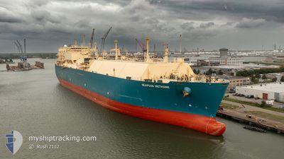
SEAPEAK METHANE
Lng Tanker
Current Trip
JP FTS
| Time Travelled | 9 days |
|---|---|
| Remaining Time | --- |
| Distance Travelled | 3731.17 nm |
| Remaining Distance | --- |
| AVG Speed | 17.1 Knots |
| MAX Speed | 19.7 Knots |
| AVG Wind | 8 knots |
| MAX Wind | 20 knots |
| MIN Temp | 26°C / 78.8°F |
| MAX Temp | 30.8°C / 87.44°F |
| Draught | 11.3 m |
| Position Received | 1 d ago |
Current Position
| Longitude | 104.34149° |
|---|---|
| Latitude | 1.29735° |
| Status | Under way using engine |
| Speed | 17.5 Knots |
| Course | 50.1° |
| Area | Singapore Strait |
| Station | T-AIS |
| Position Received | 1 d ago |
Info
Information
The current position of SEAPEAK METHANE is in Singapore Strait with coordinates 1.29735° / 104.34149° as reported on 2024-05-20 16:25 by AIS to our vessel tracker app. The vessel's current speed is 17.5 Knots
The vessel SEAPEAK METHANE (IMO: 9336737, MMSI: 311000135) is a Lng Tanker that was built in 2008 ( 16 years old ). It's sailing under the flag of [BS] Bahamas.
In this page you can find informations about the vessels current position, last detected port calls, and current voyage information. If the vessels is not in coverage by AIS you will find the latest position.
The current position of SEAPEAK METHANE is detected by our AIS receivers and we are not responsible for the reliability of the data. The last position was recorded while the vessel was in Coverage by the Ais receivers of our vessel tracking app.
The current draught of SEAPEAK METHANE as reported by AIS is 11.3 meters
Weather
| Temperature | 30.2°C / 86.36°F |
|---|---|
| Wind Speed | 8 knots |
| Direction | 91° E |
| Pressure | 1007.4 hPa |
| Humidity | 71.8 % |
| Cloud Coverage | 100 % |
Featured Company
Last Port Calls
| Port | Arrival | Departure | Time In Port |
|---|---|---|---|
| 2024-05-12 05:06 | 2024-05-13 06:09 | 1 d | |
| 2024-04-09 05:04 | 2024-04-10 06:04 | 1 d | |
| 2024-03-18 01:58 |
Most Visited Ports (Last year)
| Port | Arrivals | |
|---|---|---|
| 2 | ||
| 1 | ||
| 1 | ||
| 1 | ||
| 1 | ||
| 1 |
Last Trips
| Origin | Departure | Destination | Arrival | Distance | |
|---|---|---|---|---|---|
| 2024-04-10 10:04 | 2024-05-12 09:06 | 12117.98 nm | |||
| 2024-03-18 08:58 | 2024-04-09 09:04 | 4961.49 nm |
Events
| Time | Event | Details | Position / Dest | Info |
|---|---|---|---|---|
| 2024-05-20 16:33 | Status Changed | Default Under way using engine |
1.32291 / 104.36781
JP FTS
|
Speed: 17.5 kn Course: 50.1° |
| 2024-05-20 16:25 | OUT of Coverage |
1.29735 / 104.34149
Singapore Strait
JP FTS
|
Speed: 17.5 kn Course: 50.1° |
|
| 2024-05-20 15:16 | Change Sea Area | Malaysian part of the Singapore Strait Indonesian part of the Singapore Strait |
1.26138 / 104.14073
Singapore Strait
JP FTS
|
Speed: 5.9 kn Course: 87.1° |
| 2024-05-20 12:07 | ETA Changed | 2024/05/27 21:45 2024/05/27 23:00 |
1.13101 / 103.49315
JP FTS
|
Speed: 14.3 kn Course: 114.5° |
| 2024-05-20 11:44 | Change Sea Area | Indonesian part of the Singapore Strait Indonesian part of the Malacca Strait |
1.17202 / 103.41383
Singapore Strait
JP FTS
|
Speed: 14.6 kn Course: 134° |
| 2024-05-20 11:41 | Change Sea Area | Indonesian part of the Malacca Strait Indian part of the Laccadive Sea |
1.17831 / 103.40676
Malacca Strait
JP FTS
|
Speed: 14.9 kn Course: 129.4° |
| 2024-05-20 11:41 | Status Changed | Under way using engine Default |
1.17884 / 103.40612
JP FTS
|
Speed: 14.9 kn Course: 129° |
| 2024-05-20 11:25 | IN Coverage |
1.17831 / 103.40676
Malacca Strait
JP FTS
|
Speed: 14.9 kn Course: 129.4° |
|
| 2024-05-16 11:41 | Status Changed | Default Under way using engine |
6.85167 / 77.45500
JP FTS
|
Speed: 18.9 kn Course: 115.7° |
| 2024-05-16 11:38 | OUT of Coverage |
6.86013 / 77.44113
Laccadive Sea
JP FTS
|
Speed: 18.9 kn Course: 115.7° |