
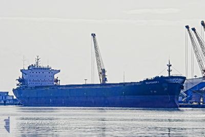
SEAPOWER I
Bulk Carrier
Current Trip
| Trip Time | 9 days |
|---|---|
| Trip Distance | 1423.13 nm |
| AVG Speed | 13.3 Knots |
| MAX Speed | 13.3 Knots |
| Draught | 13.4 m |
| AVG Wind | 8.7 knots |
| MAX Wind | 19.9 knots |
| MIN Temp | 12°C / 53.6°F |
| MAX Temp | 23.7°C / 74.66°F |
| Position Received | 1 m ago |
Current Position
| Longitude | 32.31445° |
|---|---|
| Latitude | 30.90606° |
| Status | Under way using engine |
| Speed | 9.7 Knots |
| Course | 176° |
| Area | Mediterranean Sea - Eastern Basin |
| Station | T-AIS |
| Position Received | 1 m ago |
Info
Information
The current position of SEAPOWER I is in Mediterranean Sea - Eastern Basin with coordinates 30.90606° / 32.31445° as reported on 2024-06-01 05:22 by AIS to our vessel tracker app. The vessel's current speed is 9.7 Knots and is currently inside the port of SUEZ CANAL.
The vessel SEAPOWER I (IMO: 9214331, MMSI: 215480000) is a Bulk Carrier that was built in 2001 ( 23 years old ). It's sailing under the flag of [MT] Malta.
In this page you can find informations about the vessels current position, last detected port calls, and current voyage information. If the vessels is not in coverage by AIS you will find the latest position.
The current position of SEAPOWER I is detected by our AIS receivers and we are not responsible for the reliability of the data. The last position was recorded while the vessel was in Coverage by the Ais receivers of our vessel tracking app.
The current draught of SEAPOWER I as reported by AIS is 13.4 meters
Weather
| Temperature | 23.4°C / 74.12°F |
|---|---|
| Wind Speed | 6 knots |
| Direction | 100° E |
| Pressure | 1016.8 hPa |
| Humidity | 42.1 % |
| Cloud Coverage | --- |
Featured Company
Last Port Calls
| Port | Arrival | Departure | Time In Port |
|---|---|---|---|
| 2024-06-01 03:08 | |||
| 2024-05-22 12:46 | 2024-05-22 23:25 | 10 h | |
| 2024-05-22 12:40 | 2024-05-22 12:41 | 0 m | |
| 2024-05-21 07:33 | 2024-05-22 12:31 | 1 d | |
| 2024-05-19 07:21 | |||
| 2024-05-12 04:57 | 2024-05-12 14:15 | 9 h | |
| 2024-04-20 05:04 | 2024-04-20 14:11 | 9 h |
Most Visited Ports (Last year)
| Port | Arrivals | |
|---|---|---|
| 9 | ||
| 4 | ||
| 2 | ||
| 2 | ||
| 1 | ||
| 1 |
Last Trips
| Origin | Departure | Destination | Arrival | Distance | |
|---|---|---|---|---|---|
| 2024-05-23 02:25 | 2024-06-01 05:08 | 1423.13 nm | |||
| 2024-05-22 15:41 | 2024-05-22 15:46 | 2.93 nm | |||
| 2024-05-22 15:41 | 2024-05-22 15:40 | 2.93 nm |
Events
| Time | Event | Details | Position / Dest | Info |
|---|---|---|---|---|
| 2024-06-01 04:07 | Status Changed | Under way using engine Default |
31.10152 / 32.30835
[EG] SUEZ CANAL
|
Speed: 9.8 kn Course: 198° |
| 2024-06-01 03:58 | Status Changed | Default Under way using engine |
31.12457 / 32.31576
[EG] SUEZ CANAL
|
Speed: 16.6 kn Course: 191° |
| 2024-06-01 03:51 | Status Changed | Under way using engine Default |
31.14267 / 32.32039
[EG] SUEZ CANAL
|
Speed: 5.6 kn Course: 191° |
| 2024-06-01 03:42 | Status Changed | Default Under way using engine |
31.16872 / 32.32824
[EG] SUEZ CANAL
|
Speed: 9 kn Course: 192° |
| 2024-06-01 03:08 | PORT ARRIVAL |
|
31.22236 / 32.34017
[EG] SUEZ CANAL
|
Speed: 8.6 kn Course: 199.5° |
| 2024-06-01 01:26 | ETA Changed | 2024/06/19 12:00 2024/06/17 12:00 |
31.41126 / 32.33672
CIGADING (INDONESIA)
|
Speed: 90.5 kn Course: 32.6° |
| 2024-06-01 00:54 | START Moving | 9.27 nm, North of PORT SAID |
31.40644 / 32.31549
CIGADING (INDONESIA)
|
Speed: 3.1 kn Course: 76° |
| 2024-06-01 00:37 | Status Changed | Under way using engine Default |
31.40768 / 32.30835
CIGADING (INDONESIA)
|
Speed: Course: 127° |
| 2024-06-01 00:37 | IN Coverage |
31.40768 / 32.30835
Mediterranean Sea - Eastern Basin
CIGADING (INDONESIA)
|
Speed: Course: 198.1° |
|
| 2024-05-31 22:46 | STOP Moving | 9.34 nm, North of PORT SAID |
31.40786 / 32.30825
CIGADING (INDONESIA)
|
Speed: Course: 118° |