
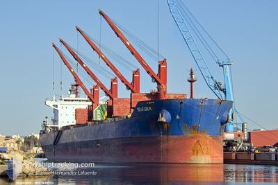
SEARIDER
Cargo
Current Trip
| Time Travelled | 22 days |
|---|---|
| Remaining Time | 1 day |
| Distance Travelled | 2395.37 nm |
| Remaining Distance | 415.25 nm |
| AVG Speed | 8 Knots |
| MAX Speed | 14.8 Knots |
| AVG Wind | 13.9 knots |
| MAX Wind | 26 knots |
| MIN Temp | 17.1°C / 62.78°F |
| MAX Temp | 30.3°C / 86.54°F |
| Draught | 7.2 m |
| Position Received | 13 m ago |
Current Position
| Longitude | 29.54142° |
|---|---|
| Latitude | 41.40673° |
| Status | Under way using engine |
| Speed | 11.1 Knots |
| Course | 70.6° |
| Area | Black Sea |
| Station | T-AIS |
| Position Received | 13 m ago |
Info
Information
The current position of SEARIDER is in Black Sea with coordinates 41.40673° / 29.54142° as reported on 2024-06-28 04:55 by AIS to our vessel tracker app. The vessel's current speed is 11.1 Knots and is heading at the port of TAMAN. The estimated time of arrival as calculated by vessel tracking app is 2024-06-29 18:21 LT
The vessel SEARIDER (IMO: 9698953, MMSI: 256427000) is a Cargo It's sailing under the flag of [MT] Malta.
In this page you can find informations about the vessels current position, last detected port calls, and current voyage information. If the vessels is not in coverage by AIS you will find the latest position.
The current position of SEARIDER is detected by our AIS receivers and we are not responsible for the reliability of the data. The last position was recorded while the vessel was in Coverage by the Ais receivers of our vessel tracking app.
The current draught of SEARIDER as reported by AIS is 7.2 meters
Weather
| Temperature | 23.3°C / 73.94°F |
|---|---|
| Wind Speed | 19 knots |
| Direction | 45° NE |
| Pressure | 1009.4 hPa |
| Humidity | 75.6 % |
| Cloud Coverage | 1 % |
Featured Company
Last Port Calls
| Port | Arrival | Departure | Time In Port |
|---|---|---|---|
| 2024-06-04 06:17 | 2024-06-05 13:14 | 1 d | |
| 2024-05-29 18:29 | 2024-06-03 21:44 | 5 d | |
| 2024-05-03 05:20 | 2024-05-06 12:00 | 3 d | |
| 2024-04-12 02:40 | 2024-04-13 23:14 | 1 d | |
| 2024-04-09 00:11 | 2024-04-10 13:21 | 1 d |
Most Visited Ports (Last year)
| Port | Arrivals | |
|---|---|---|
| 2 | ||
| 2 | ||
| 2 | ||
| 1 | ||
| 1 | ||
| 1 |
Last Trips
| Origin | Departure | Destination | Arrival | Distance | |
|---|---|---|---|---|---|
| 2024-06-03 22:44 | 2024-06-04 07:17 | 13.95 nm | |||
| 2024-05-06 15:00 | 2024-05-29 19:29 | 2907.02 nm | |||
| 2024-04-14 01:14 | 2024-05-03 08:20 | 3207.46 nm | |||
| 2024-04-10 15:21 | 2024-04-12 04:40 | 159.32 nm | |||
| 2024-03-04 03:50 | 2024-04-09 02:11 | 10205.70 nm |
Events
| Time | Event | Details | Position / Dest | Info |
|---|---|---|---|---|
| 2024-06-28 04:59 | Status Changed | Default Under way using engine |
41.41046 / 29.55560
RUTAM
|
Speed: 11.1 kn Course: 70.6° |
| 2024-06-28 02:59 | Change Sea Area | Turkish part of the Black Sea Turkish part of the Sea of Marmara |
41.23462 / 29.14352
Black Sea
RUTAM
|
Speed: 11.2 kn Course: 35.8° |
| 2024-06-27 03:57 | Status Changed | Under way using engine Default |
40.79762 / 28.34245
RUTAM
|
Speed: 11.6 kn Course: 81° |
| 2024-06-27 03:53 | Status Changed | Default Under way using engine |
40.79555 / 28.32481
RUTAM
|
Speed: 11.6 kn Course: 83.5° |
| 2024-06-26 22:03 | Status Changed | Under way using engine Default |
40.50214 / 26.97814
RUTAM
|
Speed: 10.7 kn Course: 65° |
| 2024-06-26 21:44 | IN Coverage |
40.50214 / 26.97814
Sea of Marmara
RUTAM
|
Speed: 11 kn Course: 66.8° |
|
| 2024-06-26 20:01 | Status Changed | Default Under way using engine |
40.30712 / 26.60313
RUTAM
|
Speed: 12.4 kn Course: 46° |
| 2024-06-26 19:57 | OUT of Coverage |
40.29756 / 26.58998
Sea of Marmara
RUTAM
|
Speed: 12.4 kn Course: 46° |
|
| 2024-06-26 17:25 | Detected in Sea | Turkish part of the Sea of Marmara |
40.01857 / 26.18884
Sea of Marmara
RUTAM
|
Speed: 3.3 kn Course: 80.1° |
| 2024-06-26 17:21 | Status Changed | Under way using engine Default |
40.01725 / 26.18281
RUTAM
|
Speed: 9.4 kn Course: 71° |