
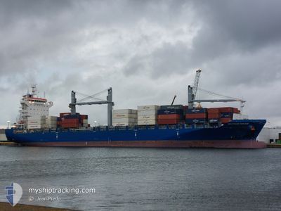
SEATRADE ORANGE
Cargo
Current Trip
PANAMA CANAL
| Time Travelled | 7 days |
|---|---|
| Remaining Time | --- |
| Distance Travelled | 1768.18 nm |
| Remaining Distance | --- |
| AVG Speed | 16.8 Knots |
| MAX Speed | 20 Knots |
| AVG Wind | 9.5 knots |
| MAX Wind | 17 knots |
| MIN Temp | 24.6°C / 76.28°F |
| MAX Temp | 31.3°C / 88.34°F |
| Draught | 8.2 m |
| Position Received | 3 d ago |
Current Position
| Longitude | -79.52925° |
|---|---|
| Latitude | 8.81752° |
| Status | At anchor |
| Speed | |
| Course | 24° |
| Area | North Pacific Ocean |
| Station | T-AIS |
| Position Received | 3 d ago |
Info
Information
The current position of SEATRADE ORANGE is in North Pacific Ocean with coordinates 8.81752° / -79.52925° as reported on 2024-06-07 12:43 by AIS to our vessel tracker app. The vessel's current speed is 0 Knots
The vessel SEATRADE ORANGE (IMO: 9690092, MMSI: 636092708) is a Cargo It's sailing under the flag of [LR] Liberia.
In this page you can find informations about the vessels current position, last detected port calls, and current voyage information. If the vessels is not in coverage by AIS you will find the latest position.
The current position of SEATRADE ORANGE is detected by our AIS receivers and we are not responsible for the reliability of the data. The last position was recorded while the vessel was in Coverage by the Ais receivers of our vessel tracking app.
The current draught of SEATRADE ORANGE as reported by AIS is 8.2 meters
Weather
| Temperature | 25.5°C / 77.9°F |
|---|---|
| Wind Speed | 9 knots |
| Direction | 182° S |
| Pressure | 1010.5 hPa |
| Humidity | 74 % |
| Cloud Coverage | 66 % |
Featured Company
Last Port Calls
| Port | Arrival | Departure | Time In Port |
|---|---|---|---|
| 2024-06-03 03:44 | 2024-06-03 15:53 | 12 h | |
| 2024-05-30 14:00 | 2024-05-31 04:06 | 14 h | |
| 2024-05-27 16:22 | 2024-05-27 17:43 | 1 h | |
| 2024-05-18 04:02 | 2024-05-18 19:31 | 15 h | |
| 2024-05-17 02:49 | 2024-05-17 10:41 | 7 h | |
| 2024-05-15 20:54 | 2024-05-16 12:44 | 15 h | |
| 2024-05-13 23:34 | 2024-05-14 21:41 | 22 h | |
| 2024-05-05 09:38 | 2024-05-05 21:49 | 12 h | |
| 2024-04-29 20:46 | 2024-04-30 08:30 | 11 h | |
| 2024-04-09 08:47 | 2024-04-10 15:21 | 1 d |
Last Trips
| Origin | Departure | Destination | Arrival | Distance | |
|---|---|---|---|---|---|
| 2024-05-31 00:06 | 2024-06-02 22:44 | 1058.16 nm | |||
| 2024-05-27 13:43 | 2024-05-30 10:00 | 732.26 nm | |||
| 2024-05-18 21:31 | 2024-05-27 12:22 | 3147.54 nm | |||
| 2024-05-17 12:41 | 2024-05-18 06:02 | 165.72 nm | |||
| 2024-05-16 14:44 | 2024-05-17 04:49 | 139.66 nm | |||
| 2024-05-14 23:41 | 2024-05-15 22:54 | 100.75 nm | |||
| 2024-05-05 17:49 | 2024-05-14 01:34 | 3562.83 nm | |||
| 2024-04-30 03:30 | 2024-05-05 05:38 | 1951.35 nm | |||
| 2024-04-11 03:21 | 2024-04-29 15:46 | 6546.48 nm | |||
| 2024-04-01 09:02 | 2024-04-09 20:47 | 1824.40 nm |
Events
| Time | Event | Details | Position / Dest | Info |
|---|---|---|---|---|
| 2024-06-08 03:39 | START Moving | 0.66 nm, North West of TABOGUILLA |
8.81818 / -79.52698
PANAMA CANAL
|
Speed: 4.9 kn Course: 80° |
| 2024-06-07 12:46 | Status Changed | Default At anchor |
8.81753 / -79.52925
PANAMA CANAL
|
Speed: Course: 24° |
| 2024-06-07 12:43 | Status Changed | At anchor Default |
8.81752 / -79.52925
PANAMA CANAL
|
Speed: Course: 24° |
| 2024-06-07 12:43 | OUT of Coverage |
8.81752 / -79.52925
North Pacific Ocean
|
Speed: Course: 336.3° |
|
| 2024-06-07 12:31 | IN Coverage |
8.81752 / -79.52925
North Pacific Ocean
|
Speed: Course: 336.3° |
|
| 2024-06-06 20:42 | OUT of Coverage |
8.88010 / -79.51542
North Pacific Ocean
|
Speed: 8.4 kn Course: 142.6° |
|
| 2024-06-06 20:42 | Detected in Sea | Panamanian part of the North Pacific Ocean |
8.88010 / -79.51542
North Pacific Ocean
|
Speed: 8.4 kn Course: 142.6° |
| 2024-06-06 20:18 | IN Coverage |
8.93073 / -79.55518
Caribbean Sea
|
Speed: 7.7 kn Course: 141.4° |
|
| 2024-06-06 11:19 | STOP Moving | 3.96 nm, South of CRISTOBAL |
9.28111 / -79.92163
PANAMA CANAL
|
Speed: 0.3 kn Course: 187° |
| 2024-06-06 10:03 | OUT of Coverage |
9.33383 / -79.91936
Caribbean Sea
|
Speed: 4 kn Course: 178° |