
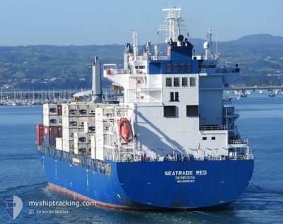
SEATRADE RED
Cargo
Current Trip
| Trip Time | 3 days |
|---|---|
| Trip Distance | 1082.30 nm |
| AVG Speed | 15.1 Knots |
| MAX Speed | 18 Knots |
| Draught | 8.8 m |
| AVG Wind | 7.6 knots |
| MAX Wind | 20 knots |
| MIN Temp | 20.5°C / 68.9°F |
| MAX Temp | 33.5°C / 92.3°F |
| Position Received | 1 d ago |
Current Position
| Longitude | -74.02387° |
|---|---|
| Latitude | 20.41530° |
| Status | Under way using engine |
| Speed | 16.8 Knots |
| Course | 167.6° |
| Area | North Atlantic Ocean |
| Station | T-AIS |
| Position Received | 1 d ago |
Info
Information
The current position of SEATRADE RED is in North Atlantic Ocean with coordinates 20.41530° / -74.02387° as reported on 2024-05-20 01:35 by AIS to our vessel tracker app. The vessel's current speed is 16.8 Knots and is currently inside the port of KINGSTON (JM).
The vessel SEATRADE RED (IMO: 9690107, MMSI: 636092711) is a Cargo It's sailing under the flag of [LR] Liberia.
In this page you can find informations about the vessels current position, last detected port calls, and current voyage information. If the vessels is not in coverage by AIS you will find the latest position.
The current position of SEATRADE RED is detected by our AIS receivers and we are not responsible for the reliability of the data. The last position was recorded while the vessel was in Coverage by the Ais receivers of our vessel tracking app.
The current draught of SEATRADE RED as reported by AIS is 8.8 meters
Weather
| Temperature | 22.6°C / 72.68°F |
|---|---|
| Wind Speed | 2 knots |
| Direction | 69° ENE |
| Pressure | 1011.5 hPa |
| Humidity | 84.1 % |
| Cloud Coverage | 72 % |
Featured Company
Last Port Calls
| Port | Arrival | Departure | Time In Port |
|---|---|---|---|
| 2024-05-21 03:22 | |||
| 2024-05-17 07:36 | 2024-05-17 23:37 | 16 h | |
| 2024-05-14 20:04 | 2024-05-14 21:15 | 1 h | |
| 2024-05-05 18:04 | 2024-05-06 21:03 | 1 d | |
| 2024-05-04 18:49 | 2024-05-05 04:36 | 9 h | |
| 2024-05-04 01:28 | 2024-05-04 09:14 | 7 h | |
| 2024-05-02 11:51 | 2024-05-03 13:26 | 1 d | |
| 2024-04-21 10:12 | 2024-04-21 21:41 | 11 h | |
| 2024-04-18 09:45 | 2024-04-19 07:49 | 22 h | |
| 2024-04-13 21:13 | 2024-04-14 12:02 | 14 h |
Most Visited Ports (Last year)
| Port | Arrivals | |
|---|---|---|
| 8 | ||
| 5 | ||
| 4 | ||
| 4 | ||
| 4 | ||
| 4 |
Last Trips
| Origin | Departure | Destination | Arrival | Distance | |
|---|---|---|---|---|---|
| 2024-05-17 19:37 | 2024-05-20 22:22 | 1082.30 nm | |||
| 2024-05-14 17:15 | 2024-05-17 03:36 | 721.96 nm | |||
| 2024-05-06 23:03 | 2024-05-14 16:04 | 3243.91 nm | |||
| 2024-05-05 06:36 | 2024-05-05 20:04 | 165.76 nm | |||
| 2024-05-04 10:14 | 2024-05-04 20:49 | 82.37 nm | |||
| 2024-05-03 15:26 | 2024-05-04 02:28 | 157.22 nm | |||
| 2024-04-21 17:41 | 2024-05-02 13:51 | 3587.63 nm | |||
| 2024-04-19 03:49 | 2024-04-21 06:12 | 691.93 nm | |||
| 2024-04-14 07:02 | 2024-04-18 05:45 | 1562.65 nm | |||
| 2024-03-27 03:18 | 2024-04-13 16:13 | 6813.57 nm |
Events
| Time | Event | Details | Position / Dest | Info |
|---|---|---|---|---|
| 2024-05-21 04:02 | STOP Moving |
17.98782 / -76.83462
[JM] KINGSTON (JM)
|
Speed: Course: 311° |
|
| 2024-05-21 03:22 | PORT ARRIVAL |
|
17.96673 / -76.83455
[JM] KINGSTON (JM)
|
Speed: 7.4 kn Course: 62° |
| 2024-05-21 01:51 | START Moving | 6.2 nm, South East of KINGSTON (JM) |
17.87532 / -76.75232
JMKIN
|
Speed: 3.4 kn Course: 107° |
| 2024-05-21 01:42 | STOP Moving | 6.14 nm, South East of KINGSTON (JM) |
17.87712 / -76.75137
JMKIN
|
Speed: 0.3 kn Course: 136° |
| 2024-05-20 01:42 | Status Changed | Default Under way using engine |
20.38418 / -74.01389
JMKIN
|
Speed: 16.8 kn Course: 167.6° |
| 2024-05-20 01:35 | OUT of Coverage |
20.41530 / -74.02387
North Atlantic Ocean
JMKIN
|
Speed: 16.8 kn Course: 167.6° |
|
| 2024-05-20 01:02 | Status Changed | Under way using engine Default |
20.56308 / -74.05705
JMKIN
|
Speed: 17 kn Course: 168° |
| 2024-05-20 00:37 | Status Changed | Default Under way using engine |
20.67500 / -74.08167
JMKIN
|
Speed: 16.7 kn Course: 168.2° |
| 2024-05-20 00:25 | Change Sea Area | Cuban part of the North Atlantic Ocean Bahamas part of the North Atlantic Ocean |
20.73002 / -74.09457
North Atlantic Ocean
JMKIN
|
Speed: 16.6 kn Course: 167.6° |
| 2024-05-20 00:19 | Status Changed | Under way using engine Default |
20.75442 / -74.10013
JMKIN
|
Speed: 16 kn Course: 168° |