
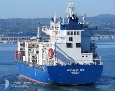
SEATRADE RED
Cargo
Current Trip
| Time Travelled | 22 h, 50 mins |
|---|---|
| Remaining Time | --- |
| Distance Travelled | 165.88 nm |
| Remaining Distance | --- |
| AVG Speed | 11.3 Knots |
| MAX Speed | 17.1 Knots |
| AVG Wind | 5.8 knots |
| MAX Wind | 30.8 knots |
| MIN Temp | 12.8°C / 55.04°F |
| MAX Temp | 20.2°C / 68.36°F |
| Draught | 8.7 m |
| Position Received | 5 h, 6 m ago |
Current Position
| Longitude | -73.89377° |
|---|---|
| Latitude | 39.29842° |
| Status | Under way using engine |
| Speed | 15 Knots |
| Course | 183.8° |
| Area | North Atlantic Ocean |
| Station | T-AIS |
| Position Received | 5 h, 6 m ago |
Info
Information
The current position of SEATRADE RED is in North Atlantic Ocean with coordinates 39.29842° / -73.89377° as reported on 2024-05-15 14:58 by AIS to our vessel tracker app. The vessel's current speed is 15 Knots and is heading at the port of SAVANNAH. The estimated time of arrival as calculated by vessel tracking app is 2024-05-17 06:00 LT
The vessel SEATRADE RED (IMO: 9690107, MMSI: 636092711) is a Cargo It's sailing under the flag of [LR] Liberia.
In this page you can find informations about the vessels current position, last detected port calls, and current voyage information. If the vessels is not in coverage by AIS you will find the latest position.
The current position of SEATRADE RED is detected by our AIS receivers and we are not responsible for the reliability of the data. The last position was recorded while the vessel was in Coverage by the Ais receivers of our vessel tracking app.
The current draught of SEATRADE RED as reported by AIS is 8.7 meters
Weather
| Temperature | 13.8°C / 56.84°F |
|---|---|
| Wind Speed | 17 knots |
| Direction | 217° SW |
| Pressure | 1000.5 hPa |
| Humidity | 98 % |
| Cloud Coverage | 90 % |
Featured Company
Last Port Calls
| Port | Arrival | Departure | Time In Port |
|---|---|---|---|
| 2024-05-14 20:04 | 2024-05-14 21:15 | 1 h | |
| 2024-05-05 18:04 | 2024-05-06 21:03 | 1 d | |
| 2024-05-04 18:49 | 2024-05-05 04:36 | 9 h | |
| 2024-05-04 01:28 | 2024-05-04 09:14 | 7 h | |
| 2024-05-02 11:51 | 2024-05-03 13:26 | 1 d | |
| 2024-04-21 10:12 | 2024-04-21 21:41 | 11 h | |
| 2024-04-18 09:45 | 2024-04-19 07:49 | 22 h | |
| 2024-04-13 21:13 | 2024-04-14 12:02 | 14 h | |
| 2024-03-25 16:03 | 2024-03-26 14:18 | 22 h | |
| 2024-03-23 22:56 | 2024-03-24 16:16 | 17 h |
Most Visited Ports (Last year)
| Port | Arrivals | |
|---|---|---|
| 7 | ||
| 5 | ||
| 4 | ||
| 4 | ||
| 4 | ||
| 4 |
Last Trips
| Origin | Departure | Destination | Arrival | Distance | |
|---|---|---|---|---|---|
| 2024-05-06 23:03 | 2024-05-14 16:04 | 3243.91 nm | |||
| 2024-05-05 06:36 | 2024-05-05 20:04 | 165.76 nm | |||
| 2024-05-04 10:14 | 2024-05-04 20:49 | 82.37 nm | |||
| 2024-05-03 15:26 | 2024-05-04 02:28 | 157.22 nm | |||
| 2024-04-21 17:41 | 2024-05-02 13:51 | 3587.63 nm | |||
| 2024-04-19 03:49 | 2024-04-21 06:12 | 691.93 nm | |||
| 2024-04-14 07:02 | 2024-04-18 05:45 | 1562.65 nm | |||
| 2024-03-27 03:18 | 2024-04-13 16:13 | 6813.57 nm | |||
| 2024-03-25 05:16 | 2024-03-26 05:03 | 158.70 nm | |||
| 2024-03-19 08:34 | 2024-03-24 11:56 | 1687.10 nm |
Events
| Time | Event | Details | Position / Dest | Info |
|---|---|---|---|---|
| 2024-05-15 15:05 | Status Changed | Default Under way using engine |
39.27167 / -73.89667
SAVANNAH
|
Speed: 15 kn Course: 183.8° |
| 2024-05-15 14:58 | OUT of Coverage |
39.29842 / -73.89377
North Atlantic Ocean
SAVANNAH
|
Speed: 15 kn Course: 183.8° |
|
| 2024-05-15 14:48 | Status Changed | Under way using engine Default |
39.34137 / -73.88990
SAVANNAH
|
Speed: 16 kn Course: 185° |
| 2024-05-15 14:44 | Status Changed | Default Under way using engine |
39.36167 / -73.88834
SAVANNAH
|
Speed: 16 kn Course: 184.2° |
| 2024-05-15 13:04 | ETA Changed | 2024/05/17 06:00 2024/05/17 07:00 |
39.81055 / -73.85238
SAVANNAH
|
Speed: 16.6 kn Course: 183.1° |
| 2024-05-15 08:37 | START Moving | 6.67 nm, West of NEW YORK |
40.64265 / -74.18988
SAVANNAH
|
Speed: 3.9 kn Course: 51° |
| 2024-05-15 08:22 | Status Changed | Under way using engine Moored |
40.64112 / -74.19103
SAVANNAH
|
Speed: 0.5 kn Course: 220° |
| 2024-05-15 07:43 | Destination Changed | SAVANNAH NEW YORK |
40.64065 / -74.19020
SAVANNAH
|
Speed: Course: 223° |
| 2024-05-15 07:43 | ETA Changed | 2024/05/17 07:00 2024/05/14 19:00 |
40.64065 / -74.19020
SAVANNAH
|
Speed: Course: 223° |
| 2024-05-15 07:37 | Draught Changed | 8.7 8.3 |
40.64065 / -74.19020
NEW YORK
|
Speed: Course: 223° |