
SEATRIBUTE
Tanker
Current Trip
| Trip Time | 13 days |
|---|---|
| Trip Distance | 2019.22 nm |
| AVG Speed | 10.5 Knots |
| MAX Speed | 13.9 Knots |
| Draught | 11.6 m |
| AVG Wind | 11 knots |
| MAX Wind | 24.8 knots |
| MIN Temp | 14.9°C / 58.82°F |
| MAX Temp | 21.5°C / 70.7°F |
| Position Received | 1 m ago |
Current Position
| Longitude | 13.77883° |
|---|---|
| Latitude | 45.61128° |
| Status | Under way using engine |
| Speed | |
| Course | 246° |
| Area | Adriatic Sea |
| Station | T-AIS |
| Position Received | 1 m ago |
Info
Information
The current position of SEATRIBUTE is in Adriatic Sea with coordinates 45.61128° / 13.77883° as reported on 2024-05-10 10:48 by AIS to our vessel tracker app. The vessel's current speed is 0 Knots and is currently inside the port of TRIESTE.
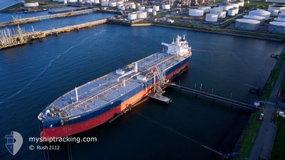
The vessel SEATRIBUTE (IMO: 9857468, MMSI: 215544000) is a Tanker It's sailing under the flag of [MT] Malta.
In this page you can find informations about the vessels current position, last detected port calls, and current voyage information. If the vessels is not in coverage by AIS you will find the latest position.
The current position of SEATRIBUTE is detected by our AIS receivers and we are not responsible for the reliability of the data. The last position was recorded while the vessel was in Coverage by the Ais receivers of our vessel tracking app.
The current draught of SEATRIBUTE as reported by AIS is 11.6 meters
Weather
| Temperature | 22°C / 71.6°F |
|---|---|
| Wind Speed | 8 knots |
| Direction | 55° NE |
| Pressure | 1018.6 hPa |
| Humidity | 35.6 % |
| Cloud Coverage | --- |
Featured Company
Events
| Time | Event | Details | Position / Dest | Info |
|---|---|---|---|---|
| 2024-05-10 10:25 | PORT ARRIVAL |
|
45.60972 / 13.77595
[IT] TRIESTE
|
Speed: 1.1 kn Course: 234° |
| 2024-05-10 10:21 | STOP Moving | 0.39 nm, North East of MUGGIA |
45.60942 / 13.77506
ITTRS
|
Speed: 0.3 kn Course: 219° |
| 2024-05-10 09:32 | Change Sea Area | Italian part of the Adriatic Sea Slovenian part of the Adriatic Sea |
45.61331 / 13.68900
Adriatic Sea
ITTRS
|
Speed: 5.2 kn Course: 84.8° |
| 2024-05-10 08:41 | Change Sea Area | Slovenian part of the Adriatic Sea Croatian part of the Adriatic Sea |
45.56668 / 13.50140
Adriatic Sea
ITTRS
|
Speed: 11.8 kn Course: 58.6° |
| 2024-05-10 03:05 | IN Coverage |
44.74052 / 13.56487
Adriatic Sea
ITTRS
|
Speed: 11.3 kn Course: 328° |
|
| 2024-05-10 03:02 | Status Changed | Under way using engine Default |
44.73430 / 13.57036
ITTRS
|
Speed: 11.4 kn Course: 328° |
| 2024-05-10 01:08 | Status Changed | Default Under way using engine |
44.43117 / 13.84441
ITTRS
|
Speed: 11.4 kn Course: 326.1° |
| 2024-05-10 01:03 | Status Changed | Under way using engine Default |
44.41729 / 13.85750
ITTRS
|
Speed: 11.4 kn Course: 326° |
| 2024-05-10 01:03 | OUT of Coverage |
44.41729 / 13.85750
Adriatic Sea
ITTRS
|
Speed: 11.4 kn Course: 326.1° |
|
| 2024-05-10 00:56 | Status Changed | Default Under way using engine |
44.39933 / 13.87419
ITTRS
|
Speed: 11.5 kn Course: 327° |