
SEATRIBUTE
Tanker
Current Trip
| Time Travelled | 20 days |
|---|---|
| Remaining Time | --- |
| Distance Travelled | 4260.40 nm |
| Remaining Distance | --- |
| AVG Speed | 11.2 Knots |
| MAX Speed | 11.2 Knots |
| AVG Wind | 7.8 knots |
| MAX Wind | 21.9 knots |
| MIN Temp | 13.4°C / 56.12°F |
| MAX Temp | 23.5°C / 74.3°F |
| Draught | 13.4 m |
| Position Received | 1 m ago |
Current Position
| Longitude | -9.67120° |
|---|---|
| Latitude | 37.76425° |
| Status | Under way using engine |
| Speed | 12.2 Knots |
| Course | 346.3° |
| Area | North Atlantic Ocean |
| Station | T-AIS |
| Position Received | 1 m ago |
Info
Information
The current position of SEATRIBUTE is in North Atlantic Ocean with coordinates 37.76425° / -9.67120° as reported on 2024-06-01 04:07 by AIS to our vessel tracker app. The vessel's current speed is 12.2 Knots and is heading at the port of TRANMERE. The estimated time of arrival as calculated by vessel tracking app is 2024-06-04 15:00 LT
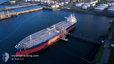
The vessel SEATRIBUTE (IMO: 9857468, MMSI: 215544000) is a Tanker It's sailing under the flag of [MT] Malta.
In this page you can find informations about the vessels current position, last detected port calls, and current voyage information. If the vessels is not in coverage by AIS you will find the latest position.
The current position of SEATRIBUTE is detected by our AIS receivers and we are not responsible for the reliability of the data. The last position was recorded while the vessel was in Coverage by the Ais receivers of our vessel tracking app.
The current draught of SEATRIBUTE as reported by AIS is 13.4 meters
Weather
| Temperature | 17.9°C / 64.22°F |
|---|---|
| Wind Speed | 12 knots |
| Direction | 342° NNW |
| Pressure | 1009 hPa |
| Humidity | 89.2 % |
| Cloud Coverage | --- |
Featured Company
Events
| Time | Event | Details | Position / Dest | Info |
|---|---|---|---|---|
| 2024-05-31 14:58 | Change Sea Area | Portuguese part of the North Atlantic Ocean Spanish part of the North Atlantic Ocean |
36.21875 / -7.46347
North Atlantic Ocean
GBTRA
|
Speed: 12.8 kn Course: 284.3° |
| 2024-05-31 14:04 | ETA Changed | 2024/06/04 15:00 2024/06/04 14:00 |
36.16853 / -7.23474
GBTRA
|
Speed: 12.4 kn Course: 287° |
| 2024-05-31 13:52 | Status Changed | Under way using engine Default |
36.15600 / -7.18375
GBTRA
|
Speed: 12.5 kn Course: 286° |
| 2024-05-31 13:48 | Status Changed | Default Under way using engine |
36.15279 / -7.17015
GBTRA
|
Speed: 12.4 kn Course: 286.2° |
| 2024-05-31 13:41 | Status Changed | Under way using engine Default |
36.14619 / -7.14205
GBTRA
|
Speed: 12.4 kn Course: 286° |
| 2024-05-31 13:36 | Status Changed | Default Under way using engine |
36.14106 / -7.12048
GBTRA
|
Speed: 12.4 kn Course: 287.5° |
| 2024-05-31 13:34 | ETA Changed | 2024/06/04 14:00 2024/06/04 16:00 |
36.13474 / -7.09566
GBTRA
|
Speed: 12.4 kn Course: 287.5° |
| 2024-05-31 13:29 | Status Changed | Under way using engine Default |
36.13370 / -7.09160
GBTRA
|
Speed: 12.4 kn Course: 287° |
| 2024-05-31 13:16 | Status Changed | Default Under way using engine |
36.12090 / -7.04050
GBTRA
|
Speed: 12.4 kn Course: 286.5° |
| 2024-05-31 12:51 | Status Changed | Under way using engine Default |
36.09738 / -6.94006
GBTRA
|
Speed: 12.2 kn Course: 286° |