
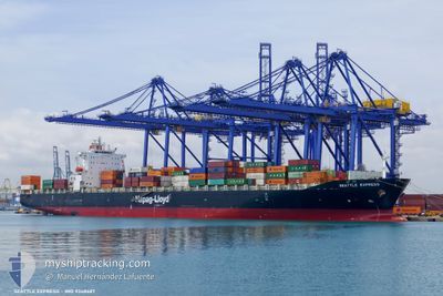
SEATTLE EXPRESS
Container Ship
Current Trip
| Time Travelled | 1 day |
|---|---|
| Remaining Time | --- |
| Distance Travelled | 601.06 nm |
| Remaining Distance | --- |
| AVG Speed | 12.7 Knots |
| MAX Speed | 13.6 Knots |
| AVG Wind | 7.5 knots |
| MAX Wind | 16 knots |
| MIN Temp | 15.4°C / 59.72°F |
| MAX Temp | 18.5°C / 65.3°F |
| Draught | 8.7 m |
| Position Received | 1 d ago |
Current Position
| Longitude | -119.33042° |
|---|---|
| Latitude | 30.34126° |
| Status | Under way using engine |
| Speed | 13 Knots |
| Course | 226.7° |
| Area | North Pacific Ocean |
| Station | T-AIS |
| Position Received | 1 d ago |
Info
Information
The current position of SEATTLE EXPRESS is in North Pacific Ocean with coordinates 30.34126° / -119.33042° as reported on 2024-06-11 07:29 by AIS to our vessel tracker app. The vessel's current speed is 13 Knots and is heading at the port of AUCKLAND. The estimated time of arrival as calculated by vessel tracking app is 2024-06-28 17:30 LT
The vessel SEATTLE EXPRESS (IMO: 9348687, MMSI: 636020257) is a Container Ship that was built in 2008 ( 16 years old ). It's sailing under the flag of [LR] Liberia.
In this page you can find informations about the vessels current position, last detected port calls, and current voyage information. If the vessels is not in coverage by AIS you will find the latest position.
The current position of SEATTLE EXPRESS is detected by our AIS receivers and we are not responsible for the reliability of the data. The last position was recorded while the vessel was in Coverage by the Ais receivers of our vessel tracking app.
The current draught of SEATTLE EXPRESS as reported by AIS is 8.7 meters
Weather
| Temperature | 18.3°C / 64.94°F |
|---|---|
| Wind Speed | 6 knots |
| Direction | 310° NW |
| Pressure | 1015.4 hPa |
| Humidity | 68.7 % |
| Cloud Coverage | 60 % |
Featured Company
Last Port Calls
| Port | Arrival | Departure | Time In Port |
|---|---|---|---|
| 2024-06-08 12:09 | 2024-06-10 12:51 | 2 d | |
| 2024-06-04 12:51 | 2024-06-05 11:17 | 22 h | |
| 2024-05-31 13:01 | 2024-06-01 08:16 | 19 h | |
| 2024-05-08 20:11 | 2024-05-10 02:00 | 1 d | |
| 2024-04-25 22:02 | 2024-04-27 08:48 | 1 d | |
| 2024-04-18 10:49 | 2024-04-19 12:25 | 1 d | |
| 2024-04-14 04:16 | 2024-04-14 23:51 | 19 h |
Last Trips
| Origin | Departure | Destination | Arrival | Distance | |
|---|---|---|---|---|---|
| 2024-06-05 04:17 | 2024-06-08 05:09 | 401.45 nm | |||
| 2024-06-01 01:16 | 2024-06-04 05:51 | 865.52 nm | |||
| 2024-05-10 14:00 | 2024-05-31 06:01 | 6531.77 nm | |||
| 2024-04-27 18:48 | 2024-05-09 08:11 | 1779.37 nm | |||
| 2024-04-19 22:25 | 2024-04-26 08:02 | 655.34 nm | |||
| 2024-04-15 11:51 | 2024-04-18 20:49 | 1303.24 nm | |||
| 2024-03-25 04:51 | 2024-04-14 16:16 | 5760.22 nm |
Events
| Time | Event | Details | Position / Dest | Info |
|---|---|---|---|---|
| 2024-06-11 07:32 | Status Changed | Default Under way using engine |
30.33420 / -119.33913
NZAKL
|
Speed: 13 kn Course: 226.7° |
| 2024-06-11 07:29 | OUT of Coverage |
30.34126 / -119.33042
North Pacific Ocean
NZAKL
|
Speed: 13 kn Course: 226.7° |
|
| 2024-06-11 07:22 | Status Changed | Under way using engine Default |
30.35813 / -119.30942
NZAKL
|
Speed: 13.2 kn Course: 227° |
| 2024-06-11 06:47 | Status Changed | Default Under way using engine |
30.44563 / -119.20229
NZAKL
|
Speed: 13 kn Course: 227.2° |
| 2024-06-11 06:46 | Status Changed | Under way using engine Default |
30.44811 / -119.19925
NZAKL
|
Speed: 13 kn Course: 224° |
| 2024-06-11 06:26 | Status Changed | Default Under way using engine |
30.49903 / -119.14085
NZAKL
|
Speed: 13.1 kn Course: 225.8° |
| 2024-06-11 06:16 | Status Changed | Under way using engine Default |
30.52424 / -119.11238
NZAKL
|
Speed: 12.9 kn Course: 231° |
| 2024-06-11 06:16 | IN Coverage |
30.52424 / -119.11238
North Pacific Ocean
NZAKL
|
Speed: 13 kn Course: 229.1° |
|
| 2024-06-11 03:56 | Status Changed | Default Under way using engine |
30.85710 / -118.67019
NZAKL
|
Speed: 13.2 kn Course: 228.9° |
| 2024-06-11 03:51 | OUT of Coverage |
30.86844 / -118.65561
North Pacific Ocean
NZAKL
|
Speed: 13.2 kn Course: 228.9° |