
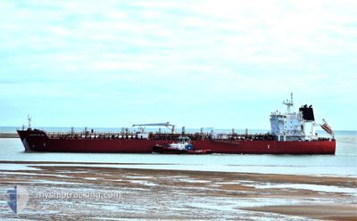
SEAWAYS CAPE MAY
Tanker
Aktuelle Reise
| Trip Time | 17 Tage |
|---|---|
| Trip Distanz | 1291.67 nm |
| Durchschnittliche Geschwindigkeit | 9.7 Knoten |
| Maximale Geschwindigkeit | 12.5 Knoten |
| Tiefgang | 8 m |
| Durchschnittliche Windgeschwindigkeit | 8.4 Knoten |
| Maximale Windgeschwindigkeit | 20.3 Knoten |
| Minimale Temperatur | 14.5°C / 58.1°F |
| Maximale Temperatur | 29.8°C / 85.64°F |
| Position erhalten | 3 m alt |
Aktuelle Position
| Länge | -118.19832° |
|---|---|
| Breite | 33.72531° |
| Zustand | At anchor |
| Geschwindigkeit | |
| Kurs | --- |
| Gebiet | North Pacific Ocean |
| Station | T-AIS |
| Position erhalten | 3 m alt |
Schiffsdetails
Information
Die SEAWAYS CAPE MAY befindet sich derzeit in North Pacific Ocean mit den Koordinaten 33.72531° / -118.19832°, Diese Position wurde am 2024-09-27 14:47 von unserer Schiffsverfolgungs-App über AIS erfasst. Das Schiff fährt momentan mit einer Geschwindigkeit von 0 Knoten und liegt im Hafen von LOS ANGELES .
Das Schiff SEAWAYS CAPE MAY (IMO: 9717785, MMSI: 538005536) ist Tanker und fährt unter der Flagge von [MH] Marshall Is.
Auf dieser Seite erhalten Sie Informationen zur aktuellen Position des Schiffes, zu den letzten bekannten Hafenanläufen und zu den aktuellen Reiseinformationen. Sollte das Schiff nicht durch AIS abgedeckt sein, wird die zuletzt erfasste Position angezeigt.
Die SEAWAYS CAPE MAY wird durch unsere AIS-Empfänger ermittelt. Wir übernehmen keine Gewähr für die Richtigkeit der Daten. Die letzte Position wurde von unseren AIS-Empfängern aufgezeichnet, während das Schiff in Reichweite war.
Der aktuelle Entwurf von SEAWAYS CAPE MAY, wie von AIS gemeldet, betragt 8 meter
Wetter
| Temperatur | 17.1°C / 62.78°F |
|---|---|
| Windgeschwindigkeit | 4 Knoten |
| Windrichtung | 257° WSW |
| Luftdruck | 1010.9 hPa |
| Luftfeuchtigkeit | 86 % |
| Wolken | --- |
Featured Company
Letzte Hafenanläufe
| Hafen | Ankunft | Abfahrt | Time In Port |
|---|---|---|---|
| 2024-09-27 12:30 | |||
| 2024-08-27 16:18 | 2024-09-10 01:37 | 13 d | |
| 2024-08-09 22:51 | 2024-08-11 23:18 | 2 d | |
| 2024-07-21 10:19 | 2024-07-22 19:45 | 1 d | |
| 2024-07-14 02:09 | 2024-07-15 05:27 | 1 d |
Meistbesuchte Häfen (Letztes Jahr)
| Hafen | Ankünfte | |
|---|---|---|
| 6 | ||
| 2 | ||
| 2 | ||
| 1 | ||
| 1 | ||
| 1 |
Letzte Reisen
| Herkunft | Abfahrt | Ziel | Ankunft | Distanz | |
|---|---|---|---|---|---|
| 2024-09-09 20:37 | 2024-09-27 05:30 | 1291.67 nm | |||
| 2024-08-11 18:18 | 2024-08-27 11:18 | 3545.63 nm | |||
| 2024-07-22 15:45 | 2024-08-09 17:51 | 4432.44 nm | |||
| 2024-07-15 01:27 | 2024-07-21 06:19 | 321.72 nm | |||
| 2024-06-20 19:06 | 2024-07-13 22:09 | 4646.39 nm |
Events
| Zeit | Ereignis | Details | Position / Ziel | Information |
|---|---|---|---|---|
| 2024-09-27 13:02 | geänderter Status | At anchor Under way using engine |
33.72623 / -118.19697
[US] LOS ANGELES
|
Geschwindigkeit: 0.1 kn Kurs: 291° |
| 2024-09-27 12:45 | STOP Bewegung |
33.72631 / -118.19698
[US] LOS ANGELES
|
Geschwindigkeit: 0.3 kn Kurs: 286° |
|
| 2024-09-27 12:30 | ZIELHAFEN |
|
33.72147 / -118.18315
[US] LOS ANGELES
|
Geschwindigkeit: 6.3 kn Kurs: 353° |
| 2024-09-27 04:25 | Auf See entdeckt | United States part of the North Pacific Ocean |
32.60429 / -117.58652
North Pacific Ocean
US LGB
|
Geschwindigkeit: 10.9 kn Kurs: 349.4° |
| 2024-09-27 00:20 | geänderter Status | Under way using engine Default |
32.32662 / -117.21170
US LGB
|
Geschwindigkeit: 9.4 kn Kurs: 246° |
| 2024-09-27 00:19 | geänderter Status | Default Under way using engine |
32.32842 / -117.20679
US LGB
|
Geschwindigkeit: 9.4 kn Kurs: 246.5° |
| 2024-09-26 23:31 | START Bewegung | 20.25 nm, North West of PUERTO SALINA |
32.34016 / -117.09527
US LGB
|
Geschwindigkeit: 3.1 kn Kurs: 107° |
| 2024-09-26 23:22 | geändertes Ziel | US LGB ROSASRITO |
32.34190 / -117.09669
US LGB
|
Geschwindigkeit: 1.4 kn Kurs: 342° |
| 2024-09-26 23:22 | geänderte voraussichtliche Ankunftszeit | 2024/09/27 12:00 2024/09/14 08:00 |
32.34190 / -117.09669
US LGB
|
Geschwindigkeit: 1.4 kn Kurs: 342° |
| 2024-09-26 23:21 | geänderter Tiefgang | 8 9 |
32.34235 / -117.09677
ROSASRITO
|
Geschwindigkeit: 0.5 kn Kurs: 332° |