
SEAWAYS NANTUCKET
Oil/Chemical Tanker
Current Trip
USCLM>>CLSWE
| Time Travelled | 2 days |
|---|---|
| Remaining Time | --- |
| Distance Travelled | 858.67 nm |
| Remaining Distance | --- |
| AVG Speed | 11.8 Knots |
| MAX Speed | 14.6 Knots |
| AVG Wind | 24.2 knots |
| MAX Wind | 34 knots |
| MIN Temp | 6.5°C / 43.7°F |
| MAX Temp | 12.8°C / 55.04°F |
| Draught | 11.9 m |
| Position Received | 4 m ago |
Current Position
| Longitude | -122.47210° |
|---|---|
| Latitude | 35.94392° |
| Status | Under way using engine |
| Speed | 12.3 Knots |
| Course | 144.8° |
| Area | North Pacific Ocean |
| Station | T-AIS |
| Position Received | 4 m ago |
Info
Information
The current position of SEAWAYS NANTUCKET is in North Pacific Ocean with coordinates 35.94392° / -122.47210° as reported on 2024-05-20 02:54 by AIS to our vessel tracker app. The vessel's current speed is 12.3 Knots
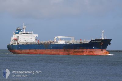
The vessel SEAWAYS NANTUCKET (IMO: 9384033, MMSI: 538003197) is a Oil/Chemical Tanker that was built in 2008 ( 16 years old ). It's sailing under the flag of [MH] Marshall Is.
In this page you can find informations about the vessels current position, last detected port calls, and current voyage information. If the vessels is not in coverage by AIS you will find the latest position.
The current position of SEAWAYS NANTUCKET is detected by our AIS receivers and we are not responsible for the reliability of the data. The last position was recorded while the vessel was in Coverage by the Ais receivers of our vessel tracking app.
The current draught of SEAWAYS NANTUCKET as reported by AIS is 11.9 meters
Weather
| Temperature | 12.7°C / 54.86°F |
|---|---|
| Wind Speed | 22 knots |
| Direction | 326° NW |
| Pressure | 1017.2 hPa |
| Humidity | 80.3 % |
| Cloud Coverage | 1 % |
Featured Company
Last Port Calls
| Port | Arrival | Departure | Time In Port |
|---|---|---|---|
| 2024-05-16 18:50 | 2024-05-17 04:09 | 9 h | |
| 2024-05-15 02:13 | 2024-05-16 13:38 | 1 d | |
| 2024-04-11 23:42 | 2024-04-30 23:49 | 19 d | |
| 2024-04-10 22:47 | 2024-04-11 10:44 | 11 h | |
| 2024-04-01 05:33 | 2024-04-05 00:06 | 3 d | |
| 2024-03-29 07:01 | 2024-03-30 02:45 | 19 h | |
| 2024-03-26 23:00 | 2024-03-27 22:39 | 23 h | |
| 2024-03-18 22:03 | 2024-03-23 17:08 | 4 d |
Most Visited Ports (Last year)
| Port | Arrivals | |
|---|---|---|
| 3 | ||
| 2 | ||
| 1 | ||
| 1 | ||
| 1 | ||
| 1 |
Last Trips
| Origin | Departure | Destination | Arrival | Distance | |
|---|---|---|---|---|---|
| 2024-05-16 06:38 | 2024-05-16 11:50 | 57.67 nm | |||
| 2024-04-30 18:49 | 2024-05-14 19:13 | 2688.30 nm | |||
| 2024-04-11 05:44 | 2024-04-11 18:42 | 158.18 nm | |||
| 2024-04-04 18:06 | 2024-04-10 17:47 | 188.83 nm | |||
| 2024-03-29 19:45 | 2024-03-31 23:33 | 660.98 nm | |||
| 2024-03-27 15:39 | 2024-03-29 00:01 | 389.25 nm | |||
| 2024-03-23 11:08 | 2024-03-26 16:00 | 344.69 nm | |||
| 2024-02-26 06:17 | 2024-03-18 16:03 | 3356.09 nm |
Events
| Time | Event | Details | Position / Dest | Info |
|---|---|---|---|---|
| 2024-05-20 01:05 | Status Changed | Under way using engine Default |
36.26414 / -122.71795
USCLM>>CLSWE
|
Speed: 12 kn Course: 145° |
| 2024-05-20 01:01 | Status Changed | Default Under way using engine |
36.27500 / -122.72667
USCLM>>CLSWE
|
Speed: 12.6 kn Course: 145.6° |
| 2024-05-20 00:55 | Status Changed | Under way using engine Default |
36.29184 / -122.73986
USCLM>>CLSWE
|
Speed: 12 kn Course: 146° |
| 2024-05-20 00:52 | Status Changed | Default Under way using engine |
36.30167 / -122.74834
USCLM>>CLSWE
|
Speed: 12.7 kn Course: 146.8° |
| 2024-05-19 20:49 | Status Changed | Under way using engine Default |
37.01624 / -123.31387
USCLM>>CLSWE
|
Speed: 11.7 kn Course: 145° |
| 2024-05-19 20:46 | Status Changed | Default Under way using engine |
37.02308 / -123.31947
USCLM>>CLSWE
|
Speed: 11.8 kn Course: 147° |
| 2024-05-19 20:10 | ETA Changed | 2024/06/06 13:00 2024/06/06 12:00 |
37.12347 / -123.40015
USCLM>>CLSWE
|
Speed: 12.1 kn Course: 145.9° |
| 2024-05-19 19:47 | Status Changed | Under way using engine Default |
37.18578 / -123.45333
USCLM>>CLSWE
|
Speed: 11.7 kn Course: 145° |
| 2024-05-19 19:44 | Status Changed | Default Under way using engine |
37.19348 / -123.45991
USCLM>>CLSWE
|
Speed: 11.7 kn Course: 144.3° |
| 2024-05-19 18:47 | Status Changed | Under way using engine Default |
37.35676 / -123.58750
USCLM>>CLSWE
|
Speed: 12 kn Course: 146° |