
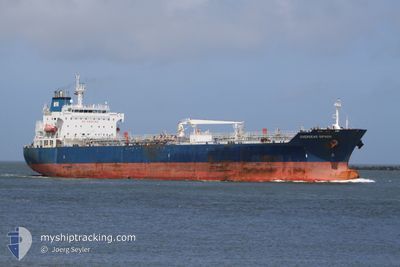
SEAWAYS NANTUCKET
Oil/Chemical Tanker
Current Trip
USCLM>>CLSWE
| Time Travelled | 15 days |
|---|---|
| Remaining Time | --- |
| Distance Travelled | 4451.46 nm |
| Remaining Distance | --- |
| AVG Speed | 12 Knots |
| MAX Speed | 14.6 Knots |
| AVG Wind | 14.7 knots |
| MAX Wind | 34 knots |
| MIN Temp | 6.5°C / 43.7°F |
| MAX Temp | 29.8°C / 85.64°F |
| Draught | 11.9 m |
| Position Received | 7 d ago |
Current Position
| Longitude | -107.29145° |
|---|---|
| Latitude | 16.76839° |
| Status | Under way using engine |
| Speed | 12.4 Knots |
| Course | 146° |
| Area | North Pacific Ocean |
| Station | T-AIS |
| Position Received | 7 d ago |
Info
Information
The current position of SEAWAYS NANTUCKET is in North Pacific Ocean with coordinates 16.76839° / -107.29145° as reported on 2024-05-24 18:35 by AIS to our vessel tracker app. The vessel's current speed is 12.4 Knots
The vessel SEAWAYS NANTUCKET (IMO: 9384033, MMSI: 538003197) is a Oil/Chemical Tanker that was built in 2008 ( 16 years old ). It's sailing under the flag of [MH] Marshall Is.
In this page you can find informations about the vessels current position, last detected port calls, and current voyage information. If the vessels is not in coverage by AIS you will find the latest position.
The current position of SEAWAYS NANTUCKET is detected by our AIS receivers and we are not responsible for the reliability of the data. The last position was recorded while the vessel was in Coverage by the Ais receivers of our vessel tracking app.
The current draught of SEAWAYS NANTUCKET as reported by AIS is 11.9 meters
Weather
| Temperature | 21.2°C / 70.16°F |
|---|---|
| Wind Speed | 12 knots |
| Direction | 99° E |
| Pressure | 1014.6 hPa |
| Humidity | 72.6 % |
| Cloud Coverage | 78 % |
Featured Company
Last Port Calls
| Port | Arrival | Departure | Time In Port |
|---|---|---|---|
| 2024-05-16 18:50 | 2024-05-17 04:09 | 9 h | |
| 2024-05-15 02:13 | 2024-05-16 13:38 | 1 d | |
| 2024-04-11 23:42 | 2024-04-30 23:49 | 19 d | |
| 2024-04-10 22:47 | 2024-04-11 10:44 | 11 h | |
| 2024-04-01 05:33 | 2024-04-05 00:06 | 3 d |
Most Visited Ports (Last year)
| Port | Arrivals | |
|---|---|---|
| 3 | ||
| 2 | ||
| 1 | ||
| 1 | ||
| 1 | ||
| 1 |
Last Trips
| Origin | Departure | Destination | Arrival | Distance | |
|---|---|---|---|---|---|
| 2024-05-16 06:38 | 2024-05-16 11:50 | 57.67 nm | |||
| 2024-04-30 18:49 | 2024-05-14 19:13 | 2688.30 nm | |||
| 2024-04-11 05:44 | 2024-04-11 18:42 | 158.18 nm | |||
| 2024-04-04 18:06 | 2024-04-10 17:47 | 188.83 nm | |||
| 2024-03-29 19:45 | 2024-03-31 23:33 | 660.98 nm |
Events
| Time | Event | Details | Position / Dest | Info |
|---|---|---|---|---|
| 2024-05-24 18:46 | Status Changed | Default Under way using engine |
16.73500 / -107.26833
USCLM>>CLSWE
|
Speed: 12.4 kn Course: 146° |
| 2024-05-24 18:35 | OUT of Coverage |
16.76839 / -107.29145
North Pacific Ocean
USCLM>>CLSWE
|
Speed: 12.4 kn Course: 146° |
|
| 2024-05-24 18:07 | Status Changed | Under way using engine Default |
16.84970 / -107.34902
USCLM>>CLSWE
|
Speed: 12.4 kn Course: 146° |
| 2024-05-24 18:02 | Status Changed | Default Under way using engine |
16.86416 / -107.35936
USCLM>>CLSWE
|
Speed: 12.4 kn Course: 146.3° |
| 2024-05-24 17:34 | Change Sea Area | High seas of the North Pacific Ocean Mexican part of the North Pacific Ocean |
16.94278 / -107.41672
North Pacific Ocean
USCLM>>CLSWE
|
Speed: 12.4 kn Course: 142.9° |
| 2024-05-24 16:30 | Status Changed | Under way using engine Default |
17.11531 / -107.57754
USCLM>>CLSWE
|
Speed: 12 kn Course: 138° |
| 2024-05-24 16:25 | Status Changed | Default Under way using engine |
17.12667 / -107.58833
USCLM>>CLSWE
|
Speed: 12 kn Course: 136.9° |
| 2024-05-24 15:46 | Status Changed | Under way using engine Default |
17.22468 / -107.68007
USCLM>>CLSWE
|
Speed: 12 kn Course: 138° |
| 2024-05-24 15:27 | Status Changed | Default Under way using engine |
17.27221 / -107.72493
USCLM>>CLSWE
|
Speed: 12.2 kn Course: 137.4° |
| 2024-05-24 13:56 | Status Changed | Under way using engine Default |
17.50312 / -107.93884
USCLM>>CLSWE
|
Speed: 12.3 kn Course: 139° |