
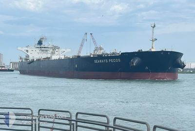
SEAWAYS PECOS
Crude Oil Tanker
Current Trip
| Time Travelled | 4 days |
|---|---|
| Remaining Time | --- |
| Distance Travelled | 951.52 nm |
| Remaining Distance | --- |
| AVG Speed | 11 Knots |
| MAX Speed | 14.3 Knots |
| AVG Wind | 9.8 knots |
| MAX Wind | 20.5 knots |
| MIN Temp | 10°C / 50°F |
| MAX Temp | 16.9°C / 62.42°F |
| Draught | 13.7 m |
| Position Received | 3 m ago |
Current Position
| Longitude | 18.87589° |
|---|---|
| Latitude | 54.45582° |
| Status | At anchor |
| Speed | 0.1 Knots |
| Course | 324° |
| Area | Baltic Sea |
| Station | T-AIS |
| Position Received | 3 m ago |
Info
Information
The current position of SEAWAYS PECOS is in Baltic Sea with coordinates 54.45582° / 18.87589° as reported on 2024-06-03 00:56 by AIS to our vessel tracker app. The vessel's current speed is 0.1 Knots
The vessel SEAWAYS PECOS (IMO: 9594743, MMSI: 538004032) is a Crude Oil Tanker that was built in 2012 ( 12 years old ). It's sailing under the flag of [MH] Marshall Is.
In this page you can find informations about the vessels current position, last detected port calls, and current voyage information. If the vessels is not in coverage by AIS you will find the latest position.
The current position of SEAWAYS PECOS is detected by our AIS receivers and we are not responsible for the reliability of the data. The last position was recorded while the vessel was in Coverage by the Ais receivers of our vessel tracking app.
The current draught of SEAWAYS PECOS as reported by AIS is 13.7 meters
Weather
| Temperature | 13.1°C / 55.58°F |
|---|---|
| Wind Speed | 8 knots |
| Direction | 321° NW |
| Pressure | 1011 hPa |
| Humidity | 95.3 % |
| Cloud Coverage | 99 % |
Featured Company
Last Port Calls
| Port | Arrival | Departure | Time In Port |
|---|---|---|---|
| 2024-05-28 00:05 | 2024-05-29 08:13 | 1 d | |
| 2024-04-24 16:25 | 2024-04-26 12:06 | 1 d | |
| 2024-04-20 18:07 | 2024-04-23 13:17 | 2 d | |
| 2024-04-07 13:21 | 2024-04-08 20:03 | 1 d |
Last Trips
| Origin | Departure | Destination | Arrival | Distance | |
|---|---|---|---|---|---|
| 2024-04-26 07:06 | 2024-05-28 02:05 | 6019.61 nm | |||
| 2024-04-23 08:17 | 2024-04-24 11:25 | 149.69 nm | |||
| 2024-04-08 17:33 | 2024-04-20 13:07 | 3032.23 nm | |||
| 2024-03-31 00:43 | 2024-04-07 10:51 | 1210.67 nm |
Events
| Time | Event | Details | Position / Dest | Info |
|---|---|---|---|---|
| 2024-06-02 01:29 | Status Changed | At anchor Default |
54.45514 / 18.87332
PLGDN
|
Speed: 0.1 kn Course: 272° |
| 2024-06-02 01:26 | Status Changed | Default At anchor |
54.45513 / 18.87340
PLGDN
|
Speed: Course: 359° |
| 2024-06-01 23:28 | STOP Moving | 8.74 nm, North East of GDANSK |
54.45632 / 18.87203
PLGDN
|
Speed: 0.3 kn Course: 18° |
| 2024-06-01 23:28 | Status Changed | At anchor Under way using engine |
54.45635 / 18.87205
PLGDN
|
Speed: 0.4 kn Course: 17° |
| 2024-06-01 21:21 | ETA Changed | 2024/06/02 02:01 2024/06/02 00:01 |
54.72152 / 19.03136
PLGDN
|
Speed: 11.1 kn Course: 167.7° |
| 2024-06-01 13:53 | Change Sea Area | Polish part of the Baltic Sea Swedish part of the Baltic Sea |
55.33440 / 16.87776
Baltic Sea
PLGDN
|
Speed: 12.1 kn Course: 102° |
| 2024-06-01 13:50 | Status Changed | Under way using engine Default |
55.33655 / 16.86043
PLGDN
|
Speed: 12.2 kn Course: 102° |
| 2024-06-01 13:33 | Status Changed | Default Under way using engine |
55.34856 / 16.76428
PLGDN
|
Speed: 12.2 kn Course: 102° |
| 2024-06-01 13:31 | Status Changed | Under way using engine Default |
55.34987 / 16.75354
PLGDN
|
Speed: 12.2 kn Course: 102° |
| 2024-06-01 12:50 | Status Changed | Default Under way using engine |
55.37850 / 16.51300
PLGDN
|
Speed: 12.2 kn Course: 100.2° |