
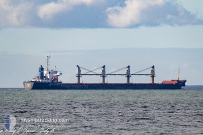
SELIN-M
Bulk Carrier
Current Trip
| Trip Time | 9 days |
|---|---|
| Trip Distance | 1404.93 nm |
| AVG Speed | 10.6 Knots |
| MAX Speed | 10.6 Knots |
| Draught | 9.8 m |
| AVG Wind | 9.8 knots |
| MAX Wind | 23 knots |
| MIN Temp | 14.3°C / 57.74°F |
| MAX Temp | 33.7°C / 92.66°F |
| Position Received | 4 d ago |
Current Position
| Longitude | 32.55132° |
|---|---|
| Latitude | 29.86884° |
| Status | Under way using engine |
| Speed | 10.1 Knots |
| Course | 171.3° |
| Area | Gulf of Suez |
| Station | T-AIS |
| Position Received | 4 d ago |
Info
Information
The current position of SELIN-M is in Gulf of Suez with coordinates 29.86884° / 32.55132° as reported on 2024-05-26 11:52 by AIS to our vessel tracker app. The vessel's current speed is 10.1 Knots and is currently inside the port of SOKHNA.
The vessel SELIN-M (IMO: 9178551, MMSI: 370387000) is a Bulk Carrier that was built in 1998 ( 26 years old ). It's sailing under the flag of [PA] Panama.
In this page you can find informations about the vessels current position, last detected port calls, and current voyage information. If the vessels is not in coverage by AIS you will find the latest position.
The current position of SELIN-M is detected by our AIS receivers and we are not responsible for the reliability of the data. The last position was recorded while the vessel was in Coverage by the Ais receivers of our vessel tracking app.
The current draught of SELIN-M as reported by AIS is 9.8 meters
Weather
| Temperature | 30.8°C / 87.44°F |
|---|---|
| Wind Speed | 8 knots |
| Direction | 335° NNW |
| Pressure | 1012.2 hPa |
| Humidity | 18.2 % |
| Cloud Coverage | 7 % |
Featured Company
Last Port Calls
| Port | Arrival | Departure | Time In Port |
|---|---|---|---|
| 2024-05-27 23:46 | |||
| 2024-05-26 02:13 | 2024-05-26 11:14 | 9 h | |
| 2024-05-11 22:20 | 2024-05-18 11:41 | 6 d | |
| 2024-04-23 22:46 | 2024-04-24 18:03 | 19 h | |
| 2024-03-20 13:15 | 2024-04-15 00:05 | 25 d |
Most Visited Ports (Last year)
| Port | Arrivals | |
|---|---|---|
| 4 | ||
| 2 | ||
| 2 | ||
| 1 | ||
| 1 | ||
| 1 |
Last Trips
| Origin | Departure | Destination | Arrival | Distance | |
|---|---|---|---|---|---|
| 2024-05-18 14:41 | 2024-05-28 01:46 | 1404.93 nm | |||
| 2024-05-18 14:41 | 2024-05-26 04:13 | 1292.22 nm | |||
| 2024-04-15 03:05 | 2024-05-12 01:20 | 2469.41 nm | |||
| 2024-04-15 03:05 | 2024-04-24 00:46 | 883.00 nm |
Events
| Time | Event | Details | Position / Dest | Info |
|---|---|---|---|---|
| 2024-05-28 00:04 | STOP Moving |
29.65333 / 32.35166
[EG] SOKHNA
|
Speed: Course: -1° |
|
| 2024-05-27 23:46 | PORT ARRIVAL |
|
29.64667 / 32.36167
[EG] SOKHNA
|
Speed: 4.9 kn Course: 273° |
| 2024-05-27 23:16 | START Moving | 2.72 nm, East of SOKHNA |
29.64667 / 32.41333
EG AIS
|
Speed: 5 kn Course: 255° |
| 2024-05-27 22:10 | STOP Moving | 2.64 nm, East of SOKHNA |
29.64333 / 32.41167
EG AIS
|
Speed: Course: -1° |
| 2024-05-27 21:35 | START Moving | 4.73 nm, East of SOKHNA |
29.67430 / 32.44586
EG AIS
|
Speed: 4.6 kn Course: 221° |
| 2024-05-26 13:25 | STOP Moving | 5.1 nm, North East of SOKHNA |
29.68248 / 32.44965
EG AIS
|
Speed: 0.2 kn Course: 305° |
| 2024-05-26 11:56 | Status Changed | Default Under way using engine |
29.85897 / 32.55299
EG AIS
|
Speed: 10.1 kn Course: 171.3° |
| 2024-05-26 11:52 | OUT of Coverage |
29.86884 / 32.55132
Gulf of Suez
EG AIS
|
Speed: 10.1 kn Course: 171.3° |
|
| 2024-05-26 11:17 | Change Sea Area | Egyptian part of the Gulf of Suez Egyptian part of the Mediterranean Sea - Eastern Basin |
29.93981 / 32.57206
Gulf of Suez
EG AIS
|
Speed: 8.8 kn Course: 223.8° |
| 2024-05-26 11:14 | PORT DEPARTURE |
|
29.94590 / 32.57759
EG AIS
|
Speed: 8.8 kn Course: 212° |