
SENIOR
Fishing
Current Trip
CH16 FOR INFO
| Time Travelled | 4 days |
|---|---|
| Remaining Time | --- |
| Distance Travelled | 479.75 nm |
| Remaining Distance | --- |
| AVG Speed | 6.8 Knots |
| MAX Speed | 14 Knots |
| AVG Wind | 13.5 knots |
| MAX Wind | 19 knots |
| MIN Temp | 10.8°C / 51.44°F |
| MAX Temp | 12.5°C / 54.5°F |
| Draught | 7.5 m |
| Position Received | 1 m ago |
Current Position
| Longitude | 2.24137° |
|---|---|
| Latitude | 59.97849° |
| Status | Under way using engine |
| Speed | 4.4 Knots |
| Course | 171° |
| Area | North Sea |
| Station | T-AIS |
| Position Received | 1 m ago |
Info
Information
The current position of SENIOR is in North Sea with coordinates 59.97849° / 2.24137° as reported on 2024-06-01 20:34 by AIS to our vessel tracker app. The vessel's current speed is 4.4 Knots
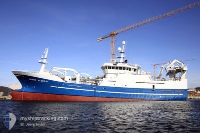
The vessel SENIOR (IMO: 9263710, MMSI: 257687000) is a Fishing It's sailing under the flag of [NO] Norway.
In this page you can find informations about the vessels current position, last detected port calls, and current voyage information. If the vessels is not in coverage by AIS you will find the latest position.
The current position of SENIOR is detected by our AIS receivers and we are not responsible for the reliability of the data. The last position was recorded while the vessel was in Coverage by the Ais receivers of our vessel tracking app.
The current draught of SENIOR as reported by AIS is 7.5 meters
Weather
| Temperature | 11.8°C / 53.24°F |
|---|---|
| Wind Speed | 17 knots |
| Direction | 321° NW |
| Pressure | 1025.3 hPa |
| Humidity | 79.2 % |
| Cloud Coverage | 7 % |
Featured Company
Last Trips
| Origin | Departure | Destination | Arrival | Distance | |
|---|---|---|---|---|---|
| 2024-05-22 06:02 | 2024-05-27 08:47 | 496.44 nm | |||
| 2024-05-15 16:42 | 2024-05-15 19:58 | 33.95 nm | |||
| 2024-05-11 12:19 | 2024-05-12 08:08 | 198.11 nm | |||
| 2024-04-19 16:18 | 2024-04-26 00:23 | 523.14 nm |
Events
| Time | Event | Details | Position / Dest | Info |
|---|---|---|---|---|
| 2024-06-01 05:54 | IN Coverage |
60.35012 / 2.14926
North Sea
|
Speed: 8.9 kn Course: 228.5° |
|
| 2024-06-01 03:56 | OUT of Coverage |
60.46798 / 2.42211
North Sea
|
Speed: 1.1 kn Course: 130.3° |
|
| 2024-06-01 03:56 | IN Coverage |
60.46798 / 2.42211
North Sea
|
Speed: 1.1 kn Course: 130.3° |
|
| 2024-06-01 02:25 | OUT of Coverage |
60.48004 / 2.38312
North Sea
|
Speed: 0.9 kn Course: 111.7° |
|
| 2024-06-01 00:00 | STOP Moving |
60.48909 / 2.35188
CH16 FOR INFO
|
Speed: 0.2 kn Course: 245° |
|
| 2024-05-31 13:46 | IN Coverage |
60.50820 / 2.33620
North Sea
|
Speed: 3.1 kn Course: 208.8° |
|
| 2024-05-31 11:34 | OUT of Coverage |
60.60852 / 2.47361
North Sea
|
Speed: 3.6 kn Course: 204.4° |
|
| 2024-05-31 07:37 | IN Coverage |
60.58070 / 2.31546
North Sea
|
Speed: 8.7 kn Course: 319.5° |
|
| 2024-05-31 05:03 | OUT of Coverage |
60.27970 / 2.16471
North Sea
|
Speed: 8 kn Course: 291.2° |
|
| 2024-05-30 23:16 | IN Coverage |
60.30474 / 2.26593
North Sea
|
Speed: 5.5 kn Course: 351.4° |