
SENIORITY
Oil/Chemical Tanker
Current Trip
| Time Travelled | 12 h, 43 mins |
|---|---|
| Remaining Time | 11 h, 45 mins |
| Distance Travelled | 115.92 nm |
| Remaining Distance | 79.15 nm |
| AVG Speed | 7.7 Knots |
| MAX Speed | 10.9 Knots |
| AVG Wind | 9.7 knots |
| MAX Wind | 12.4 knots |
| MIN Temp | 11.3°C / 52.34°F |
| MAX Temp | 12.8°C / 55.04°F |
| Draught | 6 m |
| Position Received | 1 m ago |
Current Position
| Longitude | -4.82196° |
|---|---|
| Latitude | 53.32880° |
| Status | Under way using engine |
| Speed | 6.5 Knots |
| Course | 18.6° |
| Area | Irish Sea and St. George's Channel |
| Station | T-AIS |
| Position Received | 1 m ago |
Info
Information
The current position of SENIORITY is in Irish Sea and St. George's Channel with coordinates 53.32880° / -4.82196° as reported on 2024-06-02 09:21 by AIS to our vessel tracker app. The vessel's current speed is 6.5 Knots and is heading at the port of EASTHAM. The estimated time of arrival as calculated by vessel tracking app is 2024-06-02 21:07 LT
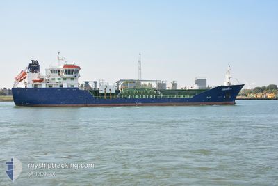
The vessel SENIORITY (IMO: 9285196, MMSI: 235098058) is a Oil/Chemical Tanker that was built in 2006 ( 18 years old ). It's sailing under the flag of [GB] United Kingdom.
In this page you can find informations about the vessels current position, last detected port calls, and current voyage information. If the vessels is not in coverage by AIS you will find the latest position.
The current position of SENIORITY is detected by our AIS receivers and we are not responsible for the reliability of the data. The last position was recorded while the vessel was in Coverage by the Ais receivers of our vessel tracking app.
The current draught of SENIORITY as reported by AIS is 6 meters
Weather
| Temperature | 11.3°C / 52.34°F |
|---|---|
| Wind Speed | 7 knots |
| Direction | 332° NNW |
| Pressure | 1030.6 hPa |
| Humidity | 79 % |
| Cloud Coverage | 26 % |
Featured Company
Last Port Calls
| Port | Arrival | Departure | Time In Port |
|---|---|---|---|
| 2024-06-01 04:20 | 2024-06-01 20:39 | 16 h | |
| 2024-05-28 11:07 | 2024-05-29 01:17 | 14 h | |
| 2024-05-26 03:18 | 2024-05-27 03:39 | 1 d | |
| 2024-05-23 13:29 | 2024-05-24 13:42 | 1 d | |
| 2024-05-20 17:03 | 2024-05-22 08:55 | 1 d | |
| 2024-05-17 05:17 | 2024-05-18 10:46 | 1 d | |
| 2024-05-14 05:11 | 2024-05-14 23:57 | 18 h | |
| 2024-05-08 18:15 | 2024-05-09 23:19 | 1 d | |
| 2024-05-05 12:02 | 2024-05-06 22:34 | 1 d | |
| 2024-04-27 11:07 | 2024-04-28 04:49 | 17 h |
Last Trips
| Origin | Departure | Destination | Arrival | Distance | |
|---|---|---|---|---|---|
| 2024-05-29 02:17 | 2024-06-01 05:20 | 640.55 nm | |||
| 2024-05-27 04:39 | 2024-05-28 12:07 | 282.70 nm | |||
| 2024-05-24 14:42 | 2024-05-26 04:18 | 49.70 nm | |||
| 2024-05-22 10:55 | 2024-05-23 14:29 | 207.91 nm | |||
| 2024-05-18 12:46 | 2024-05-20 19:03 | 486.55 nm | |||
| 2024-05-15 01:57 | 2024-05-17 07:17 | 509.59 nm | |||
| 2024-05-10 01:19 | 2024-05-14 07:11 | 214.01 nm | |||
| 2024-05-06 23:34 | 2024-05-08 20:15 | 412.22 nm | |||
| 2024-04-28 05:49 | 2024-05-05 13:02 | 159.58 nm | |||
| 2024-04-24 06:00 | 2024-04-27 12:07 | 115.39 nm |
Events
| Time | Event | Details | Position / Dest | Info |
|---|---|---|---|---|
| 2024-06-02 08:00 | Status Changed | Under way using engine Default |
53.17582 / -4.89214
EASTHAM
|
Speed: 8 kn Course: 16° |
| 2024-06-02 08:00 | IN Coverage |
53.17582 / -4.89214
Irish Sea and St. George's Channel
EASTHAM
|
Speed: 7.9 kn Course: 15.2° |
|
| 2024-06-02 06:44 | Status Changed | Default Under way using engine |
52.99731 / -4.97427
EASTHAM
|
Speed: 9.7 kn Course: 16.4° |
| 2024-06-02 06:36 | OUT of Coverage |
52.97544 / -4.98414
Irish Sea and St. George's Channel
EASTHAM
|
Speed: 9.7 kn Course: 16.4° |
|
| 2024-06-02 06:36 | Status Changed | Under way using engine Default |
52.97498 / -4.98445
EASTHAM
|
Speed: 9.9 kn Course: 14° |
| 2024-06-02 06:32 | Status Changed | Default Under way using engine |
52.96578 / -4.98864
EASTHAM
|
Speed: 9.9 kn Course: 15.2° |
| 2024-06-02 06:29 | Status Changed | Under way using engine Default |
52.95794 / -4.99215
EASTHAM
|
Speed: 9.7 kn Course: 15° |
| 2024-06-02 06:28 | Status Changed | Default Under way using engine |
52.95448 / -4.99379
EASTHAM
|
Speed: 10.2 kn Course: 15.3° |
| 2024-06-02 06:19 | Status Changed | Under way using engine Default |
52.93136 / -5.00427
EASTHAM
|
Speed: 10.3 kn Course: 16° |
| 2024-06-02 05:54 | Status Changed | Default Under way using engine |
52.86113 / -5.03658
EASTHAM
|
Speed: 10.6 kn Course: 16.2° |