
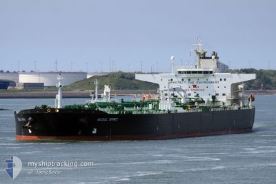
SEOUL SPIRIT
Crude Oil Tanker
Current Trip
| Trip Time | 80 days |
|---|---|
| Trip Distance | 6025.14 nm |
| AVG Speed | 11.4 Knots |
| MAX Speed | 15.7 Knots |
| Draught | 13.5 m |
| AVG Wind | 11.5 knots |
| MAX Wind | 22.4 knots |
| MIN Temp | 21.3°C / 70.34°F |
| MAX Temp | 34.3°C / 93.74°F |
| Position Received | 1 d ago |
Current Position
| Longitude | -90.23810° |
|---|---|
| Latitude | 29.96478° |
| Status | Under way using engine |
| Speed | 8.6 Knots |
| Course | 309° |
| Area | Gulf of Mexico |
| Station | T-AIS |
| Position Received | 1 d ago |
Info
Information
The current position of SEOUL SPIRIT is in Gulf of Mexico with coordinates 29.96478° / -90.23810° as reported on 2024-06-01 09:39 by AIS to our vessel tracker app. The vessel's current speed is 8.6 Knots and is currently inside the port of GOOD HOPE.
The vessel SEOUL SPIRIT (IMO: 9248409, MMSI: 311000452) is a Crude Oil Tanker that was built in 2005 ( 19 years old ). It's sailing under the flag of [BS] Bahamas.
In this page you can find informations about the vessels current position, last detected port calls, and current voyage information. If the vessels is not in coverage by AIS you will find the latest position.
The current position of SEOUL SPIRIT is detected by our AIS receivers and we are not responsible for the reliability of the data. The last position was recorded while the vessel was in Coverage by the Ais receivers of our vessel tracking app.
The current draught of SEOUL SPIRIT as reported by AIS is 13.5 meters
Weather
| Temperature | 22°C / 71.6°F |
|---|---|
| Wind Speed | 2 knots |
| Direction | 112° ESE |
| Pressure | 1015.6 hPa |
| Humidity | 94.9 % |
| Cloud Coverage | 81 % |
Featured Company
Most Visited Ports (Last year)
| Port | Arrivals | |
|---|---|---|
| 4 | ||
| 1 | ||
| 1 | ||
| 1 | ||
| 1 | ||
| 1 |
Last Trips
| Origin | Departure | Destination | Arrival | Distance | |
|---|---|---|---|---|---|
| 2024-03-13 09:10 | 2024-06-01 06:07 | 6025.14 nm |
Events
| Time | Event | Details | Position / Dest | Info |
|---|---|---|---|---|
| 2024-06-01 11:28 | STOP Moving |
29.98258 / -90.39647
[US] GOOD HOPE
|
Speed: 0.1 kn Course: 335° |
|
| 2024-06-01 11:07 | PORT ARRIVAL |
|
29.98258 / -90.39647
[US] GOOD HOPE
|
Speed: 7 kn Course: 3° |
| 2024-06-01 09:44 | Status Changed | Default Under way using engine |
29.96862 / -90.24812
ST CHARLES
|
Speed: 8.6 kn Course: 309° |
| 2024-06-01 09:39 | Status Changed | Under way using engine Default |
29.96478 / -90.23810
ST CHARLES
|
Speed: 8.2 kn Course: 308° |
| 2024-06-01 09:39 | OUT of Coverage |
29.96478 / -90.23810
Gulf of Mexico
|
Speed: 8.6 kn Course: 309° |
|
| 2024-06-01 09:36 | Status Changed | Default Under way using engine |
29.96008 / -90.23195
ST CHARLES
|
Speed: 8.5 kn Course: 339° |
| 2024-06-01 09:18 | Status Changed | Under way using engine Default |
29.92650 / -90.21347
ST CHARLES
|
Speed: 8.4 kn Course: 289° |
| 2024-06-01 09:00 | Status Changed | Default Under way using engine |
29.93797 / -90.17523
ST CHARLES
|
Speed: 7.8 kn Course: 226° |
| 2024-06-01 08:35 | Status Changed | Under way using engine Default |
29.93880 / -90.13803
ST CHARLES
|
Speed: 8.8 kn Course: 1° |
| 2024-06-01 08:32 | Status Changed | Default Under way using engine |
29.93270 / -90.13817
ST CHARLES
|
Speed: 8.9 kn Course: 330° |