
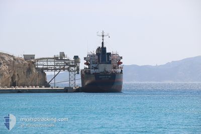
SEREF KURU
Cargo
Current Trip
| Time Travelled | 1 day |
|---|---|
| Remaining Time | --- |
| Distance Travelled | 24.69 nm |
| Remaining Distance | 64.49 nm |
| AVG Speed | 7.2 Knots |
| MAX Speed | 12.8 Knots |
| AVG Wind | 8.3 knots |
| MAX Wind | 11.9 knots |
| MIN Temp | 9.3°C / 48.74°F |
| MAX Temp | 18.7°C / 65.66°F |
| Draught | 5.3 m |
| Position Received | 3 m ago |
Current Position
| Longitude | 29.18566° |
|---|---|
| Latitude | 40.87987° |
| Status | Moored |
| Speed | |
| Course | 78° |
| Area | Sea of Marmara |
| Station | T-AIS |
| Position Received | 3 m ago |
Info
Information
The current position of SEREF KURU is in Sea of Marmara with coordinates 40.87987° / 29.18566° as reported on 2024-05-16 18:30 by AIS to our vessel tracker app. The vessel's current speed is 0 Knots and is heading at the port of BANDIRMA. The estimated time of arrival as calculated by vessel tracking app is 2024-05-17 08:00 LT
The vessel SEREF KURU (IMO: 860611100, MMSI: 352001957) is a Cargo It's sailing under the flag of [PA] Panama.
In this page you can find informations about the vessels current position, last detected port calls, and current voyage information. If the vessels is not in coverage by AIS you will find the latest position.
The current position of SEREF KURU is detected by our AIS receivers and we are not responsible for the reliability of the data. The last position was recorded while the vessel was in Coverage by the Ais receivers of our vessel tracking app.
The current draught of SEREF KURU as reported by AIS is 5.3 meters
Weather
| Temperature | 10.9°C / 51.62°F |
|---|---|
| Wind Speed | 7 knots |
| Direction | 65° ENE |
| Pressure | 1022.4 hPa |
| Humidity | 69.6 % |
| Cloud Coverage | 88 % |
Featured Company
Last Port Calls
| Port | Arrival | Departure | Time In Port |
|---|---|---|---|
| 2024-05-12 13:00 | 2024-05-15 08:17 | 2 d | |
| 2024-05-07 13:44 | 2024-05-09 07:21 | 1 d | |
| 2024-04-20 10:41 | 2024-04-25 17:45 | 5 d | |
| 2024-04-09 03:54 | 2024-04-12 17:58 | 3 d | |
| 2024-03-25 10:20 | 2024-03-31 10:48 | 6 d | |
| 2024-03-18 07:07 | 2024-03-20 13:04 | 2 d | |
| 2024-03-04 05:16 | 2024-03-09 15:48 | 5 d |
Most Visited Ports (Last year)
| Port | Arrivals | |
|---|---|---|
| 4 | ||
| 3 | ||
| 2 | ||
| 2 | ||
| 2 | ||
| 1 |
Last Trips
| Origin | Departure | Destination | Arrival | Distance | |
|---|---|---|---|---|---|
| 2024-05-09 10:21 | 2024-05-12 16:00 | 862.04 nm | |||
| 2024-04-25 19:45 | 2024-05-07 16:44 | 3039.59 nm | |||
| 2024-04-12 19:58 | 2024-04-20 12:41 | 292.14 nm | |||
| 2024-03-31 12:48 | 2024-04-09 05:54 | 2080.96 nm | |||
| 2024-03-20 16:04 | 2024-03-25 12:20 | 1073.94 nm | |||
| 2024-03-09 16:48 | 2024-03-18 10:07 | 1551.32 nm |
Events
| Time | Event | Details | Position / Dest | Info |
|---|---|---|---|---|
| 2024-05-16 17:30 | Status Changed | Moored Default |
40.87949 / 29.18594
TR BDM
|
Speed: 0.2 kn Course: 81° |
| 2024-05-16 17:24 | Status Changed | Default Moored |
40.87976 / 29.18584
TR BDM
|
Speed: 0.2 kn Course: 81° |
| 2024-05-16 15:06 | Status Changed | Moored Default |
40.87907 / 29.18697
TR BDM
|
Speed: 0.3 kn Course: 37° |
| 2024-05-16 15:00 | Status Changed | Default Moored |
40.87916 / 29.18672
TR BDM
|
Speed: 0.3 kn Course: 37° |
| 2024-05-16 14:30 | Status Changed | Moored Default |
40.87915 / 29.18674
TR BDM
|
Speed: Course: 39° |
| 2024-05-16 14:27 | Status Changed | Default Moored |
40.87917 / 29.18667
TR BDM
|
Speed: Course: 38° |
| 2024-05-16 14:18 | Status Changed | Moored Default |
40.87911 / 29.18678
TR BDM
|
Speed: 0.1 kn Course: 4° |
| 2024-05-16 14:15 | Status Changed | Default Moored |
40.87915 / 29.18703
TR BDM
|
Speed: 0.1 kn Course: 1° |
| 2024-05-16 13:42 | Status Changed | Moored Default |
40.87905 / 29.18786
TR BDM
|
Speed: 0.3 kn Course: 330° |
| 2024-05-16 13:39 | Status Changed | Default Moored |
40.87911 / 29.18812
TR BDM
|
Speed: 0.4 kn Course: 318° |