
SERIFOS
Cargo
Current Trip
| Trip Time | 2 days |
|---|---|
| Trip Distance | 639.83 nm |
| AVG Speed | 10.5 Knots |
| MAX Speed | 14.6 Knots |
| Draught | 9.6 m |
| AVG Wind | 7.3 knots |
| MAX Wind | 21 knots |
| MIN Temp | 11°C / 51.8°F |
| MAX Temp | 22.2°C / 71.96°F |
| Position Received | 4 d ago |
Current Position
| Longitude | -58.18725° |
|---|---|
| Latitude | -38.60850° |
| Status | Under way using engine |
| Speed | 11.6 Knots |
| Course | 270.6° |
| Area | South Atlantic Ocean |
| Station | T-AIS |
| Position Received | 4 d ago |
Info
Information
The current position of SERIFOS is in South Atlantic Ocean with coordinates -38.60850° / -58.18725° as reported on 2024-06-18 13:38 by AIS to our vessel tracker app. The vessel's current speed is 11.6 Knots and is currently inside the port of NECOCHEA.
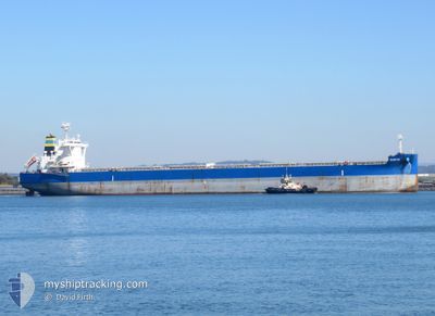
The vessel SERIFOS (IMO: 9710141, MMSI: 538010435) is a Cargo It's sailing under the flag of [MH] Marshall Is.
In this page you can find informations about the vessels current position, last detected port calls, and current voyage information. If the vessels is not in coverage by AIS you will find the latest position.
The current position of SERIFOS is detected by our AIS receivers and we are not responsible for the reliability of the data. The last position was recorded while the vessel was in Coverage by the Ais receivers of our vessel tracking app.
The current draught of SERIFOS as reported by AIS is 9.6 meters
Weather
| Temperature | 10.4°C / 50.72°F |
|---|---|
| Wind Speed | 12 knots |
| Direction | 227° SW |
| Pressure | 1010.9 hPa |
| Humidity | 80.4 % |
| Cloud Coverage | 100 % |
Featured Company
Events
| Time | Event | Details | Position / Dest | Info |
|---|---|---|---|---|
| 2024-06-18 17:17 | STOP Moving |
-38.57491 / -58.70897
[AR] NECOCHEA
|
Speed: 0.2 kn Course: 120° |
|
| 2024-06-18 17:01 | PORT ARRIVAL |
|
-38.57667 / -58.70334
[AR] NECOCHEA
|
Speed: 1.1 kn Course: 81° |
| 2024-06-18 16:15 | START Moving | 3.06 nm, South East of NECOCHEA |
-38.59673 / -58.65314
AR NEC
|
Speed: 3.2 kn Course: 280° |
| 2024-06-18 16:01 | STOP Moving | 3.37 nm, South East of NECOCHEA |
-38.59833 / -58.64667
AR NEC
|
Speed: Course: -1° |
| 2024-06-18 13:42 | Status Changed | Default Under way using engine |
-38.60831 / -58.20385
AR NEC
|
Speed: 11.6 kn Course: 270.6° |
| 2024-06-18 13:38 | Status Changed | Under way using engine Default |
-38.60850 / -58.18725
AR NEC
|
Speed: 11.6 kn Course: 272° |
| 2024-06-18 13:38 | OUT of Coverage |
-38.60850 / -58.18725
South Atlantic Ocean
AR NEC
|
Speed: 11.6 kn Course: 270.6° |
|
| 2024-06-18 13:33 | Status Changed | Default Under way using engine |
-38.60880 / -58.16460
AR NEC
|
Speed: 11.5 kn Course: 270.7° |
| 2024-06-18 13:15 | Status Changed | Under way using engine Default |
-38.60965 / -58.09140
AR NEC
|
Speed: 11.5 kn Course: 270° |
| 2024-06-18 13:14 | Status Changed | Default Under way using engine |
-38.60968 / -58.08585
AR NEC
|
Speed: 11.5 kn Course: 270.1° |