
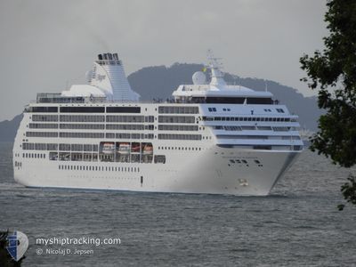
SEVEN SEAS MARINER
Passengers Ship
Current Trip
| Trip Time | 8 days |
|---|---|
| Trip Distance | 3192.75 nm |
| AVG Speed | 15.7 Knots |
| MAX Speed | 20 Knots |
| Draught | 7 m |
| AVG Wind | 11.7 knots |
| MAX Wind | 23.3 knots |
| MIN Temp | 14°C / 57.2°F |
| MAX Temp | 24.5°C / 76.1°F |
| Position Received | 3 m ago |
Current Position
| Longitude | -73.99766° |
|---|---|
| Latitude | 40.76755° |
| Status | Moored |
| Speed | |
| Course | 120° |
| Area | North Atlantic Ocean |
| Station | T-AIS |
| Position Received | 3 m ago |
Info
Information
The current position of SEVEN SEAS MARINER is in North Atlantic Ocean with coordinates 40.76755° / -73.99766° as reported on 2024-06-01 22:23 by AIS to our vessel tracker app. The vessel's current speed is 0 Knots and is currently inside the port of NEW YORK.
The vessel SEVEN SEAS MARINER (IMO: 9210139, MMSI: 311622000) is a Passengers Ship that was built in 2001 ( 23 years old ). It's sailing under the flag of [BS] Bahamas.
In this page you can find informations about the vessels current position, last detected port calls, and current voyage information. If the vessels is not in coverage by AIS you will find the latest position.
The current position of SEVEN SEAS MARINER is detected by our AIS receivers and we are not responsible for the reliability of the data. The last position was recorded while the vessel was in Coverage by the Ais receivers of our vessel tracking app.
The current draught of SEVEN SEAS MARINER as reported by AIS is 7 meters
Weather
| Temperature | 28.9°C / 84.02°F |
|---|---|
| Wind Speed | 7 knots |
| Direction | 328° NNW |
| Pressure | 1017.5 hPa |
| Humidity | 24.1 % |
| Cloud Coverage | 5 % |
Featured Company
Last Port Calls
| Port | Arrival | Departure | Time In Port |
|---|---|---|---|
| 2024-06-01 13:20 | |||
| 2024-05-23 06:10 | 2024-05-23 16:54 | 10 h | |
| 2024-05-21 05:55 | 2024-05-21 17:50 | 11 h | |
| 2024-05-21 05:24 | 2024-05-21 05:29 | 4 m | |
| 2024-05-18 07:22 | 2024-05-18 17:46 | 10 h | |
| 2024-05-17 06:07 | 2024-05-17 15:08 | 9 h | |
| 2024-05-12 11:02 | 2024-05-12 20:14 | 9 h | |
| 2024-05-09 07:18 | 2024-05-09 16:46 | 9 h | |
| 2024-05-08 08:38 | 2024-05-08 19:06 | 10 h | |
| 2024-05-07 06:20 | 2024-05-07 15:04 | 8 h |
Most Visited Ports (Last year)
| Port | Arrivals | |
|---|---|---|
| 5 | ||
| 4 | ||
| 4 | ||
| 4 | ||
| 4 | ||
| 4 |
Last Trips
| Origin | Departure | Destination | Arrival | Distance | |
|---|---|---|---|---|---|
| 2024-05-23 17:54 | 2024-06-01 09:20 | 3192.75 nm | |||
| 2024-05-21 18:50 | 2024-05-23 07:10 | 529.75 nm | |||
| 2024-05-21 06:29 | 2024-05-21 06:55 | 0.76 nm | |||
| 2024-05-18 18:46 | 2024-05-21 06:24 | 677.50 nm | |||
| 2024-05-17 16:08 | 2024-05-18 08:22 | 243.01 nm | |||
| 2024-05-12 20:14 | 2024-05-17 07:07 | 1291.63 nm | |||
| 2024-05-09 16:46 | 2024-05-12 11:02 | 1175.94 nm | |||
| 2024-05-08 19:06 | 2024-05-09 07:18 | 177.16 nm | |||
| 2024-05-07 16:04 | 2024-05-08 08:38 | 275.16 nm | |||
| 2024-05-03 17:24 | 2024-05-07 07:20 | 1115.88 nm |
Events
| Time | Event | Details | Position / Dest | Info |
|---|---|---|---|---|
| 2024-06-01 14:47 | Status Changed | Moored Under way using engine |
40.76768 / -73.99776
[US] NEW YORK
|
Speed: 0.3 kn Course: 120° |
| 2024-06-01 14:45 | STOP Moving |
40.76783 / -73.99786
[US] NEW YORK
|
Speed: 0.3 kn Course: 120° |
|
| 2024-06-01 13:20 | PORT ARRIVAL |
|
40.57921 / -74.03576
[US] NEW YORK
|
Speed: 13.4 kn Course: 350.7° |
| 2024-06-01 06:28 | Destination Changed | NEW YORK HAMILTON |
39.33082 / -72.90778
NEW YORK
|
Speed: 15.6 kn Course: 338.3° |
| 2024-06-01 06:28 | ETA Changed | 2024/06/01 12:00 |
39.33082 / -72.90778
NEW YORK
|
Speed: 15.6 kn Course: 338.3° |
| 2024-06-01 06:01 | Change Sea Area | United States part of the North Atlantic Ocean Bermudian part of the North Atlantic Ocean |
39.24113 / -72.81931
North Atlantic Ocean
|
Speed: 17.8 kn Course: 313.7° |
| 2024-06-01 06:00 | Status Changed | Under way using engine Default |
39.23844 / -72.81573
HAMILTON
|
Speed: 17.8 kn Course: 314° |
| 2024-06-01 06:00 | IN Coverage |
39.24113 / -72.81931
North Atlantic Ocean
|
Speed: 17.8 kn Course: 313.7° |
|
| 2024-05-30 21:55 | Status Changed | Default Under way using engine |
32.73333 / -64.64167
HAMILTON
|
Speed: 18.1 kn Course: 316.8° |
| 2024-05-30 21:43 | OUT of Coverage |
32.69122 / -64.59558
North Atlantic Ocean
|
Speed: 18.1 kn Course: 316.8° |