
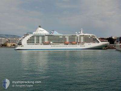
SEVEN SEAS VOYAGER
Passengers Ship
Current Trip
| Trip Time | 1 day |
|---|---|
| Trip Distance | 439.01 nm |
| AVG Speed | 15.2 Knots |
| MAX Speed | 16.8 Knots |
| Draught | 7 m |
| AVG Wind | 7.1 knots |
| MAX Wind | 14.1 knots |
| MIN Temp | 10.3°C / 50.54°F |
| MAX Temp | 19.3°C / 66.74°F |
| Position Received | 2 m ago |
Current Position
| Longitude | 28.98767° |
|---|---|
| Latitude | 41.02750° |
| Status | Moored |
| Speed | |
| Course | 59° |
| Area | Sea of Marmara |
| Station | T-AIS |
| Position Received | 2 m ago |
Info
Information
The current position of SEVEN SEAS VOYAGER is in Sea of Marmara with coordinates 41.02750° / 28.98767° as reported on 2024-05-17 09:57 by AIS to our vessel tracker app. The vessel's current speed is 0 Knots and is currently inside the port of ISTANBUL.
The vessel SEVEN SEAS VOYAGER (IMO: 9247144, MMSI: 311513000) is a Passengers Ship that was built in 2003 ( 21 years old ). It's sailing under the flag of [BS] Bahamas.
In this page you can find informations about the vessels current position, last detected port calls, and current voyage information. If the vessels is not in coverage by AIS you will find the latest position.
The current position of SEVEN SEAS VOYAGER is detected by our AIS receivers and we are not responsible for the reliability of the data. The last position was recorded while the vessel was in Coverage by the Ais receivers of our vessel tracking app.
The current draught of SEVEN SEAS VOYAGER as reported by AIS is 7 meters
Weather
| Temperature | 19.6°C / 67.28°F |
|---|---|
| Wind Speed | 9 knots |
| Direction | 79° E |
| Pressure | 1018.4 hPa |
| Humidity | 48.2 % |
| Cloud Coverage | 95 % |
Featured Company
Last Port Calls
| Port | Arrival | Departure | Time In Port |
|---|---|---|---|
| 2024-05-17 05:24 | |||
| 2024-05-15 00:36 | 2024-05-15 15:34 | 14 h | |
| 2024-05-13 08:12 | 2024-05-13 18:51 | 10 h | |
| 2024-05-12 03:44 | 2024-05-12 12:20 | 8 h | |
| 2024-05-11 05:32 | 2024-05-11 15:13 | 9 h | |
| 2024-05-10 08:34 | 2024-05-10 18:17 | 9 h | |
| 2024-05-07 12:25 | 2024-05-09 10:56 | 1 d | |
| 2024-05-06 03:37 | 2024-05-06 11:48 | 8 h | |
| 2024-05-05 05:53 | 2024-05-05 14:04 | 8 h | |
| 2024-05-02 04:28 | 2024-05-02 17:16 | 12 h |
Last Trips
| Origin | Departure | Destination | Arrival | Distance | |
|---|---|---|---|---|---|
| 2024-05-15 18:34 | 2024-05-17 08:24 | 439.01 nm | |||
| 2024-05-13 21:51 | 2024-05-15 03:36 | 178.14 nm | |||
| 2024-05-12 15:20 | 2024-05-13 11:12 | 308.58 nm | |||
| 2024-05-11 18:13 | 2024-05-12 06:44 | 179.25 nm | |||
| 2024-05-10 21:17 | 2024-05-11 08:32 | 150.64 nm | |||
| 2024-05-09 13:56 | 2024-05-10 11:34 | 341.04 nm | |||
| 2024-05-06 14:48 | 2024-05-07 15:25 | 344.75 nm | |||
| 2024-05-05 17:04 | 2024-05-06 06:37 | 184.95 nm | |||
| 2024-05-02 19:16 | 2024-05-05 08:53 | 870.20 nm | |||
| 2024-05-01 21:15 | 2024-05-02 06:28 | 87.54 nm |
Events
| Time | Event | Details | Position / Dest | Info |
|---|---|---|---|---|
| 2024-05-17 06:04 | Status Changed | Moored Under way using engine |
41.02750 / 28.98769
[TR] ISTANBUL
|
Speed: Course: 59° |
| 2024-05-17 05:42 | STOP Moving |
41.02702 / 28.98785
[TR] ISTANBUL
|
Speed: 0.1 kn Course: 24° |
|
| 2024-05-17 05:24 | PORT ARRIVAL |
|
41.00560 / 28.99618
[TR] ISTANBUL
|
Speed: 10.1 kn Course: 1.7° |
| 2024-05-16 22:41 | Status Changed | Under way using engine Default |
40.52602 / 27.03912
TR IST
|
Speed: 16 kn Course: 65° |
| 2024-05-16 22:34 | IN Coverage |
40.53013 / 27.05055
Sea of Marmara
TR IST
|
Speed: 15.6 kn Course: 64.5° |
|
| 2024-05-16 21:22 | Status Changed | Default Under way using engine |
40.37515 / 26.67813
TR IST
|
Speed: 15.7 kn Course: 40.8° |
| 2024-05-16 21:14 | OUT of Coverage |
40.34841 / 26.65063
Sea of Marmara
TR IST
|
Speed: 15.7 kn Course: 40.8° |
|
| 2024-05-16 19:13 | Change Sea Area | Turkish part of the Sea of Marmara Turkish part of the Aegean Sea |
40.02029 / 26.19291
Sea of Marmara
TR IST
|
Speed: 5.1 kn Course: 76.7° |
| 2024-05-16 18:56 | Status Changed | Under way using engine Default |
40.00867 / 26.12175
TR IST
|
Speed: 16 kn Course: 67° |
| 2024-05-16 18:51 | Status Changed | Default Under way using engine |
40.00167 / 26.09833
TR IST
|
Speed: 14.8 kn Course: 72.8° |