
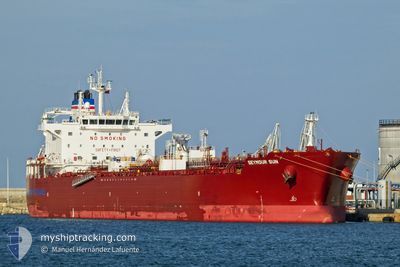
SEYMOUR SUN
Tanker
Aktuelle Reise
| Bisherige Reisezeit | 9 Tage |
|---|---|
| Verbleibende Reisezeit | 2 Tage |
| Zurückgelegte Distanz | 2637.92 nm |
| Verbleibende Distanz | 886.44 nm |
| Durchschnittliche Geschwindigkeit | 12.1 Knoten |
| Maximale Geschwindigkeit | 16.7 Knoten |
| Durchschnittliche Windgeschwindigkeit | 17 Knoten |
| Maximale Windgeschwindigkeit | 34.3 Knoten |
| Minimale Temperatur | 12.1°C / 53.78°F |
| Maximale Temperatur | 19.5°C / 67.1°F |
| Tiefgang | 10.4 m |
| Position erhalten | 7 d alt |
Aktuelle Position
| Länge | --- |
|---|---|
| Breite | --- |
| Zustand | Under way using engine |
| Geschwindigkeit | 13.6 Knoten |
| Kurs | 255° |
| Gebiet | English Channel |
| Station | T-AIS |
| Position erhalten | 7 d alt |
Schiffsdetails
Information
Die SEYMOUR SUN befindet sich derzeit in English Channel mit den Koordinaten 49.69235° / -4.57589°, Diese Position wurde am 2024-09-20 02:11 von unserer Schiffsverfolgungs-App über AIS erfasst. Das Schiff fährt momentan mit einer Geschwindigkeit von 13.6 Knoten und fahrt in den Hafen von MONTREAL. Die geschatzte Ankunftszeit, berechnet von der -App zur Schiffsverfolgung, ist 2024-09-29 22:05 LT
Das Schiff SEYMOUR SUN (IMO: 9911501, MMSI: 563145200) ist Tanker und fährt unter der Flagge von [SG] Singapore.
Auf dieser Seite erhalten Sie Informationen zur aktuellen Position des Schiffes, zu den letzten bekannten Hafenanläufen und zu den aktuellen Reiseinformationen. Sollte das Schiff nicht durch AIS abgedeckt sein, wird die zuletzt erfasste Position angezeigt.
Die SEYMOUR SUN wird durch unsere AIS-Empfänger ermittelt. Wir übernehmen keine Gewähr für die Richtigkeit der Daten. Die letzte Position wurde von unseren AIS-Empfängern aufgezeichnet, während das Schiff in Reichweite war.
Der aktuelle Entwurf von SEYMOUR SUN, wie von AIS gemeldet, betragt 10.4 meter
Wetter
| Temperatur | 13.6°C / 56.48°F |
|---|---|
| Windgeschwindigkeit | 20 Knoten |
| Windrichtung | 123° ESE |
| Luftdruck | 1017.3 hPa |
| Luftfeuchtigkeit | 89.5 % |
| Wolken | 100 % |
Featured Company
Letzte Hafenanläufe
| Hafen | Ankunft | Abfahrt | Time In Port |
|---|---|---|---|
| 2024-09-15 15:46 | 2024-09-18 19:20 | 3 d | |
| 2024-09-11 15:02 | 2024-09-13 06:12 | 1 d | |
| 2024-09-06 14:49 | 2024-09-08 10:51 | 1 d | |
| 2024-08-18 22:31 | 2024-08-20 07:05 | 1 d | |
| 2024-08-08 17:40 | 2024-08-09 19:23 | 1 d | |
| 2024-07-26 23:57 | 2024-07-29 15:57 | 2 d | |
| 2024-07-23 16:30 | 2024-07-23 18:03 | 1 h | |
| 2024-07-22 14:42 | 2024-07-22 16:50 | 2 h | |
| 2024-07-19 03:58 | 2024-07-21 03:39 | 1 d | |
| 2024-07-04 00:55 | 2024-07-05 09:32 | 1 d |
Letzte Reisen
| Herkunft | Abfahrt | Ziel | Ankunft | Distanz | |
|---|---|---|---|---|---|
| 2024-09-13 08:12 | 2024-09-15 17:46 | 267.82 nm | |||
| 2024-09-08 12:51 | 2024-09-11 17:02 | 244.00 nm | |||
| 2024-08-20 03:05 | 2024-09-06 16:49 | 4120.31 nm | |||
| 2024-08-09 15:23 | 2024-08-18 18:31 | 2103.02 nm | |||
| 2024-07-29 16:57 | 2024-08-08 13:40 | 2940.95 nm | |||
| 2024-07-23 20:03 | 2024-07-27 00:57 | 503.04 nm | |||
| 2024-07-22 18:50 | 2024-07-23 18:30 | 2.94 nm | |||
| 2024-07-21 05:39 | 2024-07-22 16:42 | 330.97 nm | |||
| 2024-07-05 05:32 | 2024-07-19 05:58 | 4074.57 nm | |||
| 2024-06-14 15:40 | 2024-07-03 20:55 | 3651.84 nm |
Events
| Zeit | Ereignis | Details | Position / Ziel | Information |
|---|---|---|---|---|
| 2024-09-20 02:19 | geänderter Status | Default Under way using engine |
49.68438 / -4.62227
CA MTR
|
Geschwindigkeit: 13.6 kn Kurs: 255° |
| 2024-09-20 02:11 | außerhalb Abdeckung |
49.69235 / -4.57589
English Channel
CA MTR
|
Geschwindigkeit: 13.6 kn Kurs: 255° |
|
| 2024-09-19 22:01 | geänderter Status | Under way using engine Default |
49.94800 / -3.13570
CA MTR
|
Geschwindigkeit: 11.7 kn Kurs: 255° |
| 2024-09-19 21:59 | geänderter Status | Default Under way using engine |
49.94930 / -3.12763
CA MTR
|
Geschwindigkeit: 11.5 kn Kurs: 256.9° |
| 2024-09-19 21:47 | geänderter Status | Under way using engine Default |
49.95889 / -3.07234
CA MTR
|
Geschwindigkeit: 11.3 kn Kurs: 253° |
| 2024-09-19 21:47 | geänderter Status | Default Under way using engine |
49.95932 / -3.07006
CA MTR
|
Geschwindigkeit: 11.1 kn Kurs: 249.9° |
| 2024-09-19 21:41 | Ändere Seegebiet | United Kingdom part of the English Channel Guernsey part of the English Channel |
49.96486 / -3.04149
English Channel
CA MTR
|
Geschwindigkeit: 11.1 kn Kurs: 249.9° |
| 2024-09-19 21:38 | geänderter Status | Under way using engine Default |
49.96769 / -3.02867
CA MTR
|
Geschwindigkeit: 11.1 kn Kurs: 252° |
| 2024-09-19 20:59 | geänderter Status | Default Under way using engine |
49.99956 / -2.85706
CA MTR
|
Geschwindigkeit: 10 kn Kurs: 255.4° |
| 2024-09-19 20:53 | geänderter Status | Under way using engine Default |
50.00418 / -2.83251
CA MTR
|
Geschwindigkeit: 10 kn Kurs: 255° |