
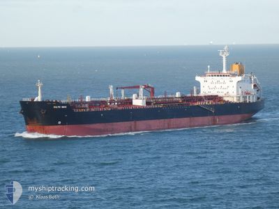
SEZAR
Oil/Chemical Tanker
Current Trip
MARMARA ERIGLISI
| Time Travelled | 42 days |
|---|---|
| Remaining Time | --- |
| Distance Travelled | 9099.64 nm |
| Remaining Distance | --- |
| AVG Speed | 10.4 Knots |
| MAX Speed | 17.1 Knots |
| AVG Wind | 8.2 knots |
| MAX Wind | 20.8 knots |
| MIN Temp | 3.8°C / 38.84°F |
| MAX Temp | 19.8°C / 67.64°F |
| Draught | 11.1 m |
| Position Received | 3 h, 36 m ago |
Current Position
| Longitude | 25.95711° |
|---|---|
| Latitude | 39.79933° |
| Status | Under way using engine |
| Speed | 0.5 Knots |
| Course | 107° |
| Area | Aegean Sea |
| Station | T-AIS |
| Position Received | 3 h, 36 m ago |
Info
Information
The current position of SEZAR is in Aegean Sea with coordinates 39.79933° / 25.95711° as reported on 2024-05-17 04:21 by AIS to our vessel tracker app. The vessel's current speed is 0.5 Knots
The vessel SEZAR (IMO: 9259991, MMSI: 352003749) is a Oil/Chemical Tanker that was built in 2003 ( 21 years old ). It's sailing under the flag of [PA] Panama.
In this page you can find informations about the vessels current position, last detected port calls, and current voyage information. If the vessels is not in coverage by AIS you will find the latest position.
The current position of SEZAR is detected by our AIS receivers and we are not responsible for the reliability of the data. The last position was recorded while the vessel was in Coverage by the Ais receivers of our vessel tracking app.
The current draught of SEZAR as reported by AIS is 11.1 meters
Weather
| Temperature | 16.1°C / 60.98°F |
|---|---|
| Wind Speed | 7 knots |
| Direction | 55° NE |
| Pressure | 1016.4 hPa |
| Humidity | 74.6 % |
| Cloud Coverage | 100 % |
Featured Company
Most Visited Ports (Last year)
| Port | Arrivals | |
|---|---|---|
| 1 |
Last Trips
| Origin | Departure | Destination | Arrival | Distance |
|---|
Events
| Time | Event | Details | Position / Dest | Info |
|---|---|---|---|---|
| 2024-05-17 04:21 | OUT of Coverage |
39.79933 / 25.95711
Aegean Sea
MARMARA ERIGLISI
|
Speed: 0.5 kn Course: 263.4° |
|
| 2024-05-17 04:11 | STOP Moving | 5.82 nm, West of BOZCAADA |
39.79879 / 25.95835
MARMARA ERIGLISI
|
Speed: 0.3 kn Course: 91° |
| 2024-05-17 03:35 | Detected in Sea | Turkish part of the Aegean Sea |
39.79485 / 25.93547
Aegean Sea
MARMARA ERIGLISI
|
Speed: 3.4 kn Course: 78.3° |
| 2024-05-16 04:46 | Detected in Sea | Greek part of the Aegean Sea |
36.04560 / 23.17127
Aegean Sea
MARMARA ERIGLISI
|
Speed: 12.2 kn Course: 81.7° |
| 2024-05-16 04:46 | IN Coverage |
36.04560 / 23.17127
Aegean Sea
MARMARA ERIGLISI
|
Speed: 12.2 kn Course: 81.7° |
|
| 2024-05-16 03:22 | OUT of Coverage |
36.04625 / 22.82412
Mediterranean Sea - Eastern Basin
MARMARA ERIGLISI
|
Speed: 12.1 kn Course: 92° |
|
| 2024-05-16 02:19 | IN Coverage |
36.05365 / 22.55696
Mediterranean Sea - Eastern Basin
MARMARA ERIGLISI
|
Speed: 12.5 kn Course: 92.5° |
|
| 2024-05-15 15:50 | OUT of Coverage |
36.13594 / 19.91421
Mediterranean Sea - Eastern Basin
MARMARA ERIGLISI
|
Speed: 12.3 kn Course: 92.1° |
|
| 2024-05-15 15:19 | IN Coverage |
36.13858 / 19.78243
Mediterranean Sea - Eastern Basin
MARMARA ERIGLISI
|
Speed: 12.3 kn Course: 90.9° |
|
| 2024-05-15 13:57 | OUT of Coverage |
36.14727 / 19.43675
Mediterranean Sea - Eastern Basin
MARMARA ERIGLISI
|
Speed: 12.2 kn Course: 92° |