
SHAHRAZAD
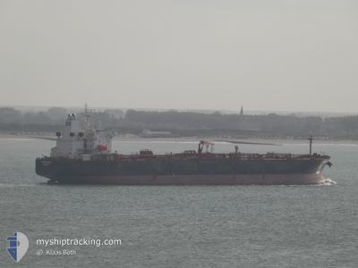
Crude Oil Tanker
Current Trip
| Time Travelled | 13 days |
|---|---|
| Remaining Time | 2 days |
| Distance Travelled | 3946.10 nm |
| Remaining Distance | 754.87 nm |
| AVG Speed | 12.1 Knots |
| MAX Speed | 15.8 Knots |
| AVG Wind | 10.7 knots |
| MAX Wind | 36 knots |
| MIN Temp | 9.5°C / 49.1°F |
| MAX Temp | 22.2°C / 71.96°F |
| Draught | 13.7 m |
| Position Received | 22 m ago |
Current Position
| Longitude | 16.61352° |
|---|---|
| Latitude | 36.00725° |
| Status | Under way using engine |
| Speed | 12.8 Knots |
| Course | 99° |
| Area | Mediterranean Sea - Eastern Basin |
| Station | T-AIS |
| Position Received | 22 m ago |
Info
Information
The current position of SHAHRAZAD is in Mediterranean Sea - Eastern Basin with coordinates 36.00725° / 16.61352° as reported on 2024-06-07 05:55 by AIS to our vessel tracker app. The vessel's current speed is 12.8 Knots and is heading at the port of ISTANBUL. The estimated time of arrival as calculated by vessel tracking app is 2024-06-09 20:15 LT
The vessel SHAHRAZAD (IMO: 9389863, MMSI: 636023086) is a Crude Oil Tanker that was built in 2009 ( 15 years old ). It's sailing under the flag of [LR] Liberia.
In this page you can find informations about the vessels current position, last detected port calls, and current voyage information. If the vessels is not in coverage by AIS you will find the latest position.
The current position of SHAHRAZAD is detected by our AIS receivers and we are not responsible for the reliability of the data. The last position was recorded while the vessel was in Coverage by the Ais receivers of our vessel tracking app.
The current draught of SHAHRAZAD as reported by AIS is 13.7 meters
Weather
| Temperature | 22.1°C / 71.78°F |
|---|---|
| Wind Speed | 10 knots |
| Direction | 316° NW |
| Pressure | 1017.2 hPa |
| Humidity | 79.2 % |
| Cloud Coverage | --- |
Featured Company
Events
| Time | Event | Details | Position / Dest | Info |
|---|---|---|---|---|
| 2024-06-07 06:01 | Status Changed | Default Under way using engine |
36.00317 / 16.63917
TRIST
|
Speed: 12.8 kn Course: 99° |
| 2024-06-07 02:37 | Status Changed | Under way using engine Default |
36.12252 / 15.79903
TRIST
|
Speed: 12.1 kn Course: 93° |
| 2024-06-07 02:33 | Status Changed | Default Under way using engine |
36.12422 / 15.78320
TRIST
|
Speed: 12.1 kn Course: 93° |
| 2024-06-07 02:20 | Status Changed | Under way using engine Default |
36.12712 / 15.72790
TRIST
|
Speed: 12.1 kn Course: 93° |
| 2024-06-07 02:08 | IN Coverage |
36.12667 / 15.73630
Mediterranean Sea - Eastern Basin
TRIST
|
Speed: 12.1 kn Course: 93° |
|
| 2024-06-07 00:57 | Status Changed | Default Under way using engine |
36.15282 / 15.39765
TRIST
|
Speed: 12 kn Course: 98° |
| 2024-06-07 00:45 | OUT of Coverage |
36.15878 / 15.34827
Mediterranean Sea - Eastern Basin
TRIST
|
Speed: 12 kn Course: 98° |
|
| 2024-06-06 22:22 | Change Sea Area | Italian part of the Mediterranean Sea - Eastern Basin Maltese part of the Mediterranean Sea - Eastern Basin |
36.29005 / 14.76113
Mediterranean Sea - Eastern Basin
TRIST
|
Speed: 12.9 kn Course: 108° |
| 2024-06-06 18:34 | Change Sea Area | Maltese part of the Mediterranean Sea - Eastern Basin Italian part of the Mediterranean Sea - Eastern Basin |
36.53657 / 13.81617
Mediterranean Sea - Eastern Basin
TRIST
|
Speed: 12.4 kn Course: 109° |
| 2024-06-06 14:00 | IN Coverage |
36.85508 / 12.78888
Mediterranean Sea - Eastern Basin
TRIST
|
Speed: 11 kn Course: 109° |