
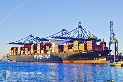
SHANGHAI EXPRESS
Container Ship
Current Trip
| Time Travelled | 14 days |
|---|---|
| Remaining Time | 1 day |
| Distance Travelled | 5994.64 nm |
| Remaining Distance | 722.00 nm |
| AVG Speed | 16.6 Knots |
| MAX Speed | 19.7 Knots |
| AVG Wind | 14.2 knots |
| MAX Wind | 37 knots |
| MIN Temp | 6.3°C / 43.34°F |
| MAX Temp | 21.4°C / 70.52°F |
| Draught | 15 m |
| Position Received | 13 h, 39 m ago |
Current Position
| Longitude | -114.31650° |
|---|---|
| Latitude | 24.86683° |
| Status | Under way using engine |
| Speed | 15.9 Knots |
| Course | 127.3° |
| Area | North Pacific Ocean |
| Station | T-AIS |
| Position Received | 13 h, 39 m ago |
Info
Information
The current position of SHANGHAI EXPRESS is in North Pacific Ocean with coordinates 24.86683° / -114.31650° as reported on 2024-06-21 07:02 by AIS to our vessel tracker app. The vessel's current speed is 15.9 Knots and is heading at the port of LAZARO CARDENAS. The estimated time of arrival as calculated by vessel tracking app is 2024-06-23 10:29 LT
The vessel SHANGHAI EXPRESS (IMO: 9501368, MMSI: 218427000) is a Container Ship that was built in 2013 ( 11 years old ). It's sailing under the flag of [DE] Germany.
In this page you can find informations about the vessels current position, last detected port calls, and current voyage information. If the vessels is not in coverage by AIS you will find the latest position.
The current position of SHANGHAI EXPRESS is detected by our AIS receivers and we are not responsible for the reliability of the data. The last position was recorded while the vessel was in Coverage by the Ais receivers of our vessel tracking app.
The current draught of SHANGHAI EXPRESS as reported by AIS is 15 meters
Weather
| Temperature | 19.9°C / 67.82°F |
|---|---|
| Wind Speed | 7 knots |
| Direction | 322° NW |
| Pressure | 1006.4 hPa |
| Humidity | 81.1 % |
| Cloud Coverage | 97 % |
Featured Company
Last Port Calls
| Port | Arrival | Departure | Time In Port |
|---|---|---|---|
| 2024-06-04 19:08 | 2024-06-06 22:55 | 2 d | |
| 2024-05-31 10:02 | 2024-06-01 03:58 | 17 h | |
| 2024-05-28 07:57 | 2024-05-29 04:33 | 20 h | |
| 2024-05-22 12:28 | 2024-05-25 09:56 | 2 d | |
| 2024-05-19 18:44 | 2024-05-20 19:34 | 1 d | |
| 2024-04-26 05:02 | 2024-04-26 23:31 | 18 h | |
| 2024-04-16 10:08 | 2024-04-18 05:14 | 1 d | |
| 2024-04-13 16:22 | 2024-04-14 13:02 | 20 h | |
| 2024-04-11 11:45 | 2024-04-12 20:36 | 1 d | |
| 2024-04-07 08:15 | 2024-04-09 08:06 | 1 d |
Most Visited Ports (Last year)
| Port | Arrivals | |
|---|---|---|
| 7 | ||
| 6 | ||
| 4 | ||
| 4 | ||
| 3 | ||
| 3 |
Last Trips
| Origin | Departure | Destination | Arrival | Distance | |
|---|---|---|---|---|---|
| 2024-06-01 11:58 | 2024-06-05 04:08 | 648.67 nm | |||
| 2024-05-29 12:33 | 2024-05-31 18:02 | 767.52 nm | |||
| 2024-05-25 17:56 | 2024-05-28 15:57 | 1160.38 nm | |||
| 2024-05-21 04:34 | 2024-05-22 20:28 | 509.58 nm | |||
| 2024-04-26 18:31 | 2024-05-20 03:44 | 8720.59 nm | |||
| 2024-04-18 01:14 | 2024-04-26 00:02 | 1921.22 nm | |||
| 2024-04-14 09:02 | 2024-04-16 06:08 | 397.46 nm | |||
| 2024-04-12 16:36 | 2024-04-13 12:22 | 176.72 nm | |||
| 2024-04-09 04:06 | 2024-04-11 07:45 | 124.31 nm | |||
| 2024-04-01 01:19 | 2024-04-07 04:15 | 1479.08 nm |
Events
| Time | Event | Details | Position / Dest | Info |
|---|---|---|---|---|
| 2024-06-21 07:04 | Status Changed | Default Under way using engine |
24.86309 / -114.31109
MXLZC
|
Speed: 15.9 kn Course: 127.3° |
| 2024-06-21 07:02 | OUT of Coverage |
24.86683 / -114.31650
North Pacific Ocean
MXLZC
|
Speed: 15.9 kn Course: 127.3° |
|
| 2024-06-21 06:57 | Status Changed | Under way using engine Default |
24.87987 / -114.33523
MXLZC
|
Speed: 16 kn Course: 127° |
| 2024-06-21 06:55 | IN Coverage |
24.87873 / -114.33362
North Pacific Ocean
MXLZC
|
Speed: 15.9 kn Course: 127.5° |
|
| 2024-06-20 20:58 | Status Changed | Default Under way using engine |
26.49064 / -116.71123
MXLZC
|
Speed: 16.1 kn Course: 128.2° |
| 2024-06-20 20:58 | OUT of Coverage |
26.49115 / -116.71195
North Pacific Ocean
MXLZC
|
Speed: 16.1 kn Course: 128.2° |
|
| 2024-06-20 20:56 | Status Changed | Under way using engine Default |
26.49507 / -116.71753
MXLZC
|
Speed: 16.1 kn Course: 129° |
| 2024-06-20 20:50 | Status Changed | Default Under way using engine |
26.51203 / -116.74154
MXLZC
|
Speed: 16 kn Course: 128.4° |
| 2024-06-20 20:31 | Status Changed | Under way using engine Default |
26.56430 / -116.81463
MXLZC
|
Speed: 16.1 kn Course: 128° |
| 2024-06-20 19:35 | Status Changed | Default Under way using engine |
26.72106 / -117.03972
MXLZC
|
Speed: 16.2 kn Course: 127° |