
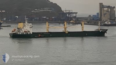
SHENG YUN LAI
Bulk Carrier
Current Trip
TH KSC
| Time Travelled | 12 days |
|---|---|
| Remaining Time | --- |
| Distance Travelled | 1758.06 nm |
| Remaining Distance | --- |
| AVG Speed | 9.4 Knots |
| MAX Speed | 11 Knots |
| AVG Wind | 10.4 knots |
| MAX Wind | 21.6 knots |
| MIN Temp | 22.9°C / 73.22°F |
| MAX Temp | 34°C / 93.2°F |
| Draught | 6 m |
| Position Received | 6 h, 38 m ago |
Current Position
| Longitude | 118.13833° |
|---|---|
| Latitude | 23.63667° |
| Status | Under way using engine |
| Speed | 9 Knots |
| Course | 48° |
| Area | South China Sea |
| Station | T-AIS |
| Position Received | 6 h, 38 m ago |
Info
Information
The current position of SHENG YUN LAI is in South China Sea with coordinates 23.63667° / 118.13833° as reported on 2024-05-18 18:43 by AIS to our vessel tracker app. The vessel's current speed is 9 Knots
The vessel SHENG YUN LAI (IMO: 9602320, MMSI: 352657000) is a Bulk Carrier that was built in 2011 ( 13 years old ). It's sailing under the flag of [PA] Panama.
In this page you can find informations about the vessels current position, last detected port calls, and current voyage information. If the vessels is not in coverage by AIS you will find the latest position.
The current position of SHENG YUN LAI is detected by our AIS receivers and we are not responsible for the reliability of the data. The last position was recorded while the vessel was in Coverage by the Ais receivers of our vessel tracking app.
The current draught of SHENG YUN LAI as reported by AIS is 6 meters
Weather
| Temperature | 23°C / 73.4°F |
|---|---|
| Wind Speed | 22 knots |
| Direction | 29° NNE |
| Pressure | 1010.4 hPa |
| Humidity | 89.7 % |
| Cloud Coverage | 100 % |
Featured Company
Events
| Time | Event | Details | Position / Dest | Info |
|---|---|---|---|---|
| 2024-05-18 18:48 | Status Changed | Default Under way using engine |
23.64778 / 118.15114
TH KSC
|
Speed: 9 kn Course: 48° |
| 2024-05-18 18:43 | Status Changed | Under way using engine Default |
23.63667 / 118.13833
TH KSC
|
Speed: 9 kn Course: 48° |
| 2024-05-18 18:43 | IN Coverage |
23.63667 / 118.13833
South China Sea
|
Speed: 9 kn Course: 48° |
|
| 2024-05-18 18:43 | OUT of Coverage |
23.63667 / 118.13833
South China Sea
|
Speed: 9 kn Course: 48° |
|
| 2024-05-17 19:40 | Status Changed | Default Under way using engine |
22.11355 / 114.40481
TH KSC
|
Speed: 9.5 kn Course: 92.1° |
| 2024-05-17 19:34 | Status Changed | Under way using engine Default |
22.11406 / 114.38708
TH KSC
|
Speed: 9.5 kn Course: 91° |
| 2024-05-17 19:34 | OUT of Coverage |
22.11406 / 114.38708
South China Sea
|
Speed: 9.5 kn Course: 92.1° |
|
| 2024-05-17 19:08 | Status Changed | Default Under way using engine |
22.11499 / 114.31548
TH KSC
|
Speed: 9.3 kn Course: 87.6° |
| 2024-05-17 18:58 | Change Sea Area | Chinese part of the South China Sea Thailand part of the Gulf of Thailand |
22.11523 / 114.28602
South China Sea
|
Speed: 9.2 kn Course: 91.9° |
| 2024-05-17 18:58 | Status Changed | Under way using engine Default |
22.11523 / 114.28602
TH KSC
|
Speed: 9.3 kn Course: 92° |