
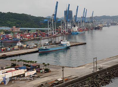
SHIN HWA NO.1
Cargo
Current Trip
| Trip Time | 1 day |
|---|---|
| Trip Distance | 240.86 nm |
| AVG Speed | 8.5 Knots |
| MAX Speed | 10.3 Knots |
| Draught | 3 m |
| AVG Wind | 11.4 knots |
| MAX Wind | 19.6 knots |
| MIN Temp | 19°C / 66.2°F |
| MAX Temp | 23.7°C / 74.66°F |
| Position Received | 2 m ago |
Current Position
| Longitude | 121.75937° |
|---|---|
| Latitude | 25.14469° |
| Status | Under way sailing |
| Speed | |
| Course | 75° |
| Area | Eastern China Sea |
| Station | T-AIS |
| Position Received | 2 m ago |
Info
Information
The current position of SHIN HWA NO.1 is in Eastern China Sea with coordinates 25.14469° / 121.75937° as reported on 2024-05-18 07:23 by AIS to our vessel tracker app. The vessel's current speed is 0 Knots and is currently inside the port of KEELUNG.
The vessel SHIN HWA NO.1 (MMSI: 416005967) is a Cargo It's sailing under the flag of [TW] Taiwan.
In this page you can find informations about the vessels current position, last detected port calls, and current voyage information. If the vessels is not in coverage by AIS you will find the latest position.
The current position of SHIN HWA NO.1 is detected by our AIS receivers and we are not responsible for the reliability of the data. The last position was recorded while the vessel was in Coverage by the Ais receivers of our vessel tracking app.
The current draught of SHIN HWA NO.1 as reported by AIS is 3 meters
Weather
| Temperature | 24.2°C / 75.56°F |
|---|---|
| Wind Speed | 12 knots |
| Direction | 82° E |
| Pressure | 1009.8 hPa |
| Humidity | 86.5 % |
| Cloud Coverage | 10 % |
Featured Company
Last Port Calls
| Port | Arrival | Departure | Time In Port |
|---|---|---|---|
| 2024-05-15 18:51 | |||
| 2024-05-12 17:41 | 2024-05-14 08:52 | 1 d | |
| 2024-05-10 19:01 | 2024-05-11 09:24 | 14 h | |
| 2024-05-08 18:04 | 2024-05-09 09:25 | 15 h | |
| 2024-05-05 16:54 | 2024-05-07 09:02 | 1 d | |
| 2024-05-03 17:41 | 2024-05-04 09:10 | 15 h | |
| 2024-05-01 16:16 | 2024-05-02 09:52 | 17 h | |
| 2024-04-28 16:12 | 2024-04-30 08:46 | 1 d | |
| 2024-04-26 18:12 | 2024-04-27 09:08 | 14 h | |
| 2024-04-24 17:27 | 2024-04-25 09:06 | 15 h |
Last Trips
| Origin | Departure | Destination | Arrival | Distance | |
|---|---|---|---|---|---|
| 2024-05-14 16:52 | 2024-05-16 02:51 | 240.86 nm | |||
| 2024-05-11 17:24 | 2024-05-13 01:41 | 239.79 nm | |||
| 2024-05-09 17:25 | 2024-05-11 03:01 | 229.39 nm | |||
| 2024-05-07 17:02 | 2024-05-09 02:04 | 239.79 nm | |||
| 2024-05-04 17:10 | 2024-05-06 00:54 | 239.30 nm | |||
| 2024-05-02 17:52 | 2024-05-04 01:41 | 210.18 nm | |||
| 2024-04-30 16:46 | 2024-05-02 00:16 | 236.41 nm | |||
| 2024-04-27 17:08 | 2024-04-29 00:12 | 239.63 nm | |||
| 2024-04-25 17:06 | 2024-04-27 02:12 | 228.09 nm | |||
| 2024-04-23 17:06 | 2024-04-25 01:27 | 239.48 nm |
Events
| Time | Event | Details | Position / Dest | Info |
|---|---|---|---|---|
| 2024-05-17 12:49 | IN Coverage |
25.14470 / 121.75940
Eastern China Sea
[TW] KEELUNG
|
Speed: Course: 76° |
|
| 2024-05-16 01:47 | OUT of Coverage |
25.14457 / 121.75940
Eastern China Sea
[TW] KEELUNG
|
Speed: 0.1 kn Course: 511° |
|
| 2024-05-15 19:07 | STOP Moving |
25.14416 / 121.75915
[TW] KEELUNG
|
Speed: 0.3 kn Course: 51° |
|
| 2024-05-15 18:51 | PORT ARRIVAL |
|
25.16199 / 121.75279
[TW] KEELUNG
|
Speed: 9.3 kn Course: 158.7° |
| 2024-05-15 17:19 | Status Changed | Under way sailing Default |
25.34026 / 121.60660
KEELUNG MAZU
|
Speed: 8 kn Course: 115° |
| 2024-05-15 17:14 | Status Changed | Default Under way sailing |
25.34500 / 121.59333
KEELUNG MAZU
|
Speed: 8.2 kn Course: 120.6° |
| 2024-05-15 17:06 | Status Changed | Under way sailing Default |
25.35357 / 121.57685
KEELUNG MAZU
|
Speed: 8 kn Course: 116° |
| 2024-05-15 16:50 | IN Coverage |
25.35272 / 121.57877
Eastern China Sea
|
Speed: 8.1 kn Course: 114.5° |
|
| 2024-05-15 06:00 | START Moving | 9.79 nm, South of LIAN JIANG |
26.16441 / 119.93949
KEELUNG MAZU
|
Speed: 6.5 kn Course: 310° |
| 2024-05-15 01:00 | STOP Moving | 9.91 nm, South of LIAN JIANG |
26.16300 / 119.94160
KEELUNG MAZU
|
Speed: 0.2 kn Course: 104° |