
SIBAL
Cargo
Current Trip
| Time Travelled | 6 days |
|---|---|
| Remaining Time | 2 h, 42 mins |
| Distance Travelled | 684.55 nm |
| Remaining Distance | 32.89 nm |
| AVG Speed | 10.7 Knots |
| MAX Speed | 13.8 Knots |
| AVG Wind | 7.4 knots |
| MAX Wind | 15 knots |
| MIN Temp | 15.8°C / 60.44°F |
| MAX Temp | 22.7°C / 72.86°F |
| Draught | 6.5 m |
| Position Received | 6 m ago |
Current Position
| Longitude | 14.22719° |
|---|---|
| Latitude | 36.35165° |
| Status | Under way using engine |
| Speed | 11.5 Knots |
| Course | 129.7° |
| Area | Mediterranean Sea - Eastern Basin |
| Station | T-AIS |
| Position Received | 6 m ago |
Info
Information
The current position of SIBAL is in Mediterranean Sea - Eastern Basin with coordinates 36.35165° / 14.22719° as reported on 2024-05-19 23:28 by AIS to our vessel tracker app. The vessel's current speed is 11.5 Knots and is heading at the port of VALLETTA. The estimated time of arrival as calculated by vessel tracking app is 2024-05-20 02:16 LT
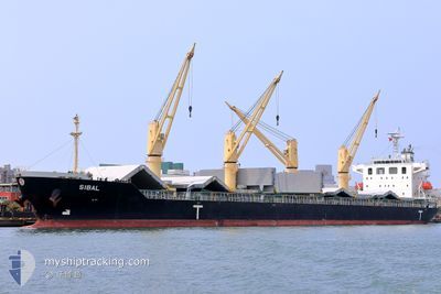
The vessel SIBAL (IMO: 9712620, MMSI: 256505000) is a Cargo It's sailing under the flag of [MT] Malta.
In this page you can find informations about the vessels current position, last detected port calls, and current voyage information. If the vessels is not in coverage by AIS you will find the latest position.
The current position of SIBAL is detected by our AIS receivers and we are not responsible for the reliability of the data. The last position was recorded while the vessel was in Coverage by the Ais receivers of our vessel tracking app.
The current draught of SIBAL as reported by AIS is 6.5 meters
Weather
| Temperature | 19.4°C / 66.92°F |
|---|---|
| Wind Speed | 12 knots |
| Direction | 79° E |
| Pressure | 1009.4 hPa |
| Humidity | 90.8 % |
| Cloud Coverage | 51 % |
Featured Company
Events
| Time | Event | Details | Position / Dest | Info |
|---|---|---|---|---|
| 2024-05-19 23:19 | Status Changed | Under way using engine Default |
36.37095 / 14.19876
MT MLA
|
Speed: 11 kn Course: 130° |
| 2024-05-19 23:07 | Status Changed | Default Under way using engine |
36.39582 / 14.16270
MT MLA
|
Speed: 11.6 kn Course: 123.5° |
| 2024-05-19 22:56 | Status Changed | Under way using engine Default |
36.41748 / 14.13033
MT MLA
|
Speed: 11.6 kn Course: 123° |
| 2024-05-19 22:47 | Status Changed | Default Under way using engine |
36.43361 / 14.09945
MT MLA
|
Speed: 11.5 kn Course: 126.3° |
| 2024-05-19 22:34 | Status Changed | Under way using engine Default |
36.45729 / 14.05613
MT MLA
|
Speed: 11.4 kn Course: 131° |
| 2024-05-19 22:25 | Status Changed | Default Under way using engine |
36.47500 / 14.02833
MT MLA
|
Speed: 11.4 kn Course: 130.2° |
| 2024-05-19 22:16 | Status Changed | Under way using engine Default |
36.49484 / 14.00046
MT MLA
|
Speed: 11 kn Course: 131° |
| 2024-05-19 22:07 | Status Changed | Default Under way using engine |
36.51167 / 13.97333
MT MLA
|
Speed: 11.3 kn Course: 130.8° |
| 2024-05-19 22:00 | Change Sea Area | Maltese part of the Mediterranean Sea - Eastern Basin Italian part of the Mediterranean Sea - Eastern Basin |
36.52621 / 13.95537
Mediterranean Sea - Eastern Basin
MT MLA
|
Speed: 11.3 kn Course: 130.8° |
| 2024-05-19 22:00 | Status Changed | Under way using engine Default |
36.52621 / 13.95537
MT MLA
|
Speed: 11.4 kn Course: 130° |